Maxwell Butte Topo Map Montana
To zoom in, hover over the map of Maxwell Butte
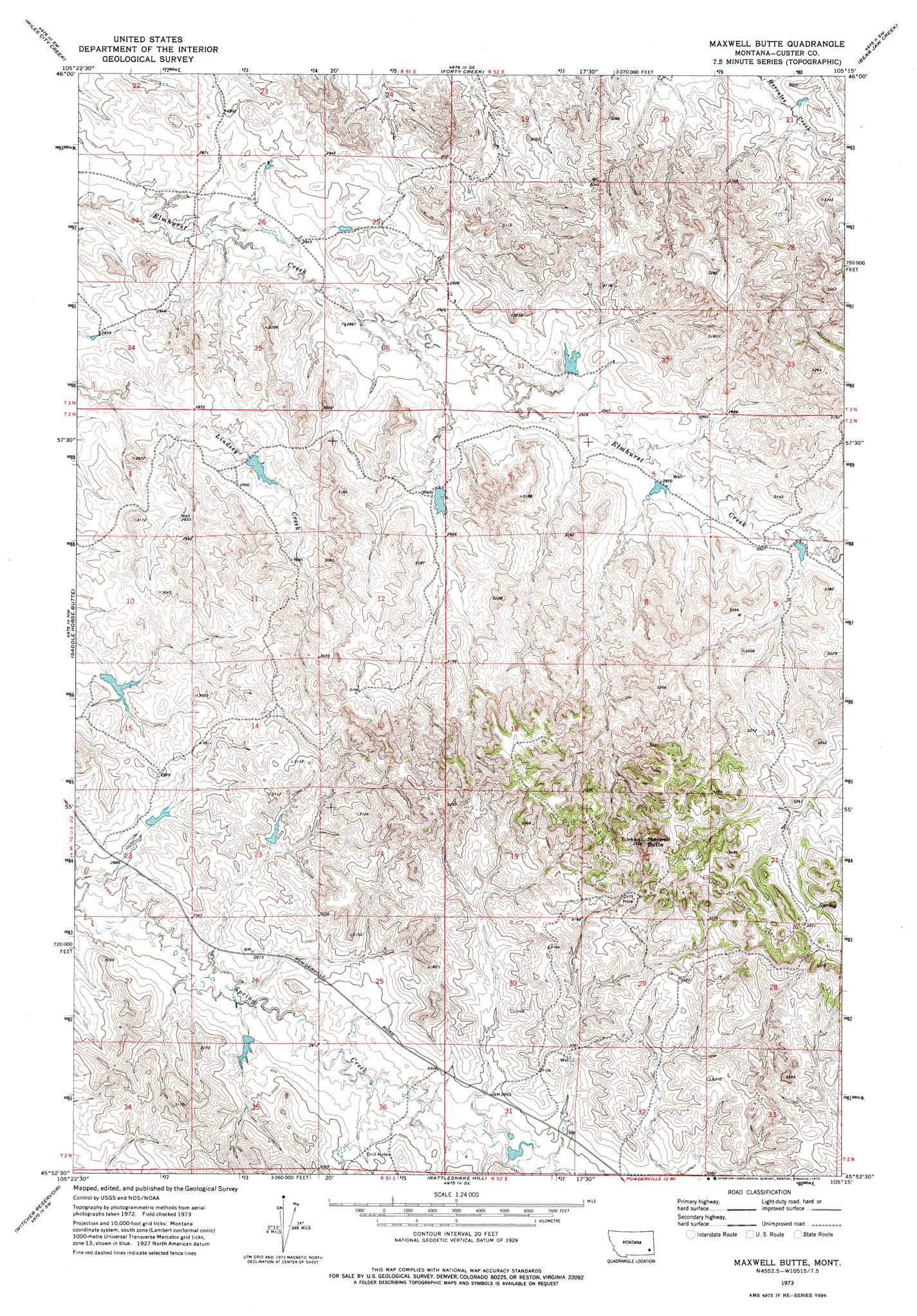
USGS Topo Quad 45105h3 - 1:24,000 scale
| Topo Map Name: | Maxwell Butte |
| USGS Topo Quad ID: | 45105h3 |
| Print Size: | ca. 21 1/4" wide x 27" high |
| Southeast Coordinates: | 45.875° N latitude / 105.25° W longitude |
| Map Center Coordinates: | 45.9375° N latitude / 105.3125° W longitude |
| U.S. State: | MT |
| Filename: | o45105h3.jpg |
| Download Map JPG Image: | Maxwell Butte topo map 1:24,000 scale |
| Map Type: | Topographic |
| Topo Series: | 7.5´ |
| Map Scale: | 1:24,000 |
| Source of Map Images: | United States Geological Survey (USGS) |
| Alternate Map Versions: |
Maxwell Butte MT 1973, updated 1976 Download PDF Buy paper map Maxwell Butte MT 2011 Download PDF Buy paper map Maxwell Butte MT 2014 Download PDF Buy paper map |
1:24,000 Topo Quads surrounding Maxwell Butte
First Creek |
Loaf Of Bread Butte |
Mizpah |
Pennock Creek |
Tepee Butte Ne |
Beebe |
Miles City Creek |
Forty Creek |
Bear Jaw Creek |
Tepee Butte |
Harris Buttes |
Saddle Horse Butte |
Maxwell Butte |
Mills Creek West |
Mills Creek East |
Divide School |
Witcher Reservoir |
Rattlesnake Hill |
Snake Butte |
Powderville |
Coalwood |
Johnnie Creek |
Cross S School |
Oliphant Butte |
Rattlesnake Ridge |
> Back to 45105e1 at 1:100,000 scale
> Back to 45104a1 at 1:250,000 scale
> Back to U.S. Topo Maps home
Maxwell Butte topo map: Gazetteer
Maxwell Butte: Dams
Fox Number 3 Dam elevation 884m 2900′Fox Number 4 Dam elevation 907m 2975′
Fox Number 5 Dam elevation 889m 2916′
L and L Dam elevation 906m 2972′
L Krutzfeldt Number 1 Dam elevation 915m 3001′
Rafferty Number 1 Dam elevation 893m 2929′
Rafferty Number 2 Dam elevation 903m 2962′
Rafferty Number 3 Dam elevation 891m 2923′
Rafferty Number 4 Dam elevation 911m 2988′
Robinson Number 1 Dam elevation 900m 2952′
Maxwell Butte: Summits
Maxwell Butte elevation 1134m 3720′Maxwell Butte: Wells
02N51E11AACD01 Well elevation 905m 2969′02N51E36DC__01 Well elevation 939m 3080′
02N52E31AAAD01 Well elevation 923m 3028′
03N51E36BCAD01 Well elevation 873m 2864′
03N52E32CBBD01 Well elevation 911m 2988′
14N50E34AAAB01 Well elevation 875m 2870′
Maxwell Butte digital topo map on disk
Buy this Maxwell Butte topo map showing relief, roads, GPS coordinates and other geographical features, as a high-resolution digital map file on DVD:
Eastern Montana & Western North Dakota
Buy digital topo maps: Eastern Montana & Western North Dakota