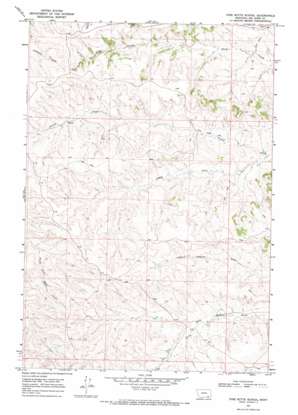
Pine Butte School Topo Map Montana
To zoom in, hover over the map of Pine Butte School
USGS Topo Quad 45106a5 - 1:24,000 scale
| Topo Map Name: | Pine Butte School |
| USGS Topo Quad ID: | 45106a5 |
| Print Size: | ca. 21 1/4" wide x 27" high |
| Southeast Coordinates: | 45° N latitude / 106.5° W longitude |
| Map Center Coordinates: | 45.0625° N latitude / 106.5625° W longitude |
| U.S. State: | MT |
| Filename: | o45106a5.jpg |
| Download Map JPG Image: | Pine Butte School topo map 1:24,000 scale |
| Map Type: | Topographic |
| Topo Series: | 7.5´ |
| Map Scale: | 1:24,000 |
| Source of Map Images: | United States Geological Survey (USGS) |
| Alternate Map Versions: |
Pine Butte School MT 1967, updated 1971 Download PDF Buy paper map Pine Butte School MT 2011 Download PDF Buy paper map Pine Butte School MT 2014 Download PDF Buy paper map |
1:24,000 Topo Quads surrounding Pine Butte School
> Back to 45106a1 at 1:100,000 scale
> Back to 45106a1 at 1:250,000 scale
> Back to U.S. Topo Maps home
Pine Butte School topo map: Gazetteer
Pine Butte School: Streams
South Fork Corral Creek elevation 1086m 3562′Pine Butte School: Wells
08S42E22DBCA01 Well elevation 1216m 3989′08S42E26CBBB01 Well elevation 1169m 3835′
08S42E28CAAA01 Well elevation 1214m 3982′
08S42E29BDAC01 Well elevation 1222m 4009′
08S42E35BBBC01 Well elevation 1204m 3950′
08S42E35DDDB01 Well elevation 1149m 3769′
08S42E35DDDB02 Well elevation 1149m 3769′
08S43E30BBCD01 Well elevation 1101m 3612′
08S43E31BBDA01 Well elevation 1137m 3730′
08S43E31BBDA02 Well elevation 1137m 3730′
09S42E01BCAD01 Well elevation 1126m 3694′
09S42E01BCAD02 Well elevation 1120m 3674′
09S42E01BCAD03 Well elevation 1117m 3664′
09S42E02ADBB01 Well elevation 1122m 3681′
09S42E02BBBD01 Well elevation 1132m 3713′
09S42E02BBCA01 Well elevation 1137m 3730′
09S42E03AADA01 Well elevation 1138m 3733′
09S42E04BABA01 Well elevation 1184m 3884′
09S42E05AAAD01 C Well elevation 1192m 3910′
09S42E11BDAA01 Well elevation 1132m 3713′
09S42E11BDCA01 Well elevation 1129m 3704′
09S42E11BDCA02 Well elevation 1131m 3710′
09S42E12BCAA01 Well elevation 1116m 3661′
09S42E25DCAD01 Well elevation 1127m 3697′
09S42E26CDCA01 Well elevation 1151m 3776′
09S42E27CDCD01 Well elevation 1172m 3845′
09S42E35DCCC01 Well elevation 1157m 3795′
09S42E36BCAB01 Well elevation 1146m 3759′
09S42E36BCBA01 Well elevation 1144m 3753′
09S43E06DDBD01 Well elevation 1092m 3582′
09S43E06DDBD02 Well elevation 1092m 3582′
09S43E06DDBD03 Well elevation 1089m 3572′
09S43E06DDCA01 Well elevation 1090m 3576′
09S43E07BCAD01 Well elevation 1105m 3625′
09S43E07CADB01 Well elevation 1086m 3562′
09S43E07CADB02 Well elevation 1115m 3658′
10S42E01AADA01 Well elevation 1187m 3894′
10S43E06ABAC01 Well elevation 1155m 3789′
Pine Butte School digital topo map on disk
Buy this Pine Butte School topo map showing relief, roads, GPS coordinates and other geographical features, as a high-resolution digital map file on DVD:
Eastern Montana & Western North Dakota
Buy digital topo maps: Eastern Montana & Western North Dakota


