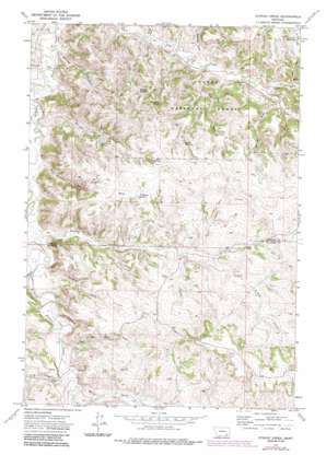
Stroud Creek Topo Map Montana
To zoom in, hover over the map of Stroud Creek
USGS Topo Quad 45106b4 - 1:24,000 scale
| Topo Map Name: | Stroud Creek |
| USGS Topo Quad ID: | 45106b4 |
| Print Size: | ca. 21 1/4" wide x 27" high |
| Southeast Coordinates: | 45.125° N latitude / 106.375° W longitude |
| Map Center Coordinates: | 45.1875° N latitude / 106.4375° W longitude |
| U.S. State: | MT |
| Filename: | o45106b4.jpg |
| Download Map JPG Image: | Stroud Creek topo map 1:24,000 scale |
| Map Type: | Topographic |
| Topo Series: | 7.5´ |
| Map Scale: | 1:24,000 |
| Source of Map Images: | United States Geological Survey (USGS) |
| Alternate Map Versions: |
Stroud Creek MT 1972, updated 1975 Download PDF Buy paper map Stroud Creek MT 1972, updated 1986 Download PDF Buy paper map Stroud Creek MT 1995, updated 1998 Download PDF Buy paper map Stroud Creek MT 2011 Download PDF Buy paper map Stroud Creek MT 2014 Download PDF Buy paper map |
| FStopo: | US Forest Service topo Stroud Creek is available: Download FStopo PDF Download FStopo TIF |
1:24,000 Topo Quads surrounding Stroud Creek
> Back to 45106a1 at 1:100,000 scale
> Back to 45106a1 at 1:250,000 scale
> Back to U.S. Topo Maps home
Stroud Creek topo map: Gazetteer
Stroud Creek: Reservoirs
Haywood Reservoir elevation 1161m 3809′Snyder Reservoir elevation 1145m 3756′
Woodard Reservoir elevation 1092m 3582′
Stroud Creek: Springs
08S43E13BDBC01 Spring elevation 1195m 3920′08S43E15CCAA01 Spring elevation 1108m 3635′
08S43E16CDBD01 Spring elevation 1123m 3684′
08S43E20CBBA01 Spring elevation 1097m 3599′
08S43E22CBAA01 Spring elevation 1085m 3559′
08S44E07ABBC01 Spring elevation 1178m 3864′
Dutchman Spring elevation 1150m 3772′
Hay Gulch Spring elevation 1112m 3648′
Rim Rock Spring elevation 1138m 3733′
Stroud Creek: Streams
Horse Creek elevation 1079m 3540′North Fork Lee Creek elevation 1063m 3487′
P K Creek elevation 1053m 3454′
South Fork Lee Creek elevation 1063m 3487′
Stroud Creek elevation 1022m 3353′
Wrench Creek elevation 1032m 3385′
Stroud Creek: Valleys
Brewster Gulch elevation 1018m 3339′Circle Bar Draw elevation 1067m 3500′
Clark Draw elevation 1050m 3444′
Feeback Draw elevation 1043m 3421′
Gloomy Glenn Draw elevation 1008m 3307′
Hay Gulch elevation 1016m 3333′
Haywood Gulch elevation 996m 3267′
Hertzler Draw elevation 1079m 3540′
Mare Pasture Gulch elevation 1024m 3359′
Rough Draw elevation 1019m 3343′
Stocker Draw elevation 1075m 3526′
Stroud Creek: Wells
07S43E08ABBB01 Well elevation 994m 3261′07S43E10DBCD01 Well elevation 1036m 3398′
08S43E05CBAC01 Well elevation 1040m 3412′
08S43E09ADCC01 Well elevation 1134m 3720′
08S43E10BCAC01 Well elevation 1136m 3727′
08S43E11CDBD01 Well elevation 1155m 3789′
08S43E13ACCA01 Well elevation 1195m 3920′
08S43E14BCCA01 Well elevation 1161m 3809′
08S43E14BCCA02 Well elevation 1161m 3809′
08S43E16CCDA01 Well elevation 1065m 3494′
08S43E17DDCA01 Well elevation 1055m 3461′
08S43E17DDDC01 Well elevation 1053m 3454′
08S43E21BBDA01 Well elevation 1053m 3454′
08S43E21BBDD01 Well elevation 1053m 3454′
08S43E21BBDD02 Well elevation 1060m 3477′
08S43E21BBDD03 Well elevation 1053m 3454′
08S43E21BCAA01 Well elevation 1063m 3487′
08S43E21BDBB01 Well elevation 1066m 3497′
08S43E21BDBB02 Well elevation 1066m 3497′
08S44E06CBAC01 Well elevation 1136m 3727′
08S44E07BBBB01 Well elevation 1142m 3746′
08S44E18BCCC01 Well elevation 1199m 3933′
08S44E18BDCC01 Well elevation 1200m 3937′
Stroud Creek digital topo map on disk
Buy this Stroud Creek topo map showing relief, roads, GPS coordinates and other geographical features, as a high-resolution digital map file on DVD:
Eastern Montana & Western North Dakota
Buy digital topo maps: Eastern Montana & Western North Dakota


