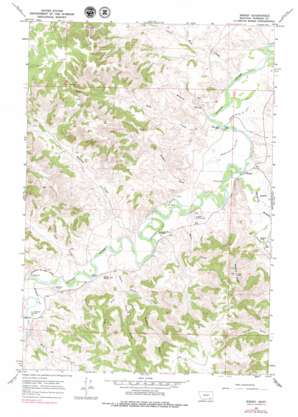
Birney Topo Map Montana
To zoom in, hover over the map of Birney
USGS Topo Quad 45106c5 - 1:24,000 scale
| Topo Map Name: | Birney |
| USGS Topo Quad ID: | 45106c5 |
| Print Size: | ca. 21 1/4" wide x 27" high |
| Southeast Coordinates: | 45.25° N latitude / 106.5° W longitude |
| Map Center Coordinates: | 45.3125° N latitude / 106.5625° W longitude |
| U.S. State: | MT |
| Filename: | o45106c5.jpg |
| Download Map JPG Image: | Birney topo map 1:24,000 scale |
| Map Type: | Topographic |
| Topo Series: | 7.5´ |
| Map Scale: | 1:24,000 |
| Source of Map Images: | United States Geological Survey (USGS) |
| Alternate Map Versions: |
Birney MT 1967, updated 1971 Download PDF Buy paper map Birney MT 1967, updated 1979 Download PDF Buy paper map Birney MT 2011 Download PDF Buy paper map Birney MT 2014 Download PDF Buy paper map |
1:24,000 Topo Quads surrounding Birney
> Back to 45106a1 at 1:100,000 scale
> Back to 45106a1 at 1:250,000 scale
> Back to U.S. Topo Maps home
Birney topo map: Gazetteer
Birney: Canals
Arnold Ditch elevation 962m 3156′Brewster E Side Ditch elevation 976m 3202′
Brewster W Side Ditch elevation 1000m 3280′
Brown Cattle County Ditch Number One elevation 954m 3129′
Brown Cattle County Ditch Number Two elevation 949m 3113′
Quarter Circle U Ditch elevation 958m 3143′
Birney: Populated Places
Birney elevation 952m 3123′Birney: Post Offices
Birney Post Office elevation 952m 3123′Birney: Springs
05S41E36CBBA01 Spring elevation 1199m 3933′05S42E30CBCB01 Spring elevation 1173m 3848′
05S42E31CCCD01 Spring elevation 1209m 3966′
Birney: Streams
Battle Butte Creek elevation 966m 3169′Bull Creek elevation 967m 3172′
Coal Bank Creek elevation 946m 3103′
Ebaugh Creek elevation 972m 3188′
Hackley Creek elevation 958m 3143′
Hanging Woman Creek elevation 952m 3123′
Home Creek elevation 957m 3139′
Middle Fork Battle Butte Creek elevation 1029m 3375′
Prairie Dog Creek elevation 975m 3198′
South Fork Battle Butte Creek elevation 1001m 3284′
Wall Creek elevation 975m 3198′
West Fork Battle Butte Creek elevation 994m 3261′
Whitten Creek elevation 965m 3166′
Zook Creek elevation 951m 3120′
Birney: Summits
Battle Butte elevation 1019m 3343′Pyramid Butte elevation 1194m 3917′
Birney: Valleys
Browns Gulch elevation 952m 3123′Nelson Draw elevation 970m 3182′
Salesbury Draw elevation 993m 3257′
Birney: Wells
05S42E25CCAB01 Well elevation 946m 3103′05S42E27ADDA01 Well elevation 977m 3205′
05S42E28CBBD01 Well elevation 1032m 3385′
05S42E34ABBA01 Well elevation 977m 3205′
06S42E01DDCC01 Well elevation 952m 3123′
06S42E01DDCC02 Well elevation 956m 3136′
06S42E02CABC01 Well elevation 1009m 3310′
06S42E13BABD01 Well elevation 958m 3143′
06S42E13DAAA01 Well elevation 953m 3126′
06S42E13DBCC01 Well elevation 952m 3123′
06S42E14DCAD01 Well elevation 958m 3143′
06S42E16ACDA01 Well elevation 1007m 3303′
06S42E21DDCA01 Well elevation 964m 3162′
06S42E23BCAC01 Well elevation 958m 3143′
06S42E23BDBA01 Well elevation 959m 3146′
06S42E23C___01 Well elevation 977m 3205′
06S42E23CAB_01 Well elevation 964m 3162′
06S42E23CABC01 Well elevation 963m 3159′
06S42E27ABBC01 Well elevation 963m 3159′
06S42E29CAAA01 Well elevation 975m 3198′
06S42E29DCDD01 Well elevation 969m 3179′
06S42E32ABA_01 Well elevation 977m 3205′
06S42E32BDB_01 Well elevation 971m 3185′
06S42E32CBA_01 Well elevation 974m 3195′
06S43E07DBCA01 Well elevation 992m 3254′
06S43E07DCCA01 Well elevation 962m 3156′
06S43E18BABC01 Well elevation 953m 3126′
06S43E19DACD01 Well elevation 967m 3172′
06S43E19DDBA01 Well elevation 964m 3162′
06S43E19DDBA02 Well elevation 965m 3166′
06S43E19DDBD01 Well elevation 967m 3172′
Birney digital topo map on disk
Buy this Birney topo map showing relief, roads, GPS coordinates and other geographical features, as a high-resolution digital map file on DVD:
Eastern Montana & Western North Dakota
Buy digital topo maps: Eastern Montana & Western North Dakota


