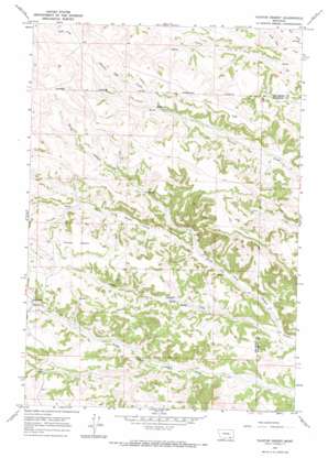
Taintor Desert Topo Map Montana
To zoom in, hover over the map of Taintor Desert
USGS Topo Quad 45106c7 - 1:24,000 scale
| Topo Map Name: | Taintor Desert |
| USGS Topo Quad ID: | 45106c7 |
| Print Size: | ca. 21 1/4" wide x 27" high |
| Southeast Coordinates: | 45.25° N latitude / 106.75° W longitude |
| Map Center Coordinates: | 45.3125° N latitude / 106.8125° W longitude |
| U.S. State: | MT |
| Filename: | o45106c7.jpg |
| Download Map JPG Image: | Taintor Desert topo map 1:24,000 scale |
| Map Type: | Topographic |
| Topo Series: | 7.5´ |
| Map Scale: | 1:24,000 |
| Source of Map Images: | United States Geological Survey (USGS) |
| Alternate Map Versions: |
Taintor Desert MT 1967, updated 1971 Download PDF Buy paper map Taintor Desert MT 2011 Download PDF Buy paper map Taintor Desert MT 2014 Download PDF Buy paper map |
1:24,000 Topo Quads surrounding Taintor Desert
> Back to 45106a1 at 1:100,000 scale
> Back to 45106a1 at 1:250,000 scale
> Back to U.S. Topo Maps home
Taintor Desert topo map: Gazetteer
Taintor Desert: Plains
Taintor Desert elevation 1329m 4360′Taintor Desert: Springs
06S40E02CBAB01 Spring elevation 1232m 4041′06S40E03BDDA01 Spring elevation 1268m 4160′
06S40E20DCCC01 Spring elevation 1291m 4235′
06S40E26CDAB01 Spring elevation 1158m 3799′
06S40E29BCCD01 Spring elevation 1278m 4192′
06S40E29CAAD01 Spring elevation 1271m 4169′
06S40E29CABA01 Spring elevation 1278m 4192′
06S40E29DADD01 Spring elevation 1259m 4130′
06S40E31ADDA01 Spring elevation 1289m 4229′
06S40E32BADD01 Spring elevation 1237m 4058′
06S40E33BCCA01 Spring elevation 1199m 3933′
Taintor Desert: Streams
Clarks Fork Canyon Creek elevation 1134m 3720′Taintor Fork Canyon Creek elevation 1075m 3526′
Taintor Desert: Wells
06N39E09BBBD01 Well elevation 1292m 4238′06S40E01CDDC01 Well elevation 1197m 3927′
06S40E02DBDA01 Well elevation 1223m 4012′
06S40E29ABBA01 Well elevation 1286m 4219′
06S40E30DDAA01 Well elevation 1278m 4192′
06S40E30DDAA02 Well elevation 1248m 4094′
06S40E36ABBC01 Well elevation 1099m 3605′
06S41E06ABBC01 Well elevation 1220m 4002′
06S41E18DCBA01 Well elevation 1161m 3809′
06S41E30CCAD01 Well elevation 1085m 3559′
07S40E01BDDB01 Well elevation 1097m 3599′
07S40E01DCBB01 Well elevation 1124m 3687′
07S40E05DDDC01 Well elevation 1253m 4110′
Taintor Desert digital topo map on disk
Buy this Taintor Desert topo map showing relief, roads, GPS coordinates and other geographical features, as a high-resolution digital map file on DVD:
Eastern Montana & Western North Dakota
Buy digital topo maps: Eastern Montana & Western North Dakota


