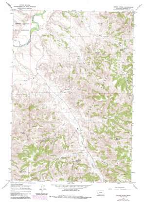
Green Creek Topo Map Montana
To zoom in, hover over the map of Green Creek
USGS Topo Quad 45106d3 - 1:24,000 scale
| Topo Map Name: | Green Creek |
| USGS Topo Quad ID: | 45106d3 |
| Print Size: | ca. 21 1/4" wide x 27" high |
| Southeast Coordinates: | 45.375° N latitude / 106.25° W longitude |
| Map Center Coordinates: | 45.4375° N latitude / 106.3125° W longitude |
| U.S. State: | MT |
| Filename: | o45106d3.jpg |
| Download Map JPG Image: | Green Creek topo map 1:24,000 scale |
| Map Type: | Topographic |
| Topo Series: | 7.5´ |
| Map Scale: | 1:24,000 |
| Source of Map Images: | United States Geological Survey (USGS) |
| Alternate Map Versions: |
Green Creek MT 1966, updated 1970 Download PDF Buy paper map Green Creek MT 1966, updated 1986 Download PDF Buy paper map Green Creek MT 1995, updated 1998 Download PDF Buy paper map Green Creek MT 2011 Download PDF Buy paper map Green Creek MT 2014 Download PDF Buy paper map |
| FStopo: | US Forest Service topo Green Creek is available: Download FStopo PDF Download FStopo TIF |
1:24,000 Topo Quads surrounding Green Creek
> Back to 45106a1 at 1:100,000 scale
> Back to 45106a1 at 1:250,000 scale
> Back to U.S. Topo Maps home
Green Creek topo map: Gazetteer
Green Creek: Parks
King Mountain Hiking and Riding Area elevation 1130m 3707′Green Creek: Reservoirs
East Fork Reservoir elevation 1106m 3628′Green Creek Reservoir elevation 1046m 3431′
King Creek Reservoir elevation 1020m 3346′
Pittman Reservoir elevation 1026m 3366′
Poker Teechee Reservoir elevation 1174m 3851′
Schaudel Reservoir elevation 977m 3205′
Green Creek: Springs
04S44E19ACDC01 Spring elevation 934m 3064′05S44E02AAAD01 Spring elevation 1131m 3710′
Gate Creek Spring elevation 1081m 3546′
Good Spring elevation 1131m 3710′
Green Creek Spring elevation 1062m 3484′
King Creek Spring elevation 1016m 3333′
Pittman Draw Spring elevation 1092m 3582′
Green Creek: Streams
Cedar Creek elevation 909m 2982′Dry Creek elevation 909m 2982′
East Fork O'Dell Creek elevation 990m 3248′
Frees Creek elevation 989m 3244′
Green Creek elevation 1016m 3333′
Hay Creek elevation 1055m 3461′
Hole-in-the-Wall Creek elevation 964m 3162′
Kelty Creek elevation 915m 3001′
Green Creek: Valleys
Black Canyon elevation 1068m 3503′Gooseberry Draw elevation 1037m 3402′
Pittman Draw elevation 1020m 3346′
Green Creek: Wells
04S44E18____01 Well elevation 915m 3001′04S44E18ABDC01 Well elevation 913m 2995′
04S44E22ABDA01 Well elevation 1009m 3310′
04S44E23DCAA01 Well elevation 1018m 3339′
04S44E28BADA01 Well elevation 982m 3221′
04S44E31BCAB01 Well elevation 948m 3110′
04S44E32DCDD01 Well elevation 988m 3241′
05S41E13CADA01 Well elevation 1154m 3786′
05S44E05CAAD01 Well elevation 978m 3208′
05S44E05CABD01 Well elevation 975m 3198′
05S44E16ABBB01 Well elevation 1005m 3297′
05S44E27ADAB01 Well elevation 1059m 3474′
08S44E09DBDD01 Well elevation 1150m 3772′
Dry Creek Well elevation 980m 3215′
King Creek Well Number One elevation 1020m 3346′
King Creek Well Number Two elevation 989m 3244′
Green Creek digital topo map on disk
Buy this Green Creek topo map showing relief, roads, GPS coordinates and other geographical features, as a high-resolution digital map file on DVD:
Eastern Montana & Western North Dakota
Buy digital topo maps: Eastern Montana & Western North Dakota


