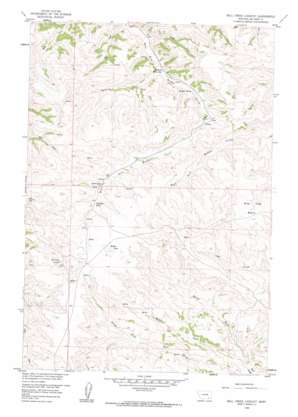
Bull Creek Lookout Topo Map Montana
To zoom in, hover over the map of Bull Creek Lookout
USGS Topo Quad 45106d7 - 1:24,000 scale
| Topo Map Name: | Bull Creek Lookout |
| USGS Topo Quad ID: | 45106d7 |
| Print Size: | ca. 21 1/4" wide x 27" high |
| Southeast Coordinates: | 45.375° N latitude / 106.75° W longitude |
| Map Center Coordinates: | 45.4375° N latitude / 106.8125° W longitude |
| U.S. State: | MT |
| Filename: | o45106d7.jpg |
| Download Map JPG Image: | Bull Creek Lookout topo map 1:24,000 scale |
| Map Type: | Topographic |
| Topo Series: | 7.5´ |
| Map Scale: | 1:24,000 |
| Source of Map Images: | United States Geological Survey (USGS) |
| Alternate Map Versions: |
Bull Creek Lookout MT 1958, updated 1960 Download PDF Buy paper map Bull Creek Lookout MT 1958, updated 1960 Download PDF Buy paper map Bull Creek Lookout MT 2011 Download PDF Buy paper map Bull Creek Lookout MT 2014 Download PDF Buy paper map |
1:24,000 Topo Quads surrounding Bull Creek Lookout
> Back to 45106a1 at 1:100,000 scale
> Back to 45106a1 at 1:250,000 scale
> Back to U.S. Topo Maps home
Bull Creek Lookout topo map: Gazetteer
Bull Creek Lookout: Basins
Wild Hog Basin elevation 1308m 4291′Bull Creek Lookout: Bends
Big Bend elevation 1233m 4045′Bull Creek Lookout: Gaps
Hardrobe Water Gap elevation 1194m 3917′Bull Creek Lookout: Lakes
Muddy Lake elevation 1359m 4458′Bull Creek Lookout: Springs
05S40E05CCCC01 Spring elevation 1361m 4465′05S40E06ABAB01 Spring elevation 1321m 4333′
05S40E09AADD01 Spring elevation 1351m 4432′
05S40E18BCCA01 Spring elevation 1367m 4484′
Hardrobe Spring elevation 1214m 3982′
Killsnight Spring elevation 1317m 4320′
Bull Creek Lookout: Streams
Brady Creek elevation 1165m 3822′Hardrobe Creek elevation 1192m 3910′
Middle Fork Bull Creek elevation 1142m 3746′
North Fork Bull Creek elevation 1142m 3746′
Bull Creek Lookout: Wells
01N43E08ACCD01 Well elevation 1361m 4465′04S40E17ABD_01 Well elevation 1155m 3789′
Bull Creek Lookout digital topo map on disk
Buy this Bull Creek Lookout topo map showing relief, roads, GPS coordinates and other geographical features, as a high-resolution digital map file on DVD:
Eastern Montana & Western North Dakota
Buy digital topo maps: Eastern Montana & Western North Dakota


