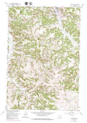
Lame Deer Topo Map Montana
To zoom in, hover over the map of Lame Deer
USGS Topo Quad 45106e6 - 1:24,000 scale
| Topo Map Name: | Lame Deer |
| USGS Topo Quad ID: | 45106e6 |
| Print Size: | ca. 21 1/4" wide x 27" high |
| Southeast Coordinates: | 45.5° N latitude / 106.625° W longitude |
| Map Center Coordinates: | 45.5625° N latitude / 106.6875° W longitude |
| U.S. State: | MT |
| Filename: | o45106e6.jpg |
| Download Map JPG Image: | Lame Deer topo map 1:24,000 scale |
| Map Type: | Topographic |
| Topo Series: | 7.5´ |
| Map Scale: | 1:24,000 |
| Source of Map Images: | United States Geological Survey (USGS) |
| Alternate Map Versions: |
Lame Deer MT 1958, updated 1960 Download PDF Buy paper map Lame Deer MT 1958, updated 1974 Download PDF Buy paper map Lame Deer MT 1958, updated 1979 Download PDF Buy paper map Lame Deer MT 2011 Download PDF Buy paper map Lame Deer MT 2014 Download PDF Buy paper map |
1:24,000 Topo Quads surrounding Lame Deer
> Back to 45106e1 at 1:100,000 scale
> Back to 45106a1 at 1:250,000 scale
> Back to U.S. Topo Maps home
Lame Deer topo map: Gazetteer
Lame Deer: Populated Places
Lame Deer elevation 1014m 3326′Lame Deer: Post Offices
Lame Deer Post Office elevation 1014m 3326′Lame Deer: Springs
03S46E17AABA01 Spring elevation 1123m 3684′Lame Deer: Streams
Alderson Creek elevation 1012m 3320′Black Canyon Creek elevation 1027m 3369′
Coal Creek elevation 1018m 3339′
Coal Creek elevation 1020m 3346′
Juddy Creek elevation 1022m 3353′
Paddy Creek elevation 1106m 3628′
Powell Creek elevation 1035m 3395′
Red Shale Creek elevation 1094m 3589′
Spang Creek elevation 1015m 3330′
Spotted Elk Creek elevation 1028m 3372′
Upper Spang Creek elevation 1061m 3480′
Lame Deer: Valleys
Calls First Gulch elevation 1077m 3533′Longjaw Coulee elevation 1133m 3717′
Soldier Gulch elevation 1026m 3366′
Sweet Medicine Gulch elevation 1054m 3458′
Lame Deer: Wells
02S41E31ACB_01 Well elevation 1022m 3353′02S41E33A___01 Well elevation 1014m 3326′
02S41E33DAA_01 Well elevation 1020m 3346′
02S41E34B___01 Well elevation 1035m 3395′
03S41E02BAD_01 Well elevation 1061m 3480′
03S41E10ABD_01 Well elevation 1040m 3412′
03S45E27AAAA01 Well elevation 1252m 4107′
03S45E27ACBB01 Well elevation 1278m 4192′
03S45E27ACBC01 Well elevation 1301m 4268′
03S45E27ACBC02 Well elevation 1301m 4268′
03S45E27ACBD01 Well elevation 1303m 4274′
04S41E06CAB_01 Well elevation 1101m 3612′
04S41E06DDC_01 Well elevation 1097m 3599′
Lame Deer digital topo map on disk
Buy this Lame Deer topo map showing relief, roads, GPS coordinates and other geographical features, as a high-resolution digital map file on DVD:
Eastern Montana & Western North Dakota
Buy digital topo maps: Eastern Montana & Western North Dakota


