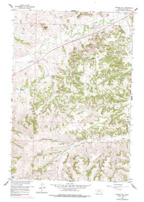
Painted Hill Topo Map Montana
To zoom in, hover over the map of Painted Hill
USGS Topo Quad 45106e7 - 1:24,000 scale
| Topo Map Name: | Painted Hill |
| USGS Topo Quad ID: | 45106e7 |
| Print Size: | ca. 21 1/4" wide x 27" high |
| Southeast Coordinates: | 45.5° N latitude / 106.75° W longitude |
| Map Center Coordinates: | 45.5625° N latitude / 106.8125° W longitude |
| U.S. State: | MT |
| Filename: | o45106e7.jpg |
| Download Map JPG Image: | Painted Hill topo map 1:24,000 scale |
| Map Type: | Topographic |
| Topo Series: | 7.5´ |
| Map Scale: | 1:24,000 |
| Source of Map Images: | United States Geological Survey (USGS) |
| Alternate Map Versions: |
Painted Hill MT 1958, updated 1960 Download PDF Buy paper map Painted Hill MT 1958, updated 1978 Download PDF Buy paper map Painted Hill MT 2011 Download PDF Buy paper map Painted Hill MT 2014 Download PDF Buy paper map |
1:24,000 Topo Quads surrounding Painted Hill
> Back to 45106e1 at 1:100,000 scale
> Back to 45106a1 at 1:250,000 scale
> Back to U.S. Topo Maps home
Painted Hill topo map: Gazetteer
Painted Hill: Populated Places
Muddy elevation 989m 3244′Painted Hill: Post Offices
Muddy Post Office (historical) elevation 989m 3244′Painted Hill: Reservoirs
Two Moon Reservoir elevation 1032m 3385′Painted Hill: Springs
Muddy Springs elevation 1048m 3438′Painted Hill: Streams
Bear Creek elevation 1152m 3779′Bee Creek elevation 1113m 3651′
Butte Creek elevation 996m 3267′
Cow Creek elevation 1073m 3520′
David Creek elevation 996m 3267′
East Fork Muddy Creek elevation 1057m 3467′
Horse Creek elevation 1137m 3730′
Killsnight Creek elevation 996m 3267′
Little Chief Creek elevation 987m 3238′
Medicine Elk Creek elevation 1108m 3635′
Muddy Creek elevation 1010m 3313′
Ridgewalker Creek elevation 989m 3244′
Shavedhead Creek elevation 1119m 3671′
Slocum Creek elevation 1080m 3543′
Spring Creek elevation 1099m 3605′
West Fork Muddy Creek elevation 1056m 3464′
Whitedirt Creek elevation 998m 3274′
Wilfred Creek elevation 1008m 3307′
Painted Hill: Summits
Painted Hill elevation 1147m 3763′Painted Hill: Valleys
Indian Coulee elevation 991m 3251′Wood Gulch elevation 1003m 3290′
Painted Hill: Wells
03S40E04ACD_01 Well elevation 990m 3248′03S40E04ACD_02 Well elevation 990m 3248′
03S40E04ADB_01 Well elevation 1007m 3303′
03S40E05CBC_01 Well elevation 994m 3261′
03S40E05CBC_02 Well elevation 994m 3261′
03S40E05DBA_01 Well elevation 996m 3267′
03S40E07BDD_01 Well elevation 993m 3257′
03S40E07CAB_01 Well elevation 1004m 3293′
03S40E07CCA_01 Well elevation 1003m 3290′
03S40E07CCA_02 Well elevation 997m 3270′
03S40E18DBA_01 Well elevation 1023m 3356′
03S40E33DDC_01 Well elevation 1095m 3592′
03S40E34CDA_01 Well elevation 1082m 3549′
Painted Hill digital topo map on disk
Buy this Painted Hill topo map showing relief, roads, GPS coordinates and other geographical features, as a high-resolution digital map file on DVD:
Eastern Montana & Western North Dakota
Buy digital topo maps: Eastern Montana & Western North Dakota


