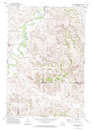
Brandenberg Topo Map Montana
To zoom in, hover over the map of Brandenberg
USGS Topo Quad 45106g2 - 1:24,000 scale
| Topo Map Name: | Brandenberg |
| USGS Topo Quad ID: | 45106g2 |
| Print Size: | ca. 21 1/4" wide x 27" high |
| Southeast Coordinates: | 45.75° N latitude / 106.125° W longitude |
| Map Center Coordinates: | 45.8125° N latitude / 106.1875° W longitude |
| U.S. State: | MT |
| Filename: | o45106g2.jpg |
| Download Map JPG Image: | Brandenberg topo map 1:24,000 scale |
| Map Type: | Topographic |
| Topo Series: | 7.5´ |
| Map Scale: | 1:24,000 |
| Source of Map Images: | United States Geological Survey (USGS) |
| Alternate Map Versions: |
Brandenberg MT 1971, updated 1974 Download PDF Buy paper map Brandenberg MT 2011 Download PDF Buy paper map Brandenberg MT 2014 Download PDF Buy paper map |
1:24,000 Topo Quads surrounding Brandenberg
> Back to 45106e1 at 1:100,000 scale
> Back to 45106a1 at 1:250,000 scale
> Back to U.S. Topo Maps home
Brandenberg topo map: Gazetteer
Brandenberg: Populated Places
Brandenberg elevation 850m 2788′Brandenberg: Post Offices
Brandenberg Post Office (historical) elevation 849m 2785′Brandenberg: Springs
01N44E34DBCB01 Spring elevation 856m 2808′Brandenberg: Streams
Alfalfa Creek elevation 833m 2732′Beaver Creek elevation 848m 2782′
Big John Creek elevation 836m 2742′
Cottonwood Creek elevation 902m 2959′
Diamond Creek elevation 845m 2772′
Dugout Creek elevation 898m 2946′
Freda Creek elevation 833m 2732′
Goodale Creek elevation 835m 2739′
Hart Creek elevation 839m 2752′
J O Creek elevation 899m 2949′
Joe Leg Creek elevation 850m 2788′
Riddle Creek elevation 885m 2903′
Straight Creek elevation 842m 2762′
Trail Creek elevation 839m 2752′
Brandenberg: Summits
Red Butte elevation 1121m 3677′Brandenberg: Wells
01N44E01ACBA01 Well elevation 833m 2732′01N44E01CBBD01 Well elevation 836m 2742′
01N44E02BCBD01 Well elevation 854m 2801′
01N44E10ABAC01 Well elevation 867m 2844′
01N44E12C___01 Well elevation 842m 2762′
01N44E12CBCA01 Well elevation 841m 2759′
01N44E12CBCD01 Well elevation 841m 2759′
01N44E12CBCD02 Well elevation 841m 2759′
01N44E12CBCD03 Well elevation 841m 2759′
01N44E14BBDC01 Well elevation 840m 2755′
01N44E14BBDC02 Well elevation 841m 2759′
01N44E14BCAB01 Well elevation 840m 2755′
01N44E22AADA01 Well elevation 844m 2769′
01N44E22C___01 Well elevation 854m 2801′
01N44E27BDBC01 Well elevation 862m 2828′
01N44E34CABD01 Well elevation 851m 2791′
01N45E06BCBA01 Well elevation 833m 2732′
01N45E17DCBB01 Well elevation 931m 3054′
01N45E18CABB01 Well elevation 871m 2857′
01N45E32DDDC01 Well elevation 942m 3090′
01S45E05DBDC01 Well elevation 879m 2883′
01S45E10BADD01 Well elevation 902m 2959′
01S45E11CBBA01 Well elevation 906m 2972′
Brandenberg digital topo map on disk
Buy this Brandenberg topo map showing relief, roads, GPS coordinates and other geographical features, as a high-resolution digital map file on DVD:
Eastern Montana & Western North Dakota
Buy digital topo maps: Eastern Montana & Western North Dakota


