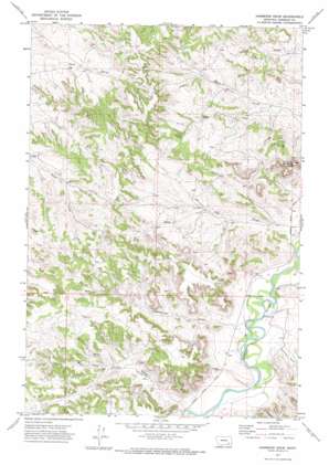
Hammond Draw Topo Map Montana
To zoom in, hover over the map of Hammond Draw
USGS Topo Quad 45106g3 - 1:24,000 scale
| Topo Map Name: | Hammond Draw |
| USGS Topo Quad ID: | 45106g3 |
| Print Size: | ca. 21 1/4" wide x 27" high |
| Southeast Coordinates: | 45.75° N latitude / 106.25° W longitude |
| Map Center Coordinates: | 45.8125° N latitude / 106.3125° W longitude |
| U.S. State: | MT |
| Filename: | o45106g3.jpg |
| Download Map JPG Image: | Hammond Draw topo map 1:24,000 scale |
| Map Type: | Topographic |
| Topo Series: | 7.5´ |
| Map Scale: | 1:24,000 |
| Source of Map Images: | United States Geological Survey (USGS) |
| Alternate Map Versions: |
Hammond Draw MT 1971, updated 1974 Download PDF Buy paper map Hammond Draw MT 2011 Download PDF Buy paper map Hammond Draw MT 2014 Download PDF Buy paper map |
1:24,000 Topo Quads surrounding Hammond Draw
> Back to 45106e1 at 1:100,000 scale
> Back to 45106a1 at 1:250,000 scale
> Back to U.S. Topo Maps home
Hammond Draw topo map: Gazetteer
Hammond Draw: Post Offices
Geddes Post Office (historical) elevation 877m 2877′Hammond Draw: Springs
01N44E30BDCA01 Spring elevation 933m 3061′Hammond Draw: Streams
Roe and Cooper Creek elevation 859m 2818′Hammond Draw: Summits
Trembling Butte elevation 983m 3225′Hammond Draw: Valleys
Hammond Draw elevation 866m 2841′Houston Draw elevation 861m 2824′
Hammond Draw: Wells
01N43E02CCDA01 Well elevation 910m 2985′01N43E15ACAA01 Well elevation 914m 2998′
01N43E22BBAA01 Well elevation 909m 2982′
01N43E24DDAA01 Well elevation 914m 2998′
01N43E25BBDC01 Well elevation 985m 3231′
01N43E26BCAB01 Well elevation 930m 3051′
01N43E27CDDD01 Well elevation 961m 3152′
01N43E36BDAC01 Well elevation 981m 3218′
01N44E04DABD01 Well elevation 878m 2880′
01N44E06CDAB01 Well elevation 918m 3011′
01N44E07AADA01 Well elevation 903m 2962′
01N44E08ACCB01 Well elevation 885m 2903′
01N44E16DBDB01 Well elevation 892m 2926′
01N44E17AAAD01 Well elevation 877m 2877′
01N44E18AACB01 Well elevation 898m 2946′
01N44E19DCAA01 Well elevation 892m 2926′
01N44E27CBAC01 Well elevation 854m 2801′
01N44E29ACBD01 Well elevation 879m 2883′
01N44E30BCDA01 Well elevation 914m 2998′
01N44E31AABA01 Well elevation 924m 3031′
01N44E31CDCB01 Well elevation 916m 3005′
01N44E33DBDC01 Well elevation 848m 2782′
01S44E04DBAA01 Well elevation 883m 2896′
01S44E05ABCC01 Well elevation 915m 3001′
01S44E06CAAB01 Well elevation 955m 3133′
01S44E08DCAD01 Well elevation 890m 2919′
01S44E10CDBC01 Well elevation 871m 2857′
01S44E14B___01 Well elevation 857m 2811′
Hammond Draw digital topo map on disk
Buy this Hammond Draw topo map showing relief, roads, GPS coordinates and other geographical features, as a high-resolution digital map file on DVD:
Eastern Montana & Western North Dakota
Buy digital topo maps: Eastern Montana & Western North Dakota


