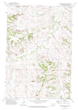
Hammond Draw Sw Topo Map Montana
To zoom in, hover over the map of Hammond Draw Sw
USGS Topo Quad 45106g4 - 1:24,000 scale
| Topo Map Name: | Hammond Draw Sw |
| USGS Topo Quad ID: | 45106g4 |
| Print Size: | ca. 21 1/4" wide x 27" high |
| Southeast Coordinates: | 45.75° N latitude / 106.375° W longitude |
| Map Center Coordinates: | 45.8125° N latitude / 106.4375° W longitude |
| U.S. State: | MT |
| Filename: | o45106g4.jpg |
| Download Map JPG Image: | Hammond Draw Sw topo map 1:24,000 scale |
| Map Type: | Topographic |
| Topo Series: | 7.5´ |
| Map Scale: | 1:24,000 |
| Source of Map Images: | United States Geological Survey (USGS) |
| Alternate Map Versions: |
Hammond Draw SW MT 1971, updated 1974 Download PDF Buy paper map Hammond Draw SW MT 2011 Download PDF Buy paper map Hammond Draw SW MT 2014 Download PDF Buy paper map |
1:24,000 Topo Quads surrounding Hammond Draw Sw
> Back to 45106e1 at 1:100,000 scale
> Back to 45106a1 at 1:250,000 scale
> Back to U.S. Topo Maps home
Hammond Draw Sw topo map: Gazetteer
Hammond Draw Sw: Populated Places
Lee (historical) elevation 896m 2939′Hammond Draw Sw: Post Offices
Lee Post Office (historical) elevation 896m 2939′Hammond Draw Sw: Springs
01N42E01CDB_01 Spring elevation 896m 2939′01N43E34BBDC01 Spring elevation 942m 3090′
Hammond Draw Sw: Streams
Bean Creek elevation 892m 2926′Bean Creek elevation 875m 2870′
Cow Creek elevation 871m 2857′
Greenleaf Creek elevation 883m 2896′
Miller Creek elevation 897m 2942′
South Fork Cow Creek elevation 896m 2939′
Hammond Draw Sw: Valleys
Hay Coulee elevation 903m 2962′Hammond Draw Sw: Wells
01N42E12ABBA01 Well elevation 903m 2962′01N42E13BCAC01 Well elevation 943m 3093′
01N42E22CABD01 Well elevation 929m 3047′
01N42E25BBCC01 Well elevation 899m 2949′
01N42E25BCDD01 Well elevation 892m 2926′
01N42E34ACAB01 Well elevation 903m 2962′
01N43E04ADDD01 Well elevation 888m 2913′
01N43E08ACCA01 Well elevation 875m 2870′
01N43E08ACDC01 Well elevation 876m 2874′
01N43E09DDDA01 Well elevation 900m 2952′
01N43E17AACA01 Well elevation 885m 2903′
01N43E18DDBA01 Well elevation 878m 2880′
01N43E20CCCD01 Well elevation 892m 2926′
01N43E21CBCA01 Well elevation 905m 2969′
01N43E29BCDA01 Well elevation 902m 2959′
01N43E30BBDB01 Well elevation 895m 2936′
01N43E31ADBC01 Well elevation 958m 3143′
01N43E31BADC01 Well elevation 946m 3103′
01N43E32DDAA01 Well elevation 927m 3041′
01N43E33BBBB01 Well elevation 909m 2982′
01S42E12C___01 Well elevation 928m 3044′
01S42E12CBDC01 Well elevation 931m 3054′
01S43E11BDDC01 Well elevation 941m 3087′
01S43E11CBDA01 Well elevation 946m 3103′
01S43E15AADD01 Well elevation 953m 3126′
01S43E16ABCC01 Well elevation 989m 3244′
01S43E17BCAC01 Well elevation 963m 3159′
06S43E20DDBB01 Well elevation 911m 2988′
Hammond Draw Sw digital topo map on disk
Buy this Hammond Draw Sw topo map showing relief, roads, GPS coordinates and other geographical features, as a high-resolution digital map file on DVD:
Eastern Montana & Western North Dakota
Buy digital topo maps: Eastern Montana & Western North Dakota


