H S School Topo Map Montana
To zoom in, hover over the map of H S School
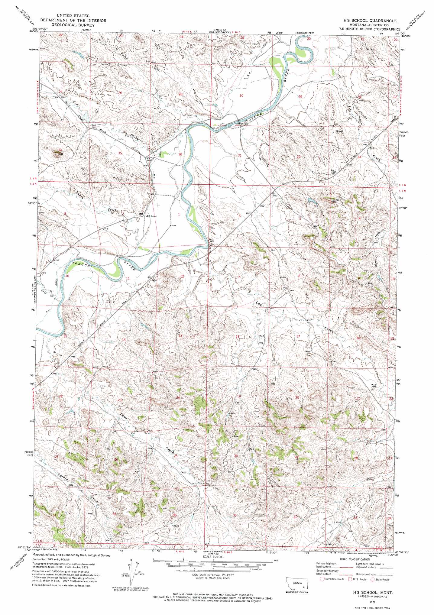
USGS Topo Quad 45106h1 - 1:24,000 scale
| Topo Map Name: | H S School |
| USGS Topo Quad ID: | 45106h1 |
| Print Size: | ca. 21 1/4" wide x 27" high |
| Southeast Coordinates: | 45.875° N latitude / 106° W longitude |
| Map Center Coordinates: | 45.9375° N latitude / 106.0625° W longitude |
| U.S. State: | MT |
| Filename: | o45106h1.jpg |
| Download Map JPG Image: | H S School topo map 1:24,000 scale |
| Map Type: | Topographic |
| Topo Series: | 7.5´ |
| Map Scale: | 1:24,000 |
| Source of Map Images: | United States Geological Survey (USGS) |
| Alternate Map Versions: |
HS School MT 1971, updated 1974 Download PDF Buy paper map S H School MT 2011 Download PDF Buy paper map S H School MT 2014 Download PDF Buy paper map |
1:24,000 Topo Quads surrounding H S School
Indian Creek |
Miller Creek Nw |
Moon Creek School |
Jack Creek Nw |
Circle L Creek |
Crain Place |
Miller Creek Sw |
Miller Creek |
Garland School |
Jack Creek |
John Hen Creek |
Brandenberg Nw |
H S School |
Fourmile Creek |
Carey-Malone School |
Hammond Draw |
Brandenberg |
Hayes Point |
North Stacey School |
Foster Creek School |
Ashland Ne |
Cook Creek Reservoir |
Beaver Creek School |
Stacey |
Elk Ridge |
> Back to 45106e1 at 1:100,000 scale
> Back to 45106a1 at 1:250,000 scale
> Back to U.S. Topo Maps home
H S School topo map: Gazetteer
H S School: Canals
S H Ditch elevation 817m 2680′H S School: Streams
Coal Creek elevation 818m 2683′Coon Creek elevation 818m 2683′
Cow Creek elevation 806m 2644′
Lay Creek elevation 812m 2664′
Pump Creek elevation 805m 2641′
Ranch Creek elevation 812m 2664′
H S School: Wells
02N45E02BBDD01 Well elevation 852m 2795′02N46E19CAAC01 Well elevation 868m 2847′
02N46E21ADBB01 Well elevation 866m 2841′
02N46E30ACDA01 Well elevation 891m 2923′
03N45E36CBBA01 Well elevation 817m 2680′
03N45E36CBBA02 Well elevation 818m 2683′
03N45E36CBBB01 Well elevation 818m 2683′
03N46E29BBDC01 Well elevation 804m 2637′
03N46E34DCCD01 Well elevation 829m 2719′
H S School digital topo map on disk
Buy this H S School topo map showing relief, roads, GPS coordinates and other geographical features, as a high-resolution digital map file on DVD:
Eastern Montana & Western North Dakota
Buy digital topo maps: Eastern Montana & Western North Dakota