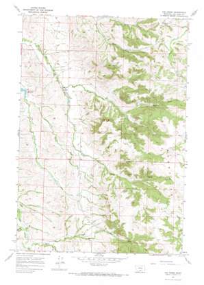
Kid Creek Topo Map Montana
To zoom in, hover over the map of Kid Creek
USGS Topo Quad 45107b2 - 1:24,000 scale
| Topo Map Name: | Kid Creek |
| USGS Topo Quad ID: | 45107b2 |
| Print Size: | ca. 21 1/4" wide x 27" high |
| Southeast Coordinates: | 45.125° N latitude / 107.125° W longitude |
| Map Center Coordinates: | 45.1875° N latitude / 107.1875° W longitude |
| U.S. State: | MT |
| Filename: | o45107b2.jpg |
| Download Map JPG Image: | Kid Creek topo map 1:24,000 scale |
| Map Type: | Topographic |
| Topo Series: | 7.5´ |
| Map Scale: | 1:24,000 |
| Source of Map Images: | United States Geological Survey (USGS) |
| Alternate Map Versions: |
Kid Creek MT 1967, updated 1971 Download PDF Buy paper map Kid Creek MT 2011 Download PDF Buy paper map Kid Creek MT 2014 Download PDF Buy paper map |
1:24,000 Topo Quads surrounding Kid Creek
> Back to 45107a1 at 1:100,000 scale
> Back to 45106a1 at 1:250,000 scale
> Back to U.S. Topo Maps home
Kid Creek topo map: Gazetteer
Kid Creek: Gaps
Sioux Pass elevation 1467m 4812′Kid Creek: Ranges
Wolf Mountains elevation 1476m 4842′Kid Creek: Streams
Bear Creek elevation 1142m 3746′Kid Creek elevation 1158m 3799′
Little Bear Creek elevation 1164m 3818′
Little Beaver Creek elevation 1134m 3720′
Middle Pine Creek elevation 1133m 3717′
North Fork Sioux Pass Creek elevation 1208m 3963′
Kid Creek: Wells
01N37E19DABB01 Well elevation 1431m 4694′Kid Creek digital topo map on disk
Buy this Kid Creek topo map showing relief, roads, GPS coordinates and other geographical features, as a high-resolution digital map file on DVD:
Eastern Montana & Western North Dakota
Buy digital topo maps: Eastern Montana & Western North Dakota


