Lemonade Springs Topo Map Montana
To zoom in, hover over the map of Lemonade Springs
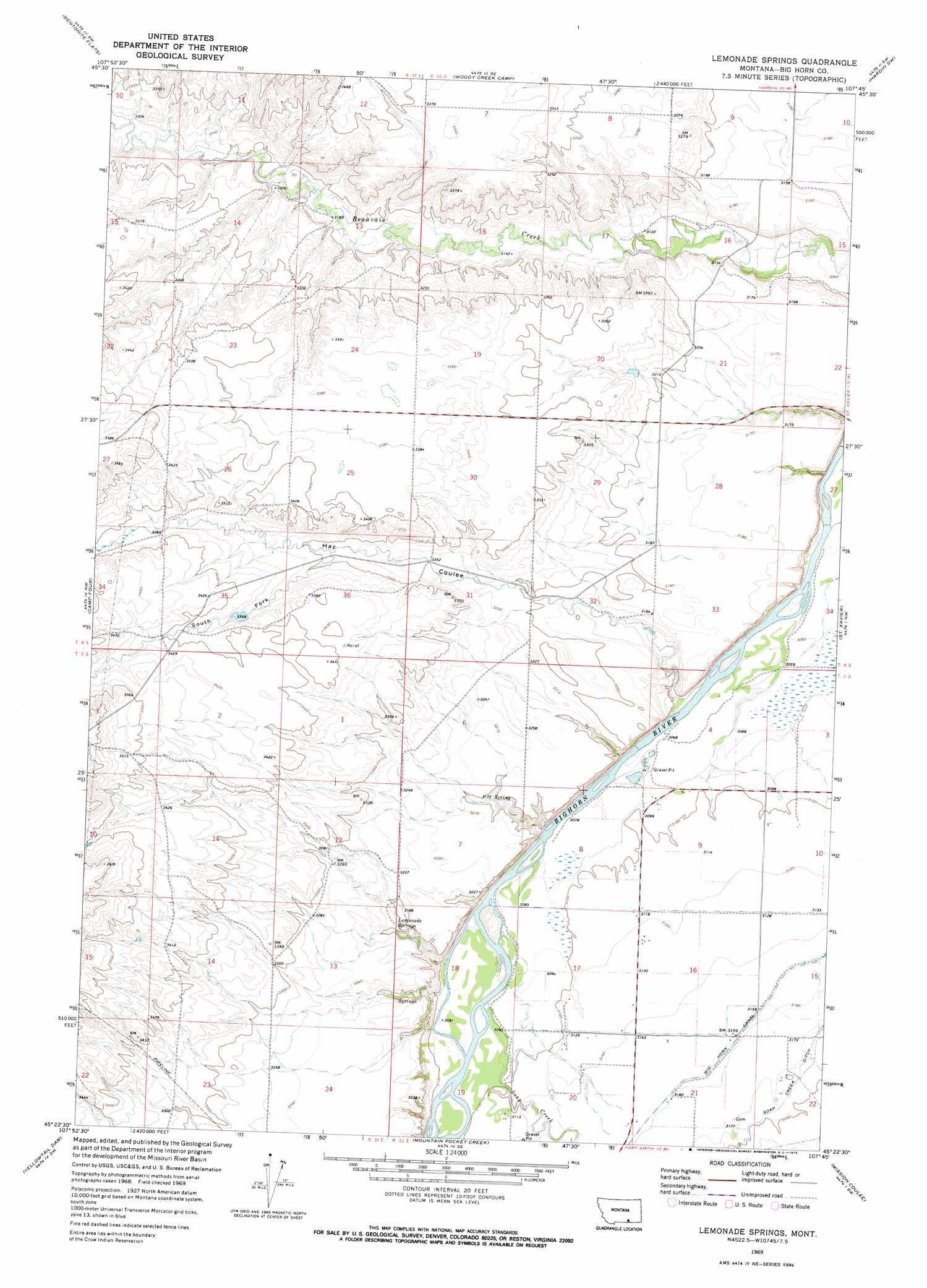
USGS Topo Quad 45107d7 - 1:24,000 scale
| Topo Map Name: | Lemonade Springs |
| USGS Topo Quad ID: | 45107d7 |
| Print Size: | ca. 21 1/4" wide x 27" high |
| Southeast Coordinates: | 45.375° N latitude / 107.75° W longitude |
| Map Center Coordinates: | 45.4375° N latitude / 107.8125° W longitude |
| U.S. State: | MT |
| Filename: | o45107d7.jpg |
| Download Map JPG Image: | Lemonade Springs topo map 1:24,000 scale |
| Map Type: | Topographic |
| Topo Series: | 7.5´ |
| Map Scale: | 1:24,000 |
| Source of Map Images: | United States Geological Survey (USGS) |
| Alternate Map Versions: |
Lemonade Springs MT 1969, updated 1973 Download PDF Buy paper map Lemonade Springs MT 2011 Download PDF Buy paper map Lemonade Springs MT 2014 Download PDF Buy paper map |
1:24,000 Topo Quads surrounding Lemonade Springs
North Telegraph Creek |
Rowley Nw |
Rowley |
Walker Hill |
Hardin |
Woody Mountain Se |
Bentonite Flats |
Woody Creek Camp |
Hardin Sw |
Prante Ranch |
Mott Creek |
Camp Four |
Lemonade Springs |
Saint Xavier |
Saint Xavier Ne |
Grapevine Dome |
Yellowtail Dam |
Mountain Pocket Creek |
Mission Coulee |
Shick Ranch |
Little Finger Ridge |
Peyote Point |
Limestone Canyon |
Dry Soap Creek |
Willow Creek Dam |
> Back to 45107a1 at 1:100,000 scale
> Back to 45106a1 at 1:250,000 scale
> Back to U.S. Topo Maps home
Lemonade Springs topo map: Gazetteer
Lemonade Springs: Springs
Lemonade Springs elevation 969m 3179′Lemonade Springs: Streams
Soap Creek elevation 940m 3083′Lemonade Springs: Valleys
Hay Coulee elevation 938m 3077′South Fork Hay Coulee elevation 1005m 3297′
Lemonade Springs: Wells
05S32E20BAA_01 Well elevation 952m 3123′Lemonade Springs digital topo map on disk
Buy this Lemonade Springs topo map showing relief, roads, GPS coordinates and other geographical features, as a high-resolution digital map file on DVD:
Eastern Montana & Western North Dakota
Buy digital topo maps: Eastern Montana & Western North Dakota