Jeans Fork Sw Topo Map Montana
To zoom in, hover over the map of Jeans Fork Sw
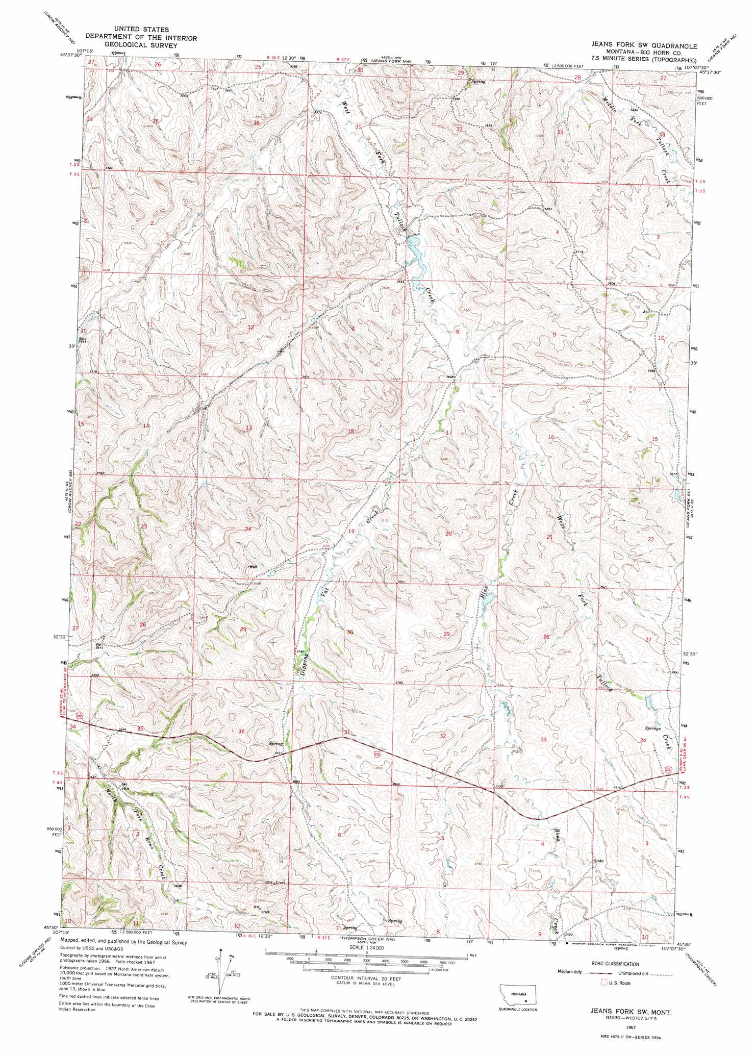
USGS Topo Quad 45107e2 - 1:24,000 scale
| Topo Map Name: | Jeans Fork Sw |
| USGS Topo Quad ID: | 45107e2 |
| Print Size: | ca. 21 1/4" wide x 27" high |
| Southeast Coordinates: | 45.5° N latitude / 107.125° W longitude |
| Map Center Coordinates: | 45.5625° N latitude / 107.1875° W longitude |
| U.S. State: | MT |
| Filename: | o45107e2.jpg |
| Download Map JPG Image: | Jeans Fork Sw topo map 1:24,000 scale |
| Map Type: | Topographic |
| Topo Series: | 7.5´ |
| Map Scale: | 1:24,000 |
| Source of Map Images: | United States Geological Survey (USGS) |
| Alternate Map Versions: |
Jeans Fork SW MT 1967, updated 1971 Download PDF Buy paper map Jeans Fork SW MT 2011 Download PDF Buy paper map Jeans Fork SW MT 2014 Download PDF Buy paper map |
1:24,000 Topo Quads surrounding Jeans Fork Sw
The Dugout |
Padlock Ranch |
Iron Spring Sw |
Wolf School |
Sarpy School |
Little Dry Creek |
Crow Agency Ne |
Jeans Fork Nw |
Jeans Fork Ne |
Chalky Point |
Crow Agency |
Crow Agency Se |
Jeans Fork Sw |
Jeans Fork Se |
Busby |
Benteen |
Lodge Grass Ne |
Thompson Creek Nw |
Thompson Creek |
Birdseye Spring |
Good Luck Creek |
Lodge Grass |
Wolf Mountain Lookout |
Spring Creek Ranch |
Kirby |
> Back to 45107e1 at 1:100,000 scale
> Back to 45106a1 at 1:250,000 scale
> Back to U.S. Topo Maps home
Jeans Fork Sw topo map: Gazetteer
Jeans Fork Sw: Dams
Close Enough Dam elevation 1081m 3546′Sticking There Dam elevation 1040m 3412′
Jeans Fork Sw: Streams
Dipping Vat Creek elevation 1051m 3448′Jeans Fork Sw: Wells
01N37E07DDDB01 Well elevation 1089m 3572′Jeans Fork Sw digital topo map on disk
Buy this Jeans Fork Sw topo map showing relief, roads, GPS coordinates and other geographical features, as a high-resolution digital map file on DVD:
Eastern Montana & Western North Dakota
Buy digital topo maps: Eastern Montana & Western North Dakota