Jeans Fork Ne Topo Map Montana
To zoom in, hover over the map of Jeans Fork Ne
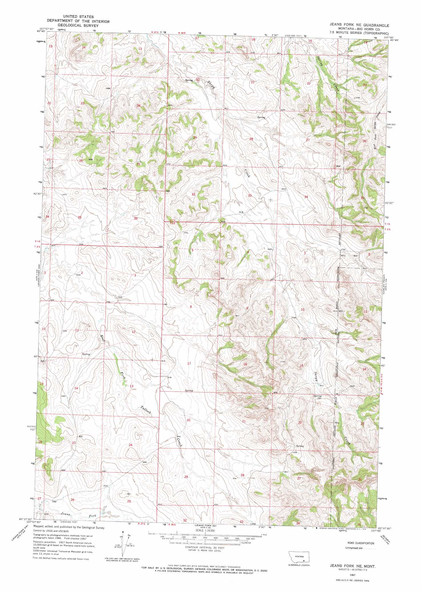
USGS Topo Quad 45107f1 - 1:24,000 scale
| Topo Map Name: | Jeans Fork Ne |
| USGS Topo Quad ID: | 45107f1 |
| Print Size: | ca. 21 1/4" wide x 27" high |
| Southeast Coordinates: | 45.625° N latitude / 107° W longitude |
| Map Center Coordinates: | 45.6875° N latitude / 107.0625° W longitude |
| U.S. State: | MT |
| Filename: | o45107f1.jpg |
| Download Map JPG Image: | Jeans Fork Ne topo map 1:24,000 scale |
| Map Type: | Topographic |
| Topo Series: | 7.5´ |
| Map Scale: | 1:24,000 |
| Source of Map Images: | United States Geological Survey (USGS) |
| Alternate Map Versions: |
Jeans Fork NE MT 1967, updated 1970 Download PDF Buy paper map Jeans Fork NE MT 2011 Download PDF Buy paper map Jeans Fork NE MT 2014 Download PDF Buy paper map |
1:24,000 Topo Quads surrounding Jeans Fork Ne
Hammond Ranch |
Iron Spring |
Minnehaha Creek South |
Mcclure Creek |
Trail Creek School |
Padlock Ranch |
Iron Spring Sw |
Wolf School |
Sarpy School |
Rough Draw |
Crow Agency Ne |
Jeans Fork Nw |
Jeans Fork Ne |
Chalky Point |
Black Spring |
Crow Agency Se |
Jeans Fork Sw |
Jeans Fork Se |
Busby |
Painted Hill |
Lodge Grass Ne |
Thompson Creek Nw |
Thompson Creek |
Birdseye Spring |
Bull Creek Lookout |
> Back to 45107e1 at 1:100,000 scale
> Back to 45106a1 at 1:250,000 scale
> Back to U.S. Topo Maps home
Jeans Fork Ne topo map: Gazetteer
Jeans Fork Ne: Wells
01S37E13BCDB01 Well elevation 1089m 3572′01S38E23BBAD01 Well elevation 1133m 3717′
02S37E03AAAD01 Well elevation 1038m 3405′
Jeans Fork Ne digital topo map on disk
Buy this Jeans Fork Ne topo map showing relief, roads, GPS coordinates and other geographical features, as a high-resolution digital map file on DVD:
Eastern Montana & Western North Dakota
Buy digital topo maps: Eastern Montana & Western North Dakota