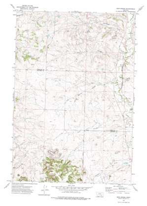
Iron Spring Topo Map Montana
To zoom in, hover over the map of Iron Spring
USGS Topo Quad 45107h2 - 1:24,000 scale
| Topo Map Name: | Iron Spring |
| USGS Topo Quad ID: | 45107h2 |
| Print Size: | ca. 21 1/4" wide x 27" high |
| Southeast Coordinates: | 45.875° N latitude / 107.125° W longitude |
| Map Center Coordinates: | 45.9375° N latitude / 107.1875° W longitude |
| U.S. State: | MT |
| Filename: | o45107h2.jpg |
| Download Map JPG Image: | Iron Spring topo map 1:24,000 scale |
| Map Type: | Topographic |
| Topo Series: | 7.5´ |
| Map Scale: | 1:24,000 |
| Source of Map Images: | United States Geological Survey (USGS) |
| Alternate Map Versions: |
Iron Spring MT 1972, updated 1975 Download PDF Buy paper map Iron Spring MT 2011 Download PDF Buy paper map Iron Spring MT 2014 Download PDF Buy paper map |
1:24,000 Topo Quads surrounding Iron Spring
> Back to 45107e1 at 1:100,000 scale
> Back to 45106a1 at 1:250,000 scale
> Back to U.S. Topo Maps home
Iron Spring topo map: Gazetteer
Iron Spring: Springs
02N36E11AACD01 Spring elevation 989m 3244′02N36E14ABAB01 Spring elevation 1001m 3284′
02N36E23AADB02 Spring elevation 1012m 3320′
02N37E18CCCD01 Spring elevation 984m 3228′
02N37E19CDDC01 Spring elevation 992m 3254′
Iron Spring elevation 976m 3202′
Iron Spring: Valleys
Coxs Coulee elevation 933m 3061′Dawes Coulee elevation 945m 3100′
Iron Spring Coulee elevation 942m 3090′
Kray Coulee elevation 951m 3120′
Rainwater Coulee elevation 925m 3034′
Willoughby Coulee elevation 934m 3064′
Iron Spring: Wells
02N36E11ADAA01 Well elevation 988m 3241′02N36E12ABDC01 Well elevation 981m 3218′
02N36E26BCDB01 Well elevation 1031m 3382′
02N36E28DDAC01 Well elevation 990m 3248′
02N37E04BDCD01 Well elevation 952m 3123′
02N37E05C___01 Well elevation 954m 3129′
02N37E08ADDC01 Well elevation 950m 3116′
02N37E08BDAD01 Well elevation 939m 3080′
02N37E17ACCC01 Well elevation 957m 3139′
02N37E18CCAD01 Well elevation 984m 3228′
02N37E20ABDB01 Well elevation 963m 3159′
02N37E20ABDC01 Well elevation 966m 3169′
02N37E21CAAC01 Well elevation 954m 3129′
02N37E28ACCB01 Well elevation 978m 3208′
02N37E28ACCB02 Well elevation 965m 3166′
02N37E29CADD01 Well elevation 971m 3185′
02N37E32BBBB01 Well elevation 982m 3221′
Iron Spring digital topo map on disk
Buy this Iron Spring topo map showing relief, roads, GPS coordinates and other geographical features, as a high-resolution digital map file on DVD:
Eastern Montana & Western North Dakota
Buy digital topo maps: Eastern Montana & Western North Dakota


