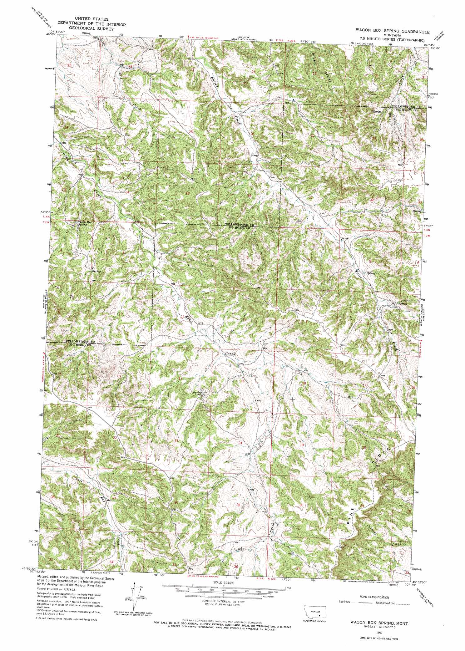
Wagon Box Spring Topo Map Montana
To zoom in, hover over the map of Wagon Box Spring
USGS Topo Quad 45107h7 - 1:24,000 scale
| Topo Map Name: | Wagon Box Spring |
| USGS Topo Quad ID: | 45107h7 |
| Print Size: | ca. 21 1/4" wide x 27" high |
| Southeast Coordinates: | 45.875° N latitude / 107.75° W longitude |
| Map Center Coordinates: | 45.9375° N latitude / 107.8125° W longitude |
| U.S. State: | MT |
| Filename: | o45107h7.jpg |
| Download Map JPG Image: | Wagon Box Spring topo map 1:24,000 scale |
| Map Type: | Topographic |
| Topo Series: | 7.5´ |
| Map Scale: | 1:24,000 |
| Source of Map Images: | United States Geological Survey (USGS) |
| Alternate Map Versions: |
Wagon Box Spring MT 1967, updated 1971 Download PDF Buy paper map Wagon Box Spring MT 2011 Download PDF Buy paper map Wagon Box Spring MT 2014 Download PDF Buy paper map |
1:24,000 Topo Quads surrounding Wagon Box Spring
P K Ranch Ne |
Bull Mountain Nw |
Mud Butte |
Coal Bank Creek |
Custer |
P K Ranch Se |
Big Marys Island |
Bull Mountain |
Waco |
Mission Creek |
Nibbe |
Pompeys Pillar |
Wagon Box Spring |
Lemon Ranch |
Foster |
Gails Coulee |
Corinth |
Blue Spring |
Chimney Creek |
Ninemile Point |
North Telegraph Creek |
Rowley Nw |
Rowley |
Walker Hill |
Hardin |
> Back to 45107e1 at 1:100,000 scale
> Back to 45106a1 at 1:250,000 scale
> Back to U.S. Topo Maps home
Wagon Box Spring topo map: Gazetteer
Wagon Box Spring: Springs
Wagon Box Spring elevation 968m 3175′Wagon Box Spring: Wells
02N31E09BAAC01 Well elevation 1066m 3497′03N31E27CAAD01 Well elevation 1015m 3330′
Wagon Box Spring digital topo map on disk
Buy this Wagon Box Spring topo map showing relief, roads, GPS coordinates and other geographical features, as a high-resolution digital map file on DVD:
Eastern Montana & Western North Dakota
Buy digital topo maps: Eastern Montana & Western North Dakota