Two Point Topo Map Montana
To zoom in, hover over the map of Two Point
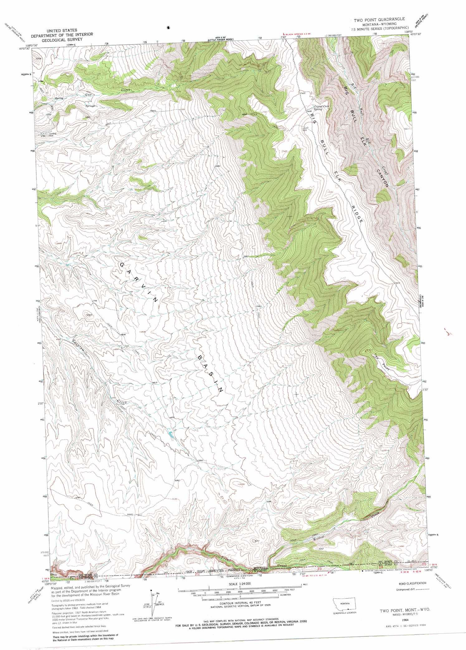
USGS Topo Quad 45108a1 - 1:24,000 scale
| Topo Map Name: | Two Point |
| USGS Topo Quad ID: | 45108a1 |
| Print Size: | ca. 21 1/4" wide x 27" high |
| Southeast Coordinates: | 45° N latitude / 108° W longitude |
| Map Center Coordinates: | 45.0625° N latitude / 108.0625° W longitude |
| U.S. States: | MT, WY |
| Filename: | o45108a1.jpg |
| Download Map JPG Image: | Two Point topo map 1:24,000 scale |
| Map Type: | Topographic |
| Topo Series: | 7.5´ |
| Map Scale: | 1:24,000 |
| Source of Map Images: | United States Geological Survey (USGS) |
| Alternate Map Versions: |
Two Point MT 1964, updated 1966 Download PDF Buy paper map Two Point MT 1964, updated 1979 Download PDF Buy paper map Two Point MT 2011 Download PDF Buy paper map Two Point MT 2014 Download PDF Buy paper map |
1:24,000 Topo Quads surrounding Two Point
Deep Creek Se |
Bear Coulee Sw |
Grapevine Dome |
Yellowtail Dam |
Mountain Pocket Creek |
East Pryor Mountain |
Dead Indian Hill |
Little Finger Ridge |
Peyote Point |
Limestone Canyon |
Mystery Cave |
Hillsboro |
Two Point |
Bear Hole |
Red Springs |
Sykes Spring |
Natural Trap Cave |
Simmons Canyon |
Mexican Hill |
Boyd Ridge |
Lovell Lakes |
Kane |
Cottonwood Canyon |
Medicine Wheel |
Bald Mountain |
> Back to 45108a1 at 1:100,000 scale
> Back to 45108a1 at 1:250,000 scale
> Back to U.S. Topo Maps home
Two Point topo map: Gazetteer
Two Point: Capes
Two Point elevation 2377m 7798′Two Point: Ridges
Big Bull Elk Ridge elevation 2264m 7427′Two Point: Springs
Crystal Cave Spring elevation 2273m 7457′Two Point: Streams
Willow Creek elevation 1445m 4740′Willow Creek elevation 1454m 4770′
Two Point digital topo map on disk
Buy this Two Point topo map showing relief, roads, GPS coordinates and other geographical features, as a high-resolution digital map file on DVD: