Warren Topo Map Montana
To zoom in, hover over the map of Warren
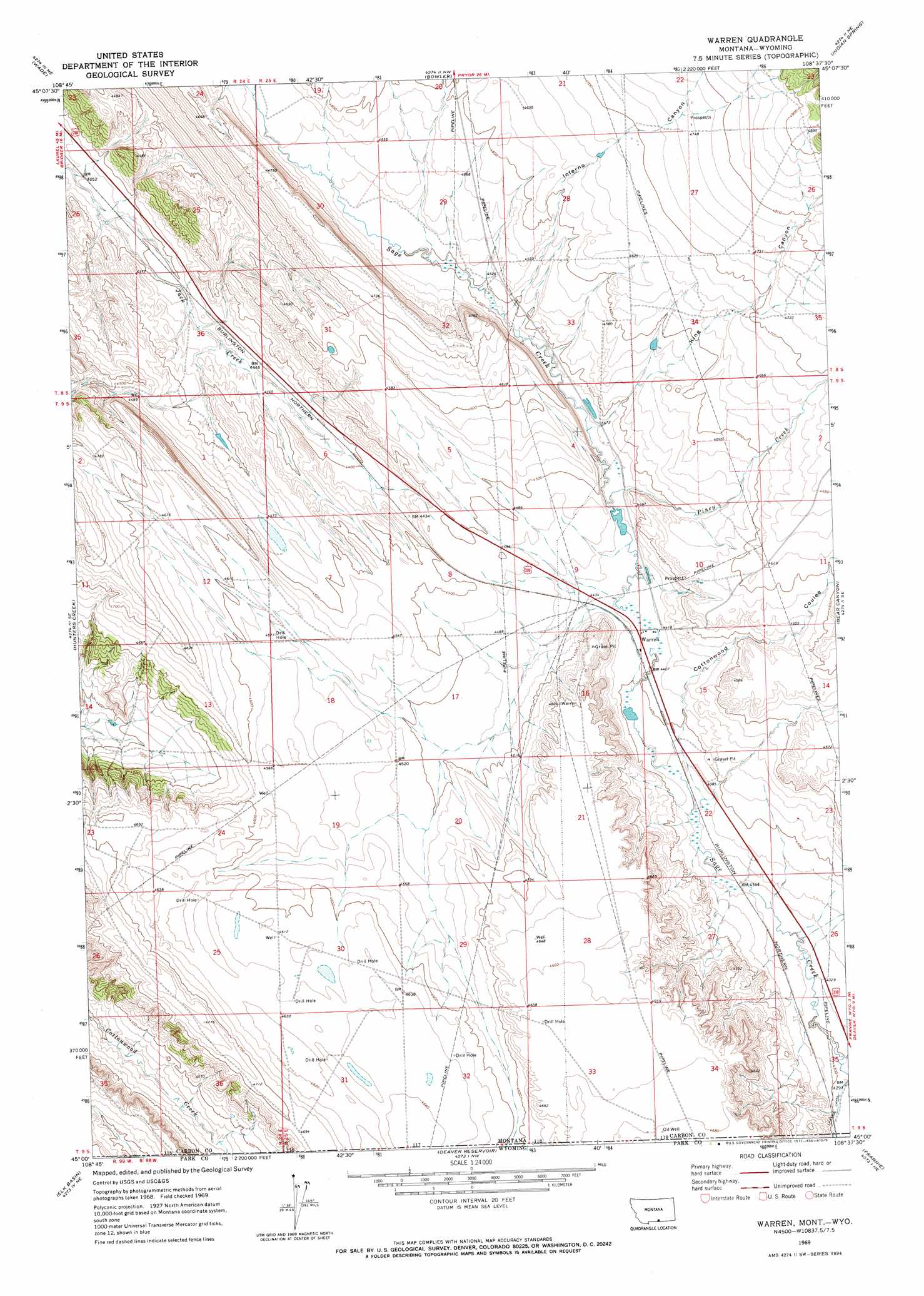
USGS Topo Quad 45108a6 - 1:24,000 scale
| Topo Map Name: | Warren |
| USGS Topo Quad ID: | 45108a6 |
| Print Size: | ca. 21 1/4" wide x 27" high |
| Southeast Coordinates: | 45° N latitude / 108.625° W longitude |
| Map Center Coordinates: | 45.0625° N latitude / 108.6875° W longitude |
| U.S. States: | MT, WY |
| Filename: | o45108a6.jpg |
| Download Map JPG Image: | Warren topo map 1:24,000 scale |
| Map Type: | Topographic |
| Topo Series: | 7.5´ |
| Map Scale: | 1:24,000 |
| Source of Map Images: | United States Geological Survey (USGS) |
| Alternate Map Versions: |
Warren MT 1969, updated 1972 Download PDF Buy paper map Warren MT 2011 Download PDF Buy paper map Warren MT 2014 Download PDF Buy paper map |
1:24,000 Topo Quads surrounding Warren
Bridger |
Bluewater |
Section House Draw |
Castle Rocks |
Deep Creek Sw |
Hatcher Pass |
Wade |
Bowler |
Indian Spring |
Big Ice Cave |
Long Draw |
Hunters Creek |
Warren |
Bear Canyon |
Red Pryor Mountain |
Elk Basin Nw |
Elk Basin |
Deaver Reservoir |
Frannie |
Cowley |
Elk Basin Sw |
Elk Basin Se |
Garland |
Byron |
Lovell |
> Back to 45108a1 at 1:100,000 scale
> Back to 45108a1 at 1:250,000 scale
> Back to U.S. Topo Maps home
Warren topo map: Gazetteer
Warren: Dams
Drum Number 2 Dam elevation 1364m 4475′Warren: Populated Places
Warren elevation 1347m 4419′Warren: Post Offices
Bean Post Office (historical) elevation 1382m 4534′Warren Post Office (historical) elevation 1347m 4419′
Warren: Reservoirs
Adams Reservoir elevation 1364m 4475′Warren: Streams
Piney Creek elevation 1354m 4442′Warren: Valleys
Cottonwood Coulee elevation 1344m 4409′Inferno Canyon elevation 1369m 4491′
King Canyon elevation 1362m 4468′
Warren: Wells
09S25E23ABCD01 Well elevation 1381m 4530′09S25E33DDDD01 Well elevation 1427m 4681′
09S25E34CCCC01 Well elevation 1426m 4678′
Warren digital topo map on disk
Buy this Warren topo map showing relief, roads, GPS coordinates and other geographical features, as a high-resolution digital map file on DVD: