Hunters Creek Topo Map Montana
To zoom in, hover over the map of Hunters Creek
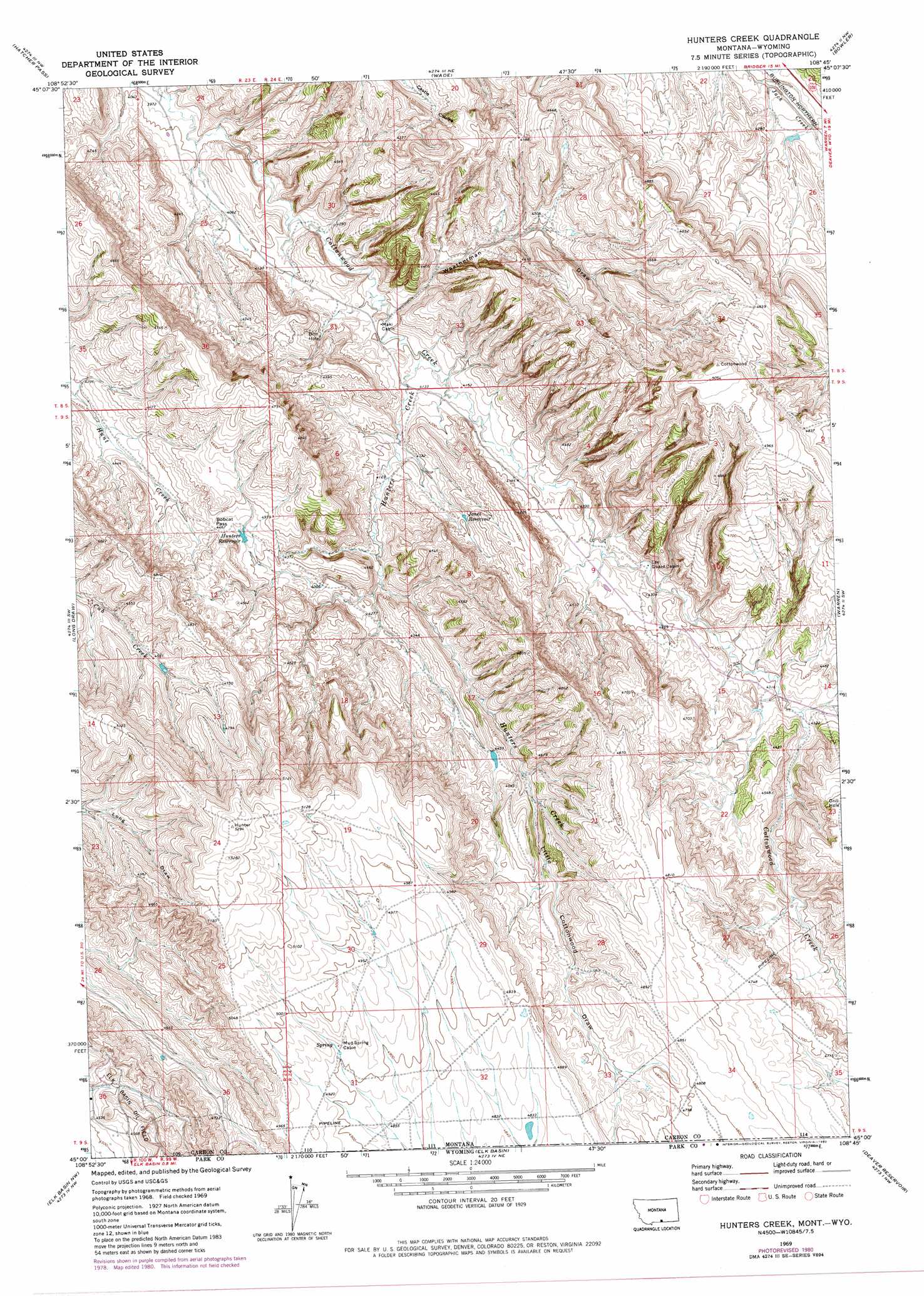
USGS Topo Quad 45108a7 - 1:24,000 scale
| Topo Map Name: | Hunters Creek |
| USGS Topo Quad ID: | 45108a7 |
| Print Size: | ca. 21 1/4" wide x 27" high |
| Southeast Coordinates: | 45° N latitude / 108.75° W longitude |
| Map Center Coordinates: | 45.0625° N latitude / 108.8125° W longitude |
| U.S. States: | MT, WY |
| Filename: | o45108a7.jpg |
| Download Map JPG Image: | Hunters Creek topo map 1:24,000 scale |
| Map Type: | Topographic |
| Topo Series: | 7.5´ |
| Map Scale: | 1:24,000 |
| Source of Map Images: | United States Geological Survey (USGS) |
| Alternate Map Versions: |
Hunters Creek MT 1969, updated 1973 Download PDF Buy paper map Hunters Creek MT 1969, updated 1980 Download PDF Buy paper map Hunters Creek MT 2011 Download PDF Buy paper map Hunters Creek MT 2014 Download PDF Buy paper map |
1:24,000 Topo Quads surrounding Hunters Creek
The Big Slide |
Bridger |
Bluewater |
Section House Draw |
Castle Rocks |
Belfry |
Hatcher Pass |
Wade |
Bowler |
Indian Spring |
Hollenbeck Draw |
Long Draw |
Hunters Creek |
Warren |
Bear Canyon |
Badger Basin |
Elk Basin Nw |
Elk Basin |
Deaver Reservoir |
Frannie |
Badlands Hills |
Elk Basin Sw |
Elk Basin Se |
Garland |
Byron |
> Back to 45108a1 at 1:100,000 scale
> Back to 45108a1 at 1:250,000 scale
> Back to U.S. Topo Maps home
Hunters Creek topo map: Gazetteer
Hunters Creek: Gaps
Bobcat Pass elevation 1364m 4475′Hunters Creek: Reservoirs
Hunters Reservoir elevation 1349m 4425′Jones Reservoir elevation 1307m 4288′
Hunters Creek: Streams
Hunters Creek elevation 1251m 4104′Hunters Creek: Valleys
Little Cottonwood Draw elevation 1361m 4465′Little Cottonwood Draw elevation 1360m 4461′
Weatherman Draw elevation 1245m 4084′
Hunters Creek digital topo map on disk
Buy this Hunters Creek topo map showing relief, roads, GPS coordinates and other geographical features, as a high-resolution digital map file on DVD: