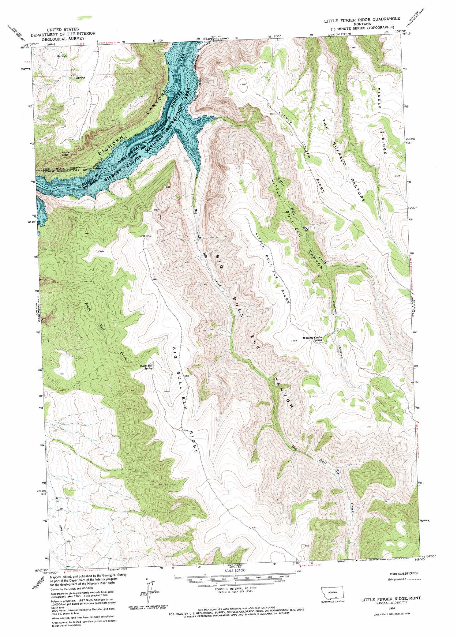
Little Finger Ridge Topo Map Montana
To zoom in, hover over the map of Little Finger Ridge
USGS Topo Quad 45108b1 - 1:24,000 scale
| Topo Map Name: | Little Finger Ridge |
| USGS Topo Quad ID: | 45108b1 |
| Print Size: | ca. 21 1/4" wide x 27" high |
| Southeast Coordinates: | 45.125° N latitude / 108° W longitude |
| Map Center Coordinates: | 45.1875° N latitude / 108.0625° W longitude |
| U.S. State: | MT |
| Filename: | o45108b1.jpg |
| Download Map JPG Image: | Little Finger Ridge topo map 1:24,000 scale |
| Map Type: | Topographic |
| Topo Series: | 7.5´ |
| Map Scale: | 1:24,000 |
| Source of Map Images: | United States Geological Survey (USGS) |
| Alternate Map Versions: |
Little Finger Ridge MT 1964, updated 1967 Download PDF Buy paper map Little Finger Ridge MT 2011 Download PDF Buy paper map Little Finger Ridge MT 2014 Download PDF Buy paper map |
1:24,000 Topo Quads surrounding Little Finger Ridge
Chilkoot Coulee |
Bear Coulee |
Mott Creek |
Camp Four |
Lemonade Springs |
Deep Creek Se |
Bear Coulee Sw |
Grapevine Dome |
Yellowtail Dam |
Mountain Pocket Creek |
East Pryor Mountain |
Dead Indian Hill |
Little Finger Ridge |
Peyote Point |
Limestone Canyon |
Mystery Cave |
Hillsboro |
Two Point |
Bear Hole |
Red Springs |
Sykes Spring |
Natural Trap Cave |
Simmons Canyon |
Mexican Hill |
Boyd Ridge |
> Back to 45108a1 at 1:100,000 scale
> Back to 45108a1 at 1:250,000 scale
> Back to U.S. Topo Maps home
Little Finger Ridge topo map: Gazetteer
Little Finger Ridge: Ridges
Little Bull Elk Ridge elevation 1886m 6187′Little Finger Ridge elevation 1749m 5738′
Middle Ridge elevation 1708m 5603′
Little Finger Ridge: Springs
Black Tail Spring elevation 1911m 6269′Whiskey Coulee Spring elevation 1851m 6072′
Little Finger Ridge: Streams
Big Bull Elk Creek elevation 1110m 3641′Little Bull Elk Creek elevation 1110m 3641′
Little Finger Ridge: Valleys
Big Bull Elk Canyon elevation 1110m 3641′Little Bull Elk Canyon elevation 1110m 3641′
Whiskey Coulee elevation 1573m 5160′
Little Finger Ridge digital topo map on disk
Buy this Little Finger Ridge topo map showing relief, roads, GPS coordinates and other geographical features, as a high-resolution digital map file on DVD: