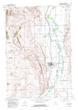
Bridger Topo Map Montana
To zoom in, hover over the map of Bridger
USGS Topo Quad 45108c8 - 1:24,000 scale
| Topo Map Name: | Bridger |
| USGS Topo Quad ID: | 45108c8 |
| Print Size: | ca. 21 1/4" wide x 27" high |
| Southeast Coordinates: | 45.25° N latitude / 108.875° W longitude |
| Map Center Coordinates: | 45.3125° N latitude / 108.9375° W longitude |
| U.S. State: | MT |
| Filename: | o45108c8.jpg |
| Download Map JPG Image: | Bridger topo map 1:24,000 scale |
| Map Type: | Topographic |
| Topo Series: | 7.5´ |
| Map Scale: | 1:24,000 |
| Source of Map Images: | United States Geological Survey (USGS) |
| Alternate Map Versions: |
Bridger MT 1956, updated 1957 Download PDF Buy paper map Bridger MT 1956, updated 1976 Download PDF Buy paper map Bridger MT 2011 Download PDF Buy paper map Bridger MT 2014 Download PDF Buy paper map |
1:24,000 Topo Quads surrounding Bridger
> Back to 45108a1 at 1:100,000 scale
> Back to 45108a1 at 1:250,000 scale
> Back to U.S. Topo Maps home
Bridger topo map: Gazetteer
Bridger: Airports
Bridger Municipal Airport elevation 1184m 3884′Bridger: Bridges
Bluewater Creek Bridge elevation 1098m 3602′Bridger: Canals
Bridger Ditch elevation 1130m 3707′Charles Miller Ditch elevation 1131m 3710′
Orchard Canal elevation 1104m 3622′
Sand Creek Canal elevation 1121m 3677′
Sand Creek Extension Ditch elevation 1112m 3648′
Bridger: Dams
Langstaff Number 1 Dam elevation 1175m 3854′Bridger: Parks
Bridger City Park elevation 1115m 3658′Jim Bridger Mountain Man Historical Marker elevation 1116m 3661′
Jim Bridger Park elevation 1117m 3664′
Memorial Park elevation 1117m 3664′
Pryor Mountains Historical Marker elevation 1093m 3585′
Bridger: Populated Places
Bridger elevation 1117m 3664′Cherry Springs (historical) elevation 1177m 3861′
Bridger: Post Offices
Bridger Post Office elevation 1117m 3664′Bridger: Streams
Bridger Creek elevation 1116m 3661′Cedar Creek elevation 1130m 3707′
Rushwater Creek elevation 1112m 3648′
Sand Creek elevation 1088m 3569′
Skunk Creek elevation 1087m 3566′
Bridger: Summits
Round Butte elevation 1181m 3874′Bridger: Wells
05S23E28ADAD01 Well elevation 1096m 3595′05S23E31ACAD01 Well elevation 1103m 3618′
05S23E32DABC01 Well elevation 1085m 3559′
05S23E32DABC02 Well elevation 1085m 3559′
05S23E33BBBB01 Well elevation 1087m 3566′
06S22E01CDBD01 Well elevation 1161m 3809′
06S22E13BDAB01 Well elevation 1149m 3769′
06S23E03BACA01 Well elevation 1094m 3589′
06S23E04CADC01 Well elevation 1094m 3589′
06S23E08DBBD01 Well elevation 1123m 3684′
06S23E08DBBD02 Well elevation 1124m 3687′
06S23E08DBCA01 Well elevation 1122m 3681′
06S23E08DBDB01 Well elevation 1122m 3681′
06S23E09ABAB01 Well elevation 1093m 3585′
06S23E09CDAD01 Well elevation 1100m 3608′
06S23E09CDCC01 Well elevation 1105m 3625′
06S23E09CDCD01 Well elevation 1104m 3622′
06S23E09CDDA01 Well elevation 1100m 3608′
06S23E09CDDC01 Well elevation 1103m 3618′
06S23E16DDDC01 Well elevation 1110m 3641′
06S23E20CADA01 Well elevation 1181m 3874′
06S23E20DBDC01 Well elevation 1156m 3792′
06S23E21DBCD01 Well elevation 1116m 3661′
06S23E22AAAB01 Well elevation 1107m 3631′
06S23E27DBBA01 Well elevation 1117m 3664′
06S23E33ADCA01 Well elevation 1117m 3664′
06S23E33DBBB01 Well elevation 1118m 3667′
06S23E34DAAC01 Well elevation 1133m 3717′
06S23E34DABD01 Well elevation 1133m 3717′
06S23E35BBCC01 Well elevation 1137m 3730′
07S23E03BDCA01 Well elevation 1131m 3710′
07S23E05ACCC01 Well elevation 1128m 3700′
07S23E05CBBA01 Well elevation 1137m 3730′
07S23E05DDAA01 Well elevation 1124m 3687′
Bridger digital topo map on disk
Buy this Bridger topo map showing relief, roads, GPS coordinates and other geographical features, as a high-resolution digital map file on DVD:


