Mott Creek Topo Map Montana
To zoom in, hover over the map of Mott Creek
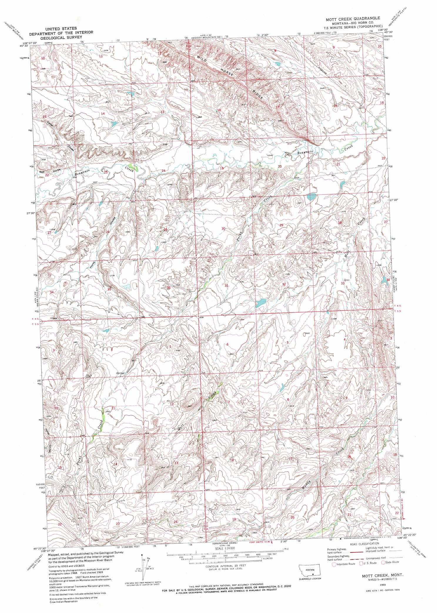
USGS Topo Quad 45108d1 - 1:24,000 scale
| Topo Map Name: | Mott Creek |
| USGS Topo Quad ID: | 45108d1 |
| Print Size: | ca. 21 1/4" wide x 27" high |
| Southeast Coordinates: | 45.375° N latitude / 108° W longitude |
| Map Center Coordinates: | 45.4375° N latitude / 108.0625° W longitude |
| U.S. State: | MT |
| Filename: | o45108d1.jpg |
| Download Map JPG Image: | Mott Creek topo map 1:24,000 scale |
| Map Type: | Topographic |
| Topo Series: | 7.5´ |
| Map Scale: | 1:24,000 |
| Source of Map Images: | United States Geological Survey (USGS) |
| Alternate Map Versions: |
Mott Creek MT 1969, updated 1972 Download PDF Buy paper map Mott Creek MT 2011 Download PDF Buy paper map Mott Creek MT 2014 Download PDF Buy paper map |
1:24,000 Topo Quads surrounding Mott Creek
Badbaby Coulee |
Woody Mountain Nw |
North Telegraph Creek |
Rowley Nw |
Rowley |
Soda Springs |
Woody Mountain |
Woody Mountain Se |
Bentonite Flats |
Woody Creek Camp |
Chilkoot Coulee |
Bear Coulee |
Mott Creek |
Camp Four |
Lemonade Springs |
Deep Creek Se |
Bear Coulee Sw |
Grapevine Dome |
Yellowtail Dam |
Mountain Pocket Creek |
East Pryor Mountain |
Dead Indian Hill |
Little Finger Ridge |
Peyote Point |
Limestone Canyon |
> Back to 45108a1 at 1:100,000 scale
> Back to 45108a1 at 1:250,000 scale
> Back to U.S. Topo Maps home
Mott Creek topo map: Gazetteer
Mott Creek: Dams
J R Scott Number 15 Dam elevation 1085m 3559′Mott Creek: Streams
Point Creek elevation 1035m 3395′Mott Creek: Valleys
Bear Coulee elevation 1078m 3536′Corral Coulee elevation 1076m 3530′
Horse Coulee elevation 1061m 3480′
Mott Creek digital topo map on disk
Buy this Mott Creek topo map showing relief, roads, GPS coordinates and other geographical features, as a high-resolution digital map file on DVD: