Soda Springs Topo Map Montana
To zoom in, hover over the map of Soda Springs
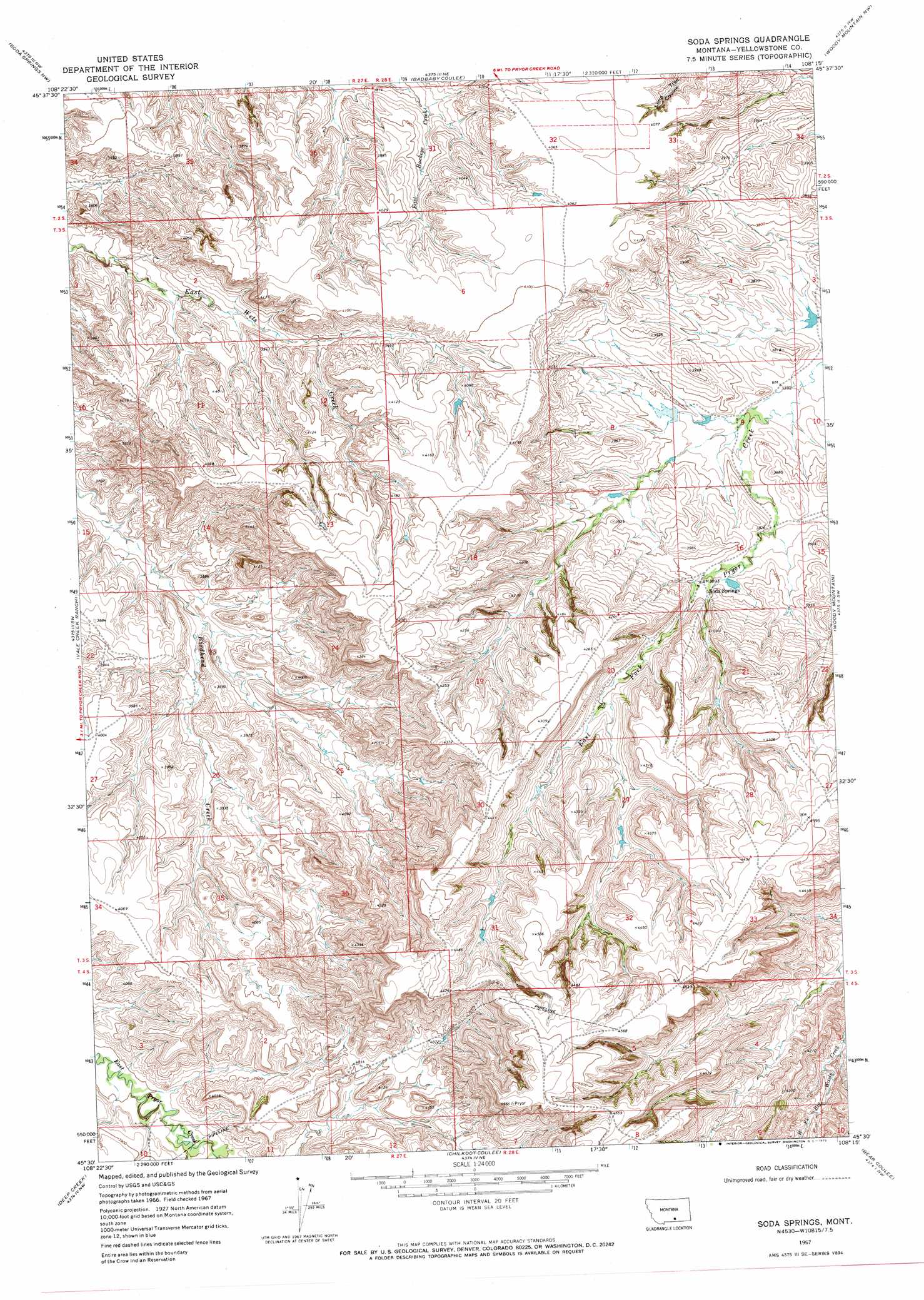
USGS Topo Quad 45108e3 - 1:24,000 scale
| Topo Map Name: | Soda Springs |
| USGS Topo Quad ID: | 45108e3 |
| Print Size: | ca. 21 1/4" wide x 27" high |
| Southeast Coordinates: | 45.5° N latitude / 108.25° W longitude |
| Map Center Coordinates: | 45.5625° N latitude / 108.3125° W longitude |
| U.S. State: | MT |
| Filename: | o45108e3.jpg |
| Download Map JPG Image: | Soda Springs topo map 1:24,000 scale |
| Map Type: | Topographic |
| Topo Series: | 7.5´ |
| Map Scale: | 1:24,000 |
| Source of Map Images: | United States Geological Survey (USGS) |
| Alternate Map Versions: |
Soda Springs MT 1967, updated 1972 Download PDF Buy paper map Soda Springs MT 2011 Download PDF Buy paper map Soda Springs MT 2014 Download PDF Buy paper map |
1:24,000 Topo Quads surrounding Soda Springs
Billings West |
Billings East |
Cottonwood Creek |
Indian Arrow |
Gails Coulee |
Yegen |
Soda Springs Nw |
Badbaby Coulee |
Woody Mountain Nw |
North Telegraph Creek |
Stratford Hill |
Vale Creek Ranch |
Soda Springs |
Woody Mountain |
Woody Mountain Se |
Pryor |
Deep Creek |
Chilkoot Coulee |
Bear Coulee |
Mott Creek |
Castle Rocks |
Deep Creek Sw |
Deep Creek Se |
Bear Coulee Sw |
Grapevine Dome |
> Back to 45108e1 at 1:100,000 scale
> Back to 45108a1 at 1:250,000 scale
> Back to U.S. Topo Maps home
Soda Springs topo map: Gazetteer
Soda Springs: Dams
Crow Number 83 Dam elevation 1153m 3782′Soda Springs: Populated Places
Soda Springs elevation 1188m 3897′Soda Springs digital topo map on disk
Buy this Soda Springs topo map showing relief, roads, GPS coordinates and other geographical features, as a high-resolution digital map file on DVD: