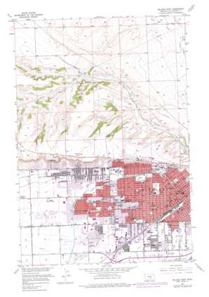
Billings West Topo Map Montana
To zoom in, hover over the map of Billings West
USGS Topo Quad 45108g5 - 1:24,000 scale
| Topo Map Name: | Billings West |
| USGS Topo Quad ID: | 45108g5 |
| Print Size: | ca. 21 1/4" wide x 27" high |
| Southeast Coordinates: | 45.75° N latitude / 108.5° W longitude |
| Map Center Coordinates: | 45.8125° N latitude / 108.5625° W longitude |
| U.S. State: | MT |
| Filename: | o45108g5.jpg |
| Download Map JPG Image: | Billings West topo map 1:24,000 scale |
| Map Type: | Topographic |
| Topo Series: | 7.5´ |
| Map Scale: | 1:24,000 |
| Source of Map Images: | United States Geological Survey (USGS) |
| Alternate Map Versions: |
Billings West MT 1957, updated 1958 Download PDF Buy paper map Billings West MT 1957, updated 1970 Download PDF Buy paper map Billings West MT 1957, updated 1977 Download PDF Buy paper map Billings West MT 2011 Download PDF Buy paper map Billings West MT 2014 Download PDF Buy paper map |
1:24,000 Topo Quads surrounding Billings West
> Back to 45108e1 at 1:100,000 scale
> Back to 45108a1 at 1:250,000 scale
> Back to U.S. Topo Maps home
Billings West topo map: Gazetteer
Billings West: Airports
Deaconess Medical Center of Billings Inc Heliport elevation 956m 3136′Logan International Airport elevation 1091m 3579′
Saint Vincent Hospital Heliport elevation 952m 3123′
Billings West: Canals
Arnold Drain elevation 982m 3221′Grey Eagle Ditch elevation 954m 3129′
Snow Ditch elevation 988m 3241′
Billings West: Cliffs
Rimrocks elevation 1093m 3585′Billings West: Parks
Cobb Field elevation 955m 3133′Daylis Stadium elevation 957m 3139′
Gorham Park elevation 983m 3225′
North Park elevation 951m 3120′
Pioneer Park elevation 961m 3152′
Rocky Mountain College Park elevation 1073m 3520′
Rose Park elevation 984m 3228′
Billings West: Populated Places
Billings elevation 952m 3123′Cameron Park elevation 1028m 3372′
Billings West: Streams
North Fork Alkali Creek elevation 1030m 3379′South Fork Alkali Creek elevation 1030m 3379′
Billings West: Summits
Ninemile Hill elevation 1060m 3477′Billings West: Wells
01N25E25CD__01 Well elevation 1010m 3313′01N25E33ABDC01 Well elevation 1021m 3349′
01N25E33CDDD01 Well elevation 997m 3270′
01N25E34DCDC01 Well elevation 988m 3241′
01N25E36CABD01 Well elevation 984m 3228′
01N25E36CBDA01 Well elevation 984m 3228′
01N25E36CCAA01 Well elevation 983m 3225′
01N25E36CDDD01 Well elevation 980m 3215′
01N26E31BCCB01 Well elevation 982m 3221′
01N26E31CCBC01 Well elevation 979m 3211′
01S25E01CDB_01 Well elevation 984m 3228′
01S25E02CCCC01 Well elevation 992m 3254′
01S25E02DDDD01 Well elevation 986m 3234′
01S25E11DDDD01 Well elevation 986m 3234′
01S26E05AABA01 Well elevation 975m 3198′
01S26E05B___01 Well elevation 977m 3205′
01S26E05CDDB01 Well elevation 963m 3159′
01S26E05DBDA01 Well elevation 964m 3162′
01S26E06AB__01 Well elevation 981m 3218′
01S26E06BDDC01 Well elevation 982m 3221′
01S26E07BB__01 Well elevation 979m 3211′
01S26E07CCCC01 Well elevation 983m 3225′
01S26E07DCDC01 Well elevation 970m 3182′
01S26E08A___01 Well elevation 961m 3152′
01S26E08DABA01 Well elevation 962m 3156′
01S26E09BB__01 Well elevation 960m 3149′
01S26E10BCBC01 Well elevation 955m 3133′
01S26E17BDAA01 Well elevation 965m 3166′
02N25E34C___01 Well elevation 1070m 3510′
Billings West digital topo map on disk
Buy this Billings West topo map showing relief, roads, GPS coordinates and other geographical features, as a high-resolution digital map file on DVD:


