Two Pine School Topo Map Montana
To zoom in, hover over the map of Two Pine School
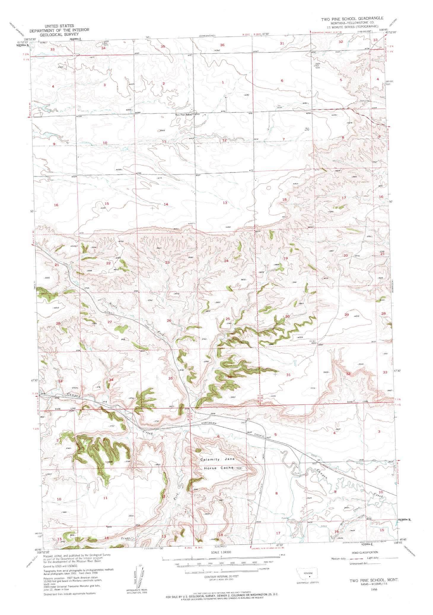
USGS Topo Quad 45108g7 - 1:24,000 scale
| Topo Map Name: | Two Pine School |
| USGS Topo Quad ID: | 45108g7 |
| Print Size: | ca. 21 1/4" wide x 27" high |
| Southeast Coordinates: | 45.75° N latitude / 108.75° W longitude |
| Map Center Coordinates: | 45.8125° N latitude / 108.8125° W longitude |
| U.S. State: | MT |
| Filename: | o45108g7.jpg |
| Download Map JPG Image: | Two Pine School topo map 1:24,000 scale |
| Map Type: | Topographic |
| Topo Series: | 7.5´ |
| Map Scale: | 1:24,000 |
| Source of Map Images: | United States Geological Survey (USGS) |
| Alternate Map Versions: |
Two Pine School MT 1956, updated 1958 Download PDF Buy paper map Two Pine School MT 1956, updated 1958 Download PDF Buy paper map Two Pine School MT 2011 Download PDF Buy paper map Two Pine School MT 2014 Download PDF Buy paper map |
1:24,000 Topo Quads surrounding Two Pine School
Hailstone Basin Se |
Broadview West |
Broadview East |
Hay Basin South |
North Fork Crooked Creek West |
Wheat Basin |
Rock Spring |
Comanche |
Acton |
Hickson Ranch |
Hunter Lake |
Molt |
Two Pine School |
Rimrock |
Billings West |
Horse Butte |
Park City |
Laurel |
Mossmain |
Yegen |
Rapids |
Montaqua |
Silesia |
Mossmain Sw |
Stratford Hill |
> Back to 45108e1 at 1:100,000 scale
> Back to 45108a1 at 1:250,000 scale
> Back to U.S. Topo Maps home
Two Pine School topo map: Gazetteer
Two Pine School: Benches
Calamity Jane Horse Cache elevation 1174m 3851′Two Pine School: Dams
F Downs Number 1 Dam elevation 1234m 4048′Two Pine School: Streams
Dry Creek elevation 1024m 3359′North Fork Canyon Creek elevation 1053m 3454′
South Fork Canyon Creek elevation 1056m 3464′
Two Pine School: Wells
01N23E12A___01 Well elevation 1259m 4130′01N23E35DDBD01 Well elevation 1074m 3523′
01S24E10BDAA01 Well elevation 1032m 3385′
Two Pine School digital topo map on disk
Buy this Two Pine School topo map showing relief, roads, GPS coordinates and other geographical features, as a high-resolution digital map file on DVD: