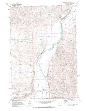
Hollenbeck Draw Topo Map Montana
To zoom in, hover over the map of Hollenbeck Draw
USGS Topo Quad 45109a1 - 1:24,000 scale
| Topo Map Name: | Hollenbeck Draw |
| USGS Topo Quad ID: | 45109a1 |
| Print Size: | ca. 21 1/4" wide x 27" high |
| Southeast Coordinates: | 45° N latitude / 109° W longitude |
| Map Center Coordinates: | 45.0625° N latitude / 109.0625° W longitude |
| U.S. States: | MT, WY |
| Filename: | o45109a1.jpg |
| Download Map JPG Image: | Hollenbeck Draw topo map 1:24,000 scale |
| Map Type: | Topographic |
| Topo Series: | 7.5´ |
| Map Scale: | 1:24,000 |
| Source of Map Images: | United States Geological Survey (USGS) |
| Alternate Map Versions: |
Hollenbeck Draw MT 1969, updated 1972 Download PDF Buy paper map Hollenbeck Draw MT 1969, updated 1972 Download PDF Buy paper map Hollenbeck Draw MT 2011 Download PDF Buy paper map Hollenbeck Draw MT 2014 Download PDF Buy paper map |
1:24,000 Topo Quads surrounding Hollenbeck Draw
> Back to 45109a1 at 1:100,000 scale
> Back to 45108a1 at 1:250,000 scale
> Back to U.S. Topo Maps home
Hollenbeck Draw topo map: Gazetteer
Hollenbeck Draw: Bridges
Wills Ditch Bridge elevation 1218m 3996′Hollenbeck Draw: Canals
Doctor Ditch elevation 1235m 4051′Grove Creek Canal elevation 1209m 3966′
Grove Creek Canal elevation 1200m 3937′
Interstate Ditch elevation 1223m 4012′
Rocky Point Ditch elevation 1196m 3923′
Rocky Point Ditch elevation 1192m 3910′
Silver Tip Ditch elevation 1179m 3868′
Sirrine Ditch elevation 1224m 4015′
Wills Ditch elevation 1213m 3979′
Hollenbeck Draw: Dams
Big Reservoir Dam elevation 1329m 4360′Limberger Dam elevation 1309m 4294′
Hollenbeck Draw: Populated Places
Chance elevation 1218m 3996′Hollenbeck Draw: Post Offices
Chance Post Office (historical) elevation 1218m 3996′Riverview Post Office (historical) elevation 1181m 3874′
Hollenbeck Draw: Reservoirs
Monroe Reservoir elevation 1220m 4002′V O Reservoir elevation 1216m 3989′
Hollenbeck Draw: Streams
Dilworth Creek elevation 1200m 3937′Grove Creek elevation 1205m 3953′
Wolf Creek elevation 1182m 3877′
Hollenbeck Draw: Valleys
Big Sand Coulee elevation 1218m 3996′Hollenbeck Draw elevation 1190m 3904′
Mill Draw elevation 1214m 3982′
Sand Coulee elevation 1233m 4045′
Hollenbeck Draw: Wells
08S22E27ACCC01 Well elevation 1178m 3864′08S22E28DDAD01 Well elevation 1186m 3891′
08S22E32DDAD01 Well elevation 1201m 3940′
08S22E34CCCB01 Well elevation 1188m 3897′
09S22E05DBBC01 Well elevation 1212m 3976′
09S22E17ACCD01 Well elevation 1209m 3966′
09S22E19ADBD01 Well elevation 1207m 3959′
09S22E20CDCD01 Well elevation 1210m 3969′
09S22E30BADD01 Well elevation 1224m 4015′
09S22E31ADAA01 Well elevation 1221m 4005′
Hollenbeck Draw digital topo map on disk
Buy this Hollenbeck Draw topo map showing relief, roads, GPS coordinates and other geographical features, as a high-resolution digital map file on DVD:


