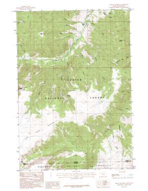
Mount Maurice Topo Map Montana
To zoom in, hover over the map of Mount Maurice
USGS Topo Quad 45109a3 - 1:24,000 scale
| Topo Map Name: | Mount Maurice |
| USGS Topo Quad ID: | 45109a3 |
| Print Size: | ca. 21 1/4" wide x 27" high |
| Southeast Coordinates: | 45° N latitude / 109.25° W longitude |
| Map Center Coordinates: | 45.0625° N latitude / 109.3125° W longitude |
| U.S. States: | MT, WY |
| Filename: | o45109a3.jpg |
| Download Map JPG Image: | Mount Maurice topo map 1:24,000 scale |
| Map Type: | Topographic |
| Topo Series: | 7.5´ |
| Map Scale: | 1:24,000 |
| Source of Map Images: | United States Geological Survey (USGS) |
| Alternate Map Versions: |
Mount Maurice MT 1986, updated 1986 Download PDF Buy paper map Mount Maurice MT 1996, updated 1999 Download PDF Buy paper map Mount Maurice MT 2011 Download PDF Buy paper map Mount Maurice MT 2014 Download PDF Buy paper map |
| FStopo: | US Forest Service topo Mount Maurice is available: Download FStopo PDF Download FStopo TIF |
1:24,000 Topo Quads surrounding Mount Maurice
> Back to 45109a1 at 1:100,000 scale
> Back to 45108a1 at 1:250,000 scale
> Back to U.S. Topo Maps home
Mount Maurice topo map: Gazetteer
Mount Maurice: Capes
Sheridan Point elevation 2872m 9422′Mount Maurice: Forests
Custer National Forest - Beartooth Division elevation 2381m 7811′Mount Maurice: Plains
Line Creek Plateau elevation 3042m 9980′Mount Maurice: Streams
Corral Creek elevation 1946m 6384′Cyclone Creek elevation 1885m 6184′
Maurice Creek elevation 1879m 6164′
Ratine Creek elevation 1941m 6368′
Seeley Creek elevation 1912m 6272′
Sheep Creek elevation 2022m 6633′
Sheridan Creek elevation 1927m 6322′
Snow Creek elevation 2029m 6656′
Spring Creek elevation 1961m 6433′
Mount Maurice: Summits
Maurice Mount elevation 2821m 9255′Tolman Mountain elevation 3002m 9849′
Wapiti Mountain elevation 2868m 9409′
Mount Maurice: Trails
Custer National Forest Trail elevation 2929m 9609′Mount Maurice: Valleys
Hakel Gulch elevation 1943m 6374′Haywood Gulch elevation 1884m 6181′
Woods Gulch elevation 1949m 6394′
Mount Maurice digital topo map on disk
Buy this Mount Maurice topo map showing relief, roads, GPS coordinates and other geographical features, as a high-resolution digital map file on DVD:


