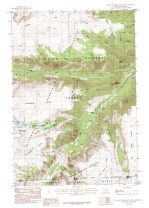
Black Pyramid Mountain Topo Map Montana
To zoom in, hover over the map of Black Pyramid Mountain
USGS Topo Quad 45109a4 - 1:24,000 scale
| Topo Map Name: | Black Pyramid Mountain |
| USGS Topo Quad ID: | 45109a4 |
| Print Size: | ca. 21 1/4" wide x 27" high |
| Southeast Coordinates: | 45° N latitude / 109.375° W longitude |
| Map Center Coordinates: | 45.0625° N latitude / 109.4375° W longitude |
| U.S. States: | MT, WY |
| Filename: | o45109a4.jpg |
| Download Map JPG Image: | Black Pyramid Mountain topo map 1:24,000 scale |
| Map Type: | Topographic |
| Topo Series: | 7.5´ |
| Map Scale: | 1:24,000 |
| Source of Map Images: | United States Geological Survey (USGS) |
| Alternate Map Versions: |
Black Pyramid Mountain MT 1986, updated 1986 Download PDF Buy paper map Black Pyramid Mountain MT 1986, updated 1986 Download PDF Buy paper map Black Pyramid Mountain MT 1996, updated 1999 Download PDF Buy paper map Black Pyramid Mountain MT 2011 Download PDF Buy paper map Black Pyramid Mountain MT 2014 Download PDF Buy paper map |
| FStopo: | US Forest Service topo Black Pyramid Mountain is available: Download FStopo PDF Download FStopo TIF |
1:24,000 Topo Quads surrounding Black Pyramid Mountain
> Back to 45109a1 at 1:100,000 scale
> Back to 45108a1 at 1:250,000 scale
> Back to U.S. Topo Maps home
Black Pyramid Mountain topo map: Gazetteer
Black Pyramid Mountain: Lakes
Broadwater Lake elevation 2434m 7985′Cresent Lake elevation 3046m 9993′
Daly Lake elevation 2950m 9678′
Elk Horn Lake elevation 3066m 10059′
Greenough Lake elevation 2220m 7283′
Hairpin Lake elevation 3094m 10150′
Hellroaring Lake elevation 2955m 9694′
Hellroaring Lakes elevation 3093m 10147′
Line Lake elevation 2961m 9714′
Rydberg Lake elevation 2899m 9511′
Smethurst Lake elevation 2930m 9612′
Snowbank Lake elevation 3073m 10082′
Black Pyramid Mountain: Mines
Edsel Mine elevation 2331m 7647′Gallon Jug Mine elevation 2954m 9691′
Black Pyramid Mountain: Plains
Hellroaring Plateau elevation 3166m 10387′Silver Run Plateau elevation 3154m 10347′
Black Pyramid Mountain: Populated Places
Richel Lodge elevation 2042m 6699′Black Pyramid Mountain: Streams
Chain Creek elevation 2375m 7791′Chan Creek elevation 2378m 7801′
Grass Creek elevation 2215m 7267′
Hellroaring Creek elevation 2234m 7329′
Laduala Creek elevation 2493m 8179′
Laduala Creek elevation 2493m 8179′
Lake Fork elevation 2039m 6689′
Lost Picket Creek elevation 2354m 7723′
Misery Creek elevation 2202m 7224′
Plateau Creek elevation 2275m 7463′
Quad Creek elevation 2247m 7372′
Silver Falls Creek elevation 2272m 7454′
Wyoming Creek elevation 2182m 7158′
Wyoming Creek elevation 2184m 7165′
Black Pyramid Mountain: Summits
Black Pyramid Mountain elevation 2609m 8559′Tolman Point elevation 2603m 8540′
Black Pyramid Mountain digital topo map on disk
Buy this Black Pyramid Mountain topo map showing relief, roads, GPS coordinates and other geographical features, as a high-resolution digital map file on DVD:


