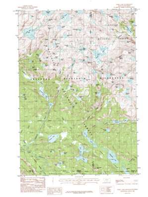
Fossil Lake Topo Map Montana
To zoom in, hover over the map of Fossil Lake
USGS Topo Quad 45109a7 - 1:24,000 scale
| Topo Map Name: | Fossil Lake |
| USGS Topo Quad ID: | 45109a7 |
| Print Size: | ca. 21 1/4" wide x 27" high |
| Southeast Coordinates: | 45° N latitude / 109.75° W longitude |
| Map Center Coordinates: | 45.0625° N latitude / 109.8125° W longitude |
| U.S. States: | MT, WY |
| Filename: | o45109a7.jpg |
| Download Map JPG Image: | Fossil Lake topo map 1:24,000 scale |
| Map Type: | Topographic |
| Topo Series: | 7.5´ |
| Map Scale: | 1:24,000 |
| Source of Map Images: | United States Geological Survey (USGS) |
| Alternate Map Versions: |
Fossil Lake MT 1986, updated 1986 Download PDF Buy paper map Fossil Lake MT 1986, updated 1986 Download PDF Buy paper map Fossil Lake MT 1991, updated 1997 Download PDF Buy paper map Fossil Lake MT 2000, updated 2005 Download PDF Buy paper map Fossil Lake MT 2011 Download PDF Buy paper map Fossil Lake MT 2014 Download PDF Buy paper map |
| FStopo: | US Forest Service topo Fossil Lake is available: Download FStopo PDF Download FStopo TIF |
1:24,000 Topo Quads surrounding Fossil Lake
> Back to 45109a1 at 1:100,000 scale
> Back to 45108a1 at 1:250,000 scale
> Back to U.S. Topo Maps home
Fossil Lake topo map: Gazetteer
Fossil Lake: Lakes
Aquarius Lake elevation 2790m 9153′Basin Lake elevation 3009m 9872′
Big Moose Lake elevation 2444m 8018′
Big Moose Lake elevation 2444m 8018′
Boulder Lakes elevation 2791m 9156′
Broadwater Lake elevation 2556m 8385′
Canyon Lake elevation 2681m 8795′
Cliff Lake elevation 2813m 9229′
Cradle Lake elevation 2924m 9593′
Crazy Lakes elevation 2450m 8038′
Crazy Lakes elevation 2475m 8120′
Curl Lake elevation 2556m 8385′
Dewey Lake elevation 2837m 9307′
Diamond Lake elevation 2606m 8549′
Dollar Lake elevation 2737m 8979′
Finger Lake elevation 2949m 9675′
Fizzle Lake elevation 3005m 9858′
Fossil Lake elevation 3019m 9904′
Fox Lake elevation 2460m 8070′
Fulcrum Lake elevation 2959m 9708′
Gallery Lake elevation 3021m 9911′
Kersey Lake elevation 2465m 8087′
Lake of the Clouds elevation 2948m 9671′
Lake of the Winds elevation 3006m 9862′
Leaky Raft Lake elevation 3095m 10154′
Lillis Lake elevation 2484m 8149′
Little Molar Lake elevation 2838m 9311′
Lone Elk Lake elevation 3065m 10055′
Looking Glass Lake elevation 3135m 10285′
Lower Aero Lake elevation 3046m 9993′
Margaret Lake elevation 2471m 8106′
Mariane Lake elevation 2909m 9543′
Marsh Lake elevation 2740m 8989′
Medicine Lake elevation 3019m 9904′
Moccasin Lake elevation 2875m 9432′
Molar Lake elevation 3010m 9875′
No Bones Lake elevation 3045m 9990′
Nymph Lake elevation 2837m 9307′
Oly Lake elevation 2945m 9662′
Ouzel Lake elevation 2875m 9432′
Paddle Lake elevation 3073m 10082′
Peanut Lake elevation 2887m 9471′
Pneumonia Lake elevation 3021m 9911′
Production Lake elevation 3071m 10075′
Recroitment Lake elevation 3068m 10065′
Reed Lake elevation 2398m 7867′
Rock Island Lake elevation 2494m 8182′
Rough Lake elevation 3087m 10127′
Russell Lake elevation 2667m 8750′
Sedge Lake elevation 2765m 9071′
Shelter Lake elevation 3069m 10068′
Skull Lake elevation 2948m 9671′
Snowbank Lake elevation 3105m 10187′
Sodalite Lake elevation 2983m 9786′
Splinter Lake elevation 3150m 10334′
Stash Lake elevation 3044m 9986′
Stepping Stone Lake elevation 3135m 10285′
Surprise Lake elevation 3004m 9855′
Twin Lakes elevation 2644m 8674′
Twin Outlets Lake elevation 2800m 9186′
Vernon Lake elevation 2400m 7874′
Wand Lake elevation 2837m 9307′
Washtub Lake elevation 2801m 9189′
Weasel Lake elevation 3035m 9957′
Widewater Lake elevation 2449m 8034′
Wiedy Lake elevation 2739m 8986′
Fossil Lake: Streams
Broadwater River elevation 2431m 7975′Farley Creek elevation 2460m 8070′
Forage Creek elevation 2435m 7988′
Hemingway Creek elevation 2443m 8015′
Russell Creek elevation 2460m 8070′
Sedge Creek elevation 2436m 7992′
Sodalite Creek elevation 2556m 8385′
West Fork Clarks Fork elevation 2431m 7975′
Fossil Lake: Summits
Bald Knob elevation 3085m 10121′Middle Mountain elevation 2955m 9694′
Mount Dewey elevation 3478m 11410′
Mount Rosebud elevation 3409m 11184′
Oxide Mountain elevation 3051m 10009′
Rock Island Butte elevation 2706m 8877′
Fossil Lake digital topo map on disk
Buy this Fossil Lake topo map showing relief, roads, GPS coordinates and other geographical features, as a high-resolution digital map file on DVD:


