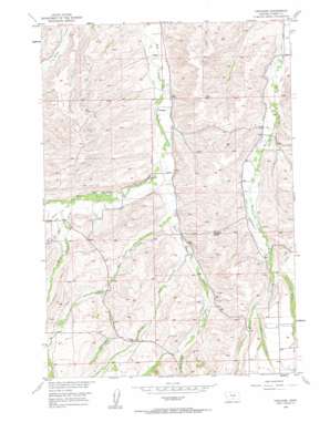
Castagne Topo Map Montana
To zoom in, hover over the map of Castagne
USGS Topo Quad 45109c3 - 1:24,000 scale
| Topo Map Name: | Castagne |
| USGS Topo Quad ID: | 45109c3 |
| Print Size: | ca. 21 1/4" wide x 27" high |
| Southeast Coordinates: | 45.25° N latitude / 109.25° W longitude |
| Map Center Coordinates: | 45.3125° N latitude / 109.3125° W longitude |
| U.S. State: | MT |
| Filename: | o45109c3.jpg |
| Download Map JPG Image: | Castagne topo map 1:24,000 scale |
| Map Type: | Topographic |
| Topo Series: | 7.5´ |
| Map Scale: | 1:24,000 |
| Source of Map Images: | United States Geological Survey (USGS) |
| Alternate Map Versions: |
Castagne MT 1956, updated 1958 Download PDF Buy paper map Castagne MT 1956, updated 1958 Download PDF Buy paper map Castagne MT 2011 Download PDF Buy paper map Castagne MT 2014 Download PDF Buy paper map |
1:24,000 Topo Quads surrounding Castagne
> Back to 45109a1 at 1:100,000 scale
> Back to 45108a1 at 1:250,000 scale
> Back to U.S. Topo Maps home
Castagne topo map: Gazetteer
Castagne: Canals
Andrews Ditch elevation 1437m 4714′Antilla Ditch elevation 1430m 4691′
Barnett Ditch elevation 1457m 4780′
Caldwell Ditch elevation 1406m 4612′
Canal S elevation 1537m 5042′
Crane Ditch elevation 1463m 4799′
Doty Ditch elevation 1371m 4498′
Inderland-Ramsland Ditch elevation 1391m 4563′
Pleasant Valley Ditch elevation 1426m 4678′
Taylor Ditch elevation 1555m 5101′
Castagne: Dams
Thiellis Dam elevation 1643m 5390′Castagne: Gaps
Missouri Cutoff elevation 1534m 5032′Castagne: Post Offices
Castagne Post Office (historical) elevation 1404m 4606′Castagne: Streams
Barlow Creek elevation 1476m 4842′Bull Creek elevation 1525m 5003′
Cole Creek elevation 1501m 4924′
East Red Lodge Creek elevation 1425m 4675′
Harney Creek elevation 1464m 4803′
Hogan Creek elevation 1454m 4770′
Powers Creek elevation 1543m 5062′
Spring Creek elevation 1500m 4921′
Thiel Creek elevation 1446m 4744′
Underwood Creek elevation 1488m 4881′
West Red Lodge Creek elevation 1425m 4675′
Castagne: Valleys
Schroeder Gulch elevation 1525m 5003′Castagne: Wells
05S20E33ACBC01 Well elevation 1404m 4606′06S20E07BCCB01 Well elevation 1431m 4694′
Castagne digital topo map on disk
Buy this Castagne topo map showing relief, roads, GPS coordinates and other geographical features, as a high-resolution digital map file on DVD:


