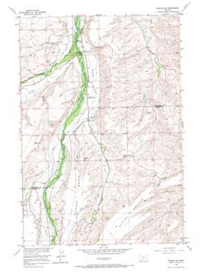
Roscoe Nw Topo Map Montana
To zoom in, hover over the map of Roscoe Nw
USGS Topo Quad 45109d4 - 1:24,000 scale
| Topo Map Name: | Roscoe Nw |
| USGS Topo Quad ID: | 45109d4 |
| Print Size: | ca. 21 1/4" wide x 27" high |
| Southeast Coordinates: | 45.375° N latitude / 109.375° W longitude |
| Map Center Coordinates: | 45.4375° N latitude / 109.4375° W longitude |
| U.S. State: | MT |
| Filename: | o45109d4.jpg |
| Download Map JPG Image: | Roscoe Nw topo map 1:24,000 scale |
| Map Type: | Topographic |
| Topo Series: | 7.5´ |
| Map Scale: | 1:24,000 |
| Source of Map Images: | United States Geological Survey (USGS) |
| Alternate Map Versions: |
Roscoe NW MT 1956, updated 1957 Download PDF Buy paper map Roscoe NW MT 1956, updated 1966 Download PDF Buy paper map Roscoe NW MT 2011 Download PDF Buy paper map Roscoe NW MT 2014 Download PDF Buy paper map |
1:24,000 Topo Quads surrounding Roscoe Nw
> Back to 45109a1 at 1:100,000 scale
> Back to 45108a1 at 1:250,000 scale
> Back to U.S. Topo Maps home
Roscoe Nw topo map: Gazetteer
Roscoe Nw: Benches
Coleman Bench elevation 1550m 5085′Roscoe Nw: Bridges
Smith Bridge elevation 1268m 4160′Roscoe Nw: Canals
Butcher Creek Ditch elevation 1328m 4356′Butcher Creek Rosebud Ditch County elevation 1362m 4468′
Eggen-Piper Ditch elevation 1349m 4425′
Johnson Ditch elevation 1326m 4350′
Kyle Ferster-Seely Ditch elevation 1411m 4629′
Olson Ditch elevation 1387m 4550′
Olson Ditch elevation 1518m 4980′
Ross-Flannigan Ditch elevation 1287m 4222′
Selleck-Espeland Ditch elevation 1479m 4852′
Selleck-Scott Ditch elevation 1503m 4931′
Sylvester-Beasly Ditch elevation 1268m 4160′
Tuttle Luther Ditch elevation 1427m 4681′
Waterman Ditch elevation 1363m 4471′
Woodard Ditch elevation 1342m 4402′
Roscoe Nw: Parks
Jorgen Elesius Madson Historical Marker elevation 1324m 4343′Roscoe Nw: Streams
Antelope Creek elevation 1350m 4429′Butcher Creek elevation 1269m 4163′
Chimney Creek elevation 1364m 4475′
East Rosebud Creek elevation 1273m 4176′
Horse Creek elevation 1262m 4140′
West Rosebud Creek elevation 1272m 4173′
Roscoe Nw: Summits
Yancey Hill elevation 1468m 4816′Roscoe Nw: Wells
04S18E13DCBC01 Well elevation 1289m 4229′04S18E14BBDA01 Well elevation 1329m 4360′
04S18E22DCAA01 Well elevation 1317m 4320′
04S18E23AADB01 Well elevation 1292m 4238′
04S18E23BDCD01 Well elevation 1305m 4281′
05S18E03ABBB01 Well elevation 1494m 4901′
Roscoe Nw digital topo map on disk
Buy this Roscoe Nw topo map showing relief, roads, GPS coordinates and other geographical features, as a high-resolution digital map file on DVD:


