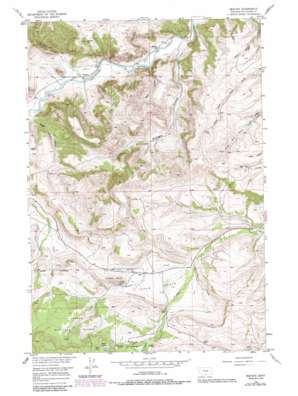
Beehive Topo Map Montana
To zoom in, hover over the map of Beehive
USGS Topo Quad 45109d6 - 1:24,000 scale
| Topo Map Name: | Beehive |
| USGS Topo Quad ID: | 45109d6 |
| Print Size: | ca. 21 1/4" wide x 27" high |
| Southeast Coordinates: | 45.375° N latitude / 109.625° W longitude |
| Map Center Coordinates: | 45.4375° N latitude / 109.6875° W longitude |
| U.S. State: | MT |
| Filename: | o45109d6.jpg |
| Download Map JPG Image: | Beehive topo map 1:24,000 scale |
| Map Type: | Topographic |
| Topo Series: | 7.5´ |
| Map Scale: | 1:24,000 |
| Source of Map Images: | United States Geological Survey (USGS) |
| Alternate Map Versions: |
Beehive MT 1956, updated 1958 Download PDF Buy paper map Beehive MT 1956, updated 1968 Download PDF Buy paper map Beehive MT 1956, updated 1986 Download PDF Buy paper map Beehive MT 1996, updated 1999 Download PDF Buy paper map Beehive MT 2011 Download PDF Buy paper map Beehive MT 2014 Download PDF Buy paper map |
| FStopo: | US Forest Service topo Beehive is available: Download FStopo PDF Download FStopo TIF |
1:24,000 Topo Quads surrounding Beehive
> Back to 45109a1 at 1:100,000 scale
> Back to 45108a1 at 1:250,000 scale
> Back to U.S. Topo Maps home
Beehive topo map: Gazetteer
Beehive: Basins
Dean Basin elevation 1591m 5219′Beehive: Bridges
Dale Creek Bridge elevation 1570m 5150′Beehive: Canals
Lewis-Hudson-Fowler Ditch elevation 1617m 5305′Beehive: Lakes
Heart Lake elevation 1865m 6118′Island Lake elevation 1839m 6033′
Beehive: Populated Places
Beehive elevation 1411m 4629′Dean elevation 1596m 5236′
Beehive: Post Offices
Beehive Post Office (historical) elevation 1411m 4629′Dean Post Office (historical) elevation 1596m 5236′
Beehive: Springs
05S16E03BDCC01 Spring elevation 1564m 5131′Beehive: Streams
Bad Canyon Creek elevation 1409m 4622′Dale Creek elevation 1549m 5082′
East Fishtail Creek elevation 1676m 5498′
Meadow Creek elevation 1550m 5085′
Midnight Creek elevation 1366m 4481′
Sheep Creek elevation 1494m 4901′
West Fishtail Creek elevation 1675m 5495′
Beehive: Summits
Beehive Rock elevation 1643m 5390′Fishtail Butte elevation 1750m 5741′
Beehive: Valleys
Dark Canyon elevation 1394m 4573′Magpie Canyon elevation 1437m 4714′
Midnight Canyon elevation 1388m 4553′
Beehive: Wells
04S16E14DCAB01 Well elevation 1403m 4603′04S16E22CABB01 Well elevation 1424m 4671′
04S16E23BABA01 Well elevation 1409m 4622′
04S17E07DCDD01 Well elevation 1372m 4501′
04S17E08CCAC01 Well elevation 1360m 4461′
04S17E18AABB01 Well elevation 1431m 4694′
04S17E18AADD01 Well elevation 1378m 4520′
04S17E18ACAD01 Well elevation 1389m 4557′
05S16E13AACB01 Well elevation 1595m 5232′
05S16E14CDBC01 Well elevation 1740m 5708′
05S16E24CDDA01 Well elevation 1715m 5626′
Beehive digital topo map on disk
Buy this Beehive topo map showing relief, roads, GPS coordinates and other geographical features, as a high-resolution digital map file on DVD:


