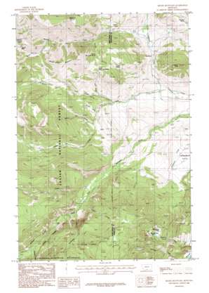
Meyer Mountain Topo Map Montana
To zoom in, hover over the map of Meyer Mountain
USGS Topo Quad 45109d8 - 1:24,000 scale
| Topo Map Name: | Meyer Mountain |
| USGS Topo Quad ID: | 45109d8 |
| Print Size: | ca. 21 1/4" wide x 27" high |
| Southeast Coordinates: | 45.375° N latitude / 109.875° W longitude |
| Map Center Coordinates: | 45.4375° N latitude / 109.9375° W longitude |
| U.S. State: | MT |
| Filename: | o45109d8.jpg |
| Download Map JPG Image: | Meyer Mountain topo map 1:24,000 scale |
| Map Type: | Topographic |
| Topo Series: | 7.5´ |
| Map Scale: | 1:24,000 |
| Source of Map Images: | United States Geological Survey (USGS) |
| Alternate Map Versions: |
Meyer Mountain MT 1986, updated 1986 Download PDF Buy paper map Meyer Mountain MT 2011 Download PDF Buy paper map Meyer Mountain MT 2014 Download PDF Buy paper map |
| FStopo: | US Forest Service topo Meyer Mountain is available: Download FStopo PDF Download FStopo TIF |
1:24,000 Topo Quads surrounding Meyer Mountain
> Back to 45109a1 at 1:100,000 scale
> Back to 45108a1 at 1:250,000 scale
> Back to U.S. Topo Maps home
Meyer Mountain topo map: Gazetteer
Meyer Mountain: Flats
Horseman Flats elevation 1849m 6066′Meyer Mountain: Gaps
Meyers Creek Pass elevation 2470m 8103′Meyer Mountain: Lakes
Mountain View Lake elevation 2056m 6745′Meyer Mountain: Mines
Mouat Mine elevation 2084m 6837′Mount Mine elevation 1780m 5839′
Meyer Mountain: Populated Places
Limestone elevation 1687m 5534′Meyers Creek elevation 1852m 6076′
Mountain View elevation 2076m 6811′
Meyer Mountain: Post Offices
Limestone Post Office (historical) elevation 1687m 5534′Meyer Mountain: Springs
04S15E20ABBA01 Spring elevation 1727m 5666′04S15E20ABCD01 Spring elevation 1725m 5659′
04S15E28AACC01 Spring elevation 1649m 5410′
04S15E28ACAD01 Spring elevation 1628m 5341′
04S15E28DBAB01 Spring elevation 1615m 5298′
04S15E33ABDB01 Spring elevation 1633m 5357′
04S15E33BDBB01 Spring elevation 1666m 5465′
05S15E08CAAA01 Spring elevation 2043m 6702′
05S15E08DBBB01 Spring elevation 2014m 6607′
North Pass Creek Spring elevation 1993m 6538′
Quaker Spring elevation 2078m 6817′
South Pass Creek Spring elevation 1999m 6558′
Whittaker Spring elevation 1963m 6440′
Meyer Mountain: Streams
Bear Pen Creek elevation 1829m 6000′Castle Creek elevation 1600m 5249′
Cathedral Creek elevation 1912m 6272′
Initial Creek elevation 1881m 6171′
Iron Creek elevation 1871m 6138′
Lodgepole Creek elevation 1631m 5351′
Meyers Creek elevation 1705m 5593′
Mountain View Creek elevation 1576m 5170′
Pass Creek elevation 1779m 5836′
Picket Pin Creek elevation 1720m 5643′
Saderbalm Creek elevation 2044m 6706′
South Fork Meyers Creek elevation 2119m 6952′
Swamp Creek elevation 1789m 5869′
Verdigris Creek elevation 1597m 5239′
Meyer Mountain: Summits
Limestone Butte elevation 2284m 7493′Meyer Mountain elevation 2514m 8248′
Washburn Mountain elevation 2546m 8353′
Meyer Mountain: Wells
04S15E29ACDA01 Well elevation 1646m 5400′05S15E21AACA01 Well elevation 1514m 4967′
Meyer Mountain digital topo map on disk
Buy this Meyer Mountain topo map showing relief, roads, GPS coordinates and other geographical features, as a high-resolution digital map file on DVD:


