Hunter Lake Topo Map Montana
To zoom in, hover over the map of Hunter Lake
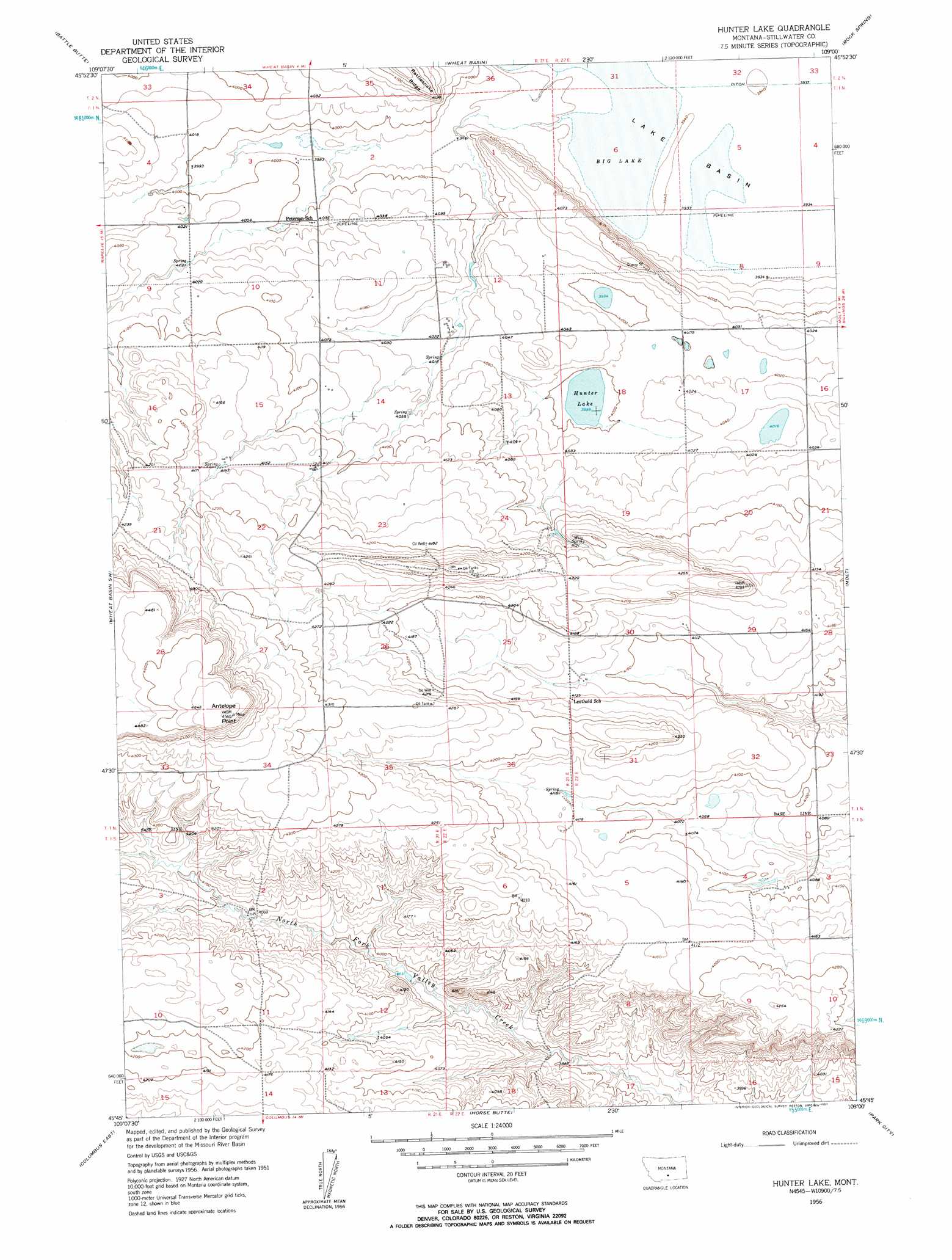
USGS Topo Quad 45109g1 - 1:24,000 scale
| Topo Map Name: | Hunter Lake |
| USGS Topo Quad ID: | 45109g1 |
| Print Size: | ca. 21 1/4" wide x 27" high |
| Southeast Coordinates: | 45.75° N latitude / 109° W longitude |
| Map Center Coordinates: | 45.8125° N latitude / 109.0625° W longitude |
| U.S. State: | MT |
| Filename: | o45109g1.jpg |
| Download Map JPG Image: | Hunter Lake topo map 1:24,000 scale |
| Map Type: | Topographic |
| Topo Series: | 7.5´ |
| Map Scale: | 1:24,000 |
| Source of Map Images: | United States Geological Survey (USGS) |
| Alternate Map Versions: |
Hunter Lake MT 1956, updated 1957 Download PDF Buy paper map Hunter Lake MT 1956, updated 1957 Download PDF Buy paper map Hunter Lake MT 2011 Download PDF Buy paper map Hunter Lake MT 2014 Download PDF Buy paper map |
1:24,000 Topo Quads surrounding Hunter Lake
Locomotive Butte Se |
Hailstone Basin |
Hailstone Basin Se |
Broadview West |
Broadview East |
Rapelje |
Battle Butte |
Wheat Basin |
Rock Spring |
Comanche |
Lindemulder Hill |
Wheat Basin Sw |
Hunter Lake |
Molt |
Two Pine School |
Columbus West |
Columbus East |
Horse Butte |
Park City |
Laurel |
Whitebird School |
Shane Ridge |
Rapids |
Montaqua |
Silesia |
> Back to 45109e1 at 1:100,000 scale
> Back to 45108a1 at 1:250,000 scale
> Back to U.S. Topo Maps home
Hunter Lake topo map: Gazetteer
Hunter Lake: Lakes
Hunter Lake elevation 1219m 3999′Hunter Lake: Springs
Wiig Spring elevation 1262m 4140′Hunter Lake: Summits
Antelope Point elevation 1391m 4563′Hunter Lake: Wells
01N21E02BCCC01 Well elevation 1214m 3982′01N21E03DABA01 Well elevation 1216m 3989′
01N21E14ABBC01 Well elevation 1231m 4038′
01N21E22AAAA01 Well elevation 1258m 4127′
01N22E07DADA01 Well elevation 1229m 4032′
01N22E29AAAC01 Well elevation 1265m 4150′
01S21E02CADC01 Well elevation 1241m 4071′
Hunter Lake digital topo map on disk
Buy this Hunter Lake topo map showing relief, roads, GPS coordinates and other geographical features, as a high-resolution digital map file on DVD: