Battle Butte Topo Map Montana
To zoom in, hover over the map of Battle Butte
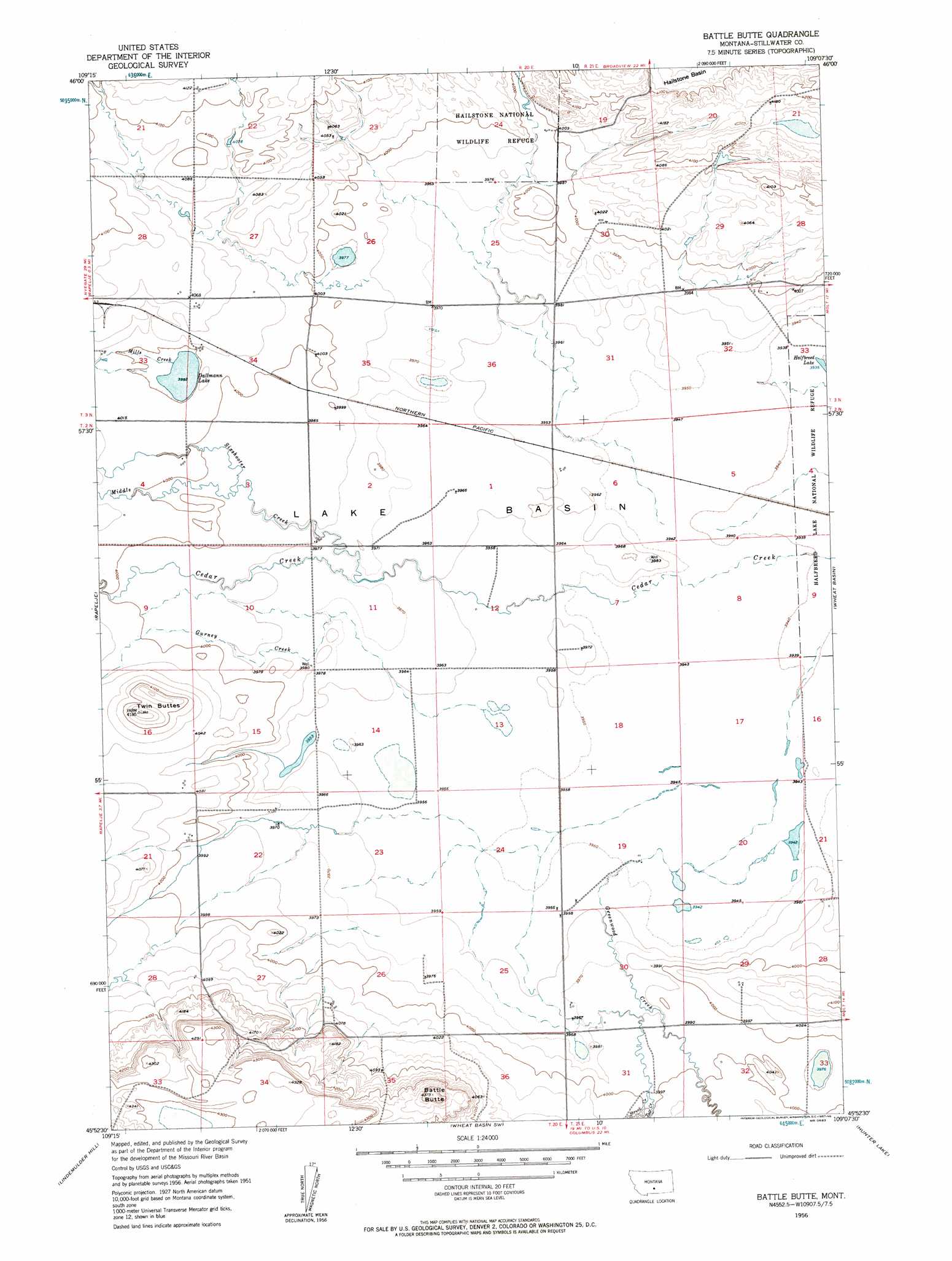
USGS Topo Quad 45109h2 - 1:24,000 scale
| Topo Map Name: | Battle Butte |
| USGS Topo Quad ID: | 45109h2 |
| Print Size: | ca. 21 1/4" wide x 27" high |
| Southeast Coordinates: | 45.875° N latitude / 109.125° W longitude |
| Map Center Coordinates: | 45.9375° N latitude / 109.1875° W longitude |
| U.S. State: | MT |
| Filename: | o45109h2.jpg |
| Download Map JPG Image: | Battle Butte topo map 1:24,000 scale |
| Map Type: | Topographic |
| Topo Series: | 7.5´ |
| Map Scale: | 1:24,000 |
| Source of Map Images: | United States Geological Survey (USGS) |
| Alternate Map Versions: |
Battle Butte MT 1956, updated 1957 Download PDF Buy paper map Battle Butte MT 2011 Download PDF Buy paper map Battle Butte MT 2014 Download PDF Buy paper map |
1:24,000 Topo Quads surrounding Battle Butte
O'Brien Hill |
Locomotive Butte |
Mount Sinai |
Eagle Point |
Belmont |
Locomotive Butte Sw |
Locomotive Butte Se |
Hailstone Basin |
Hailstone Basin Se |
Broadview West |
Russell Gulch |
Rapelje |
Battle Butte |
Wheat Basin |
Rock Spring |
Antelope Point |
Lindemulder Hill |
Wheat Basin Sw |
Hunter Lake |
Molt |
Springtime |
Columbus West |
Columbus East |
Horse Butte |
Park City |
> Back to 45109e1 at 1:100,000 scale
> Back to 45108a1 at 1:250,000 scale
> Back to U.S. Topo Maps home
Battle Butte topo map: Gazetteer
Battle Butte: Dams
Hailstone National Wildlife Refuge Dam elevation 1222m 4009′Battle Butte: Lakes
Dallmann Lake elevation 1218m 3996′Battle Butte: Reservoirs
Hailstone Lake elevation 1222m 4009′Battle Butte: Streams
Greenwood Creek elevation 1204m 3950′Gurney Creek elevation 1207m 3959′
Middle Creek elevation 1217m 3992′
Mills Creek elevation 1218m 3996′
Struck Creek elevation 1204m 3950′
Toll Creek elevation 1219m 3999′
Battle Butte: Summits
Battle Butte elevation 1334m 4376′Twin Buttes elevation 1273m 4176′
Battle Butte: Wells
02N20E15BAAD01 Well elevation 1219m 3999′Battle Butte digital topo map on disk
Buy this Battle Butte topo map showing relief, roads, GPS coordinates and other geographical features, as a high-resolution digital map file on DVD: