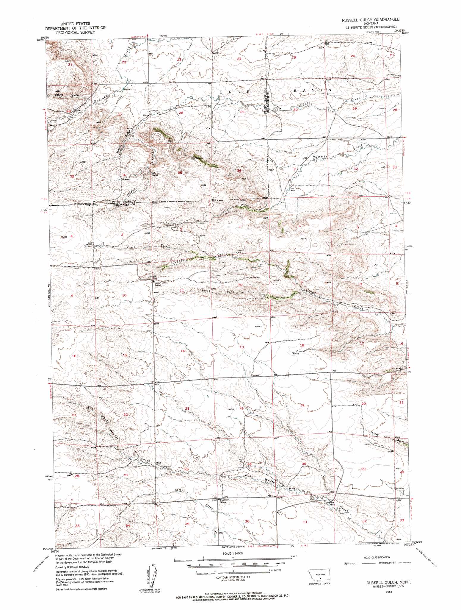
Russell Gulch Topo Map Montana
To zoom in, hover over the map of Russell Gulch
USGS Topo Quad 45109h4 - 1:24,000 scale
| Topo Map Name: | Russell Gulch |
| USGS Topo Quad ID: | 45109h4 |
| Print Size: | ca. 21 1/4" wide x 27" high |
| Southeast Coordinates: | 45.875° N latitude / 109.375° W longitude |
| Map Center Coordinates: | 45.9375° N latitude / 109.4375° W longitude |
| U.S. State: | MT |
| Filename: | o45109h4.jpg |
| Download Map JPG Image: | Russell Gulch topo map 1:24,000 scale |
| Map Type: | Topographic |
| Topo Series: | 7.5´ |
| Map Scale: | 1:24,000 |
| Source of Map Images: | United States Geological Survey (USGS) |
| Alternate Map Versions: |
Russell Gulch MT 1955, updated 1957 Download PDF Buy paper map Russell Gulch MT 2011 Download PDF Buy paper map Russell Gulch MT 2014 Download PDF Buy paper map |
1:24,000 Topo Quads surrounding Russell Gulch
Jim Creek |
Progress |
O'Brien Hill |
Locomotive Butte |
Mount Sinai |
Gibson Sw |
Gibson |
Locomotive Butte Sw |
Locomotive Butte Se |
Hailstone Basin |
Sourdough School |
Stephens Hill Ne |
Russell Gulch |
Rapelje |
Battle Butte |
Lone Indian Butte |
Stephens Hill |
Antelope Point |
Lindemulder Hill |
Wheat Basin Sw |
Work Creek |
Reed Point |
Springtime |
Columbus West |
Columbus East |
> Back to 45109e1 at 1:100,000 scale
> Back to 45108a1 at 1:250,000 scale
> Back to U.S. Topo Maps home
Russell Gulch topo map: Gazetteer
Russell Gulch: Dams
Robbie Dam elevation 1377m 4517′Russell Gulch: Streams
North Fork Cedar Creek elevation 1455m 4773′South Fork Cedar Creek elevation 1362m 4468′
Russell Gulch: Valleys
Hoppy Gulch elevation 1413m 4635′Russell Gulch elevation 1397m 4583′
Russell Gulch: Wells
03N18E23AAAB01 Well elevation 1355m 4445′03N18E23BBBC01 Well elevation 1370m 4494′
Russell Gulch digital topo map on disk
Buy this Russell Gulch topo map showing relief, roads, GPS coordinates and other geographical features, as a high-resolution digital map file on DVD: