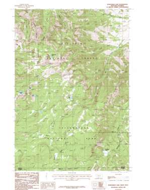
Sportsman Lake Topo Map Montana
To zoom in, hover over the map of Sportsman Lake
USGS Topo Quad 45110a8 - 1:24,000 scale
| Topo Map Name: | Sportsman Lake |
| USGS Topo Quad ID: | 45110a8 |
| Print Size: | ca. 21 1/4" wide x 27" high |
| Southeast Coordinates: | 45° N latitude / 110.875° W longitude |
| Map Center Coordinates: | 45.0625° N latitude / 110.9375° W longitude |
| U.S. States: | MT, WY |
| Filename: | o45110a8.jpg |
| Download Map JPG Image: | Sportsman Lake topo map 1:24,000 scale |
| Map Type: | Topographic |
| Topo Series: | 7.5´ |
| Map Scale: | 1:24,000 |
| Source of Map Images: | United States Geological Survey (USGS) |
| Alternate Map Versions: |
Sportsman Lake MT 1986, updated 1987 Download PDF Buy paper map Sportsman Lake MT 2000, updated 2005 Download PDF Buy paper map Sportsman Lake MT 2011 Download PDF Buy paper map Sportsman Lake MT 2014 Download PDF Buy paper map |
| FStopo: | US Forest Service topo Sportsman Lake is available: Download FStopo PDF Download FStopo TIF |
1:24,000 Topo Quads surrounding Sportsman Lake
> Back to 45110a1 at 1:100,000 scale
> Back to 45110a1 at 1:250,000 scale
> Back to U.S. Topo Maps home
Sportsman Lake topo map: Gazetteer
Sportsman Lake: Lakes
Crag Lake elevation 2677m 8782′Crescent Lake elevation 2616m 8582′
High Lake elevation 2676m 8779′
Sedge Lake elevation 2704m 8871′
Shooting Star Lake elevation 2653m 8704′
Sportsman Lake elevation 2350m 7709′
Sportsman Lake: Streams
Lion Creek elevation 1942m 6371′Mill Creek elevation 1939m 6361′
Sportsman Lake: Summits
Sawtooth Mountain elevation 2869m 9412′Shooting Star Mountain elevation 2942m 9652′
Sportsman Lake: Trails
Sportsman Lake Trail elevation 2440m 8005′Sportsman Lake digital topo map on disk
Buy this Sportsman Lake topo map showing relief, roads, GPS coordinates and other geographical features, as a high-resolution digital map file on DVD:


