Mount Douglas Topo Map Montana
To zoom in, hover over the map of Mount Douglas
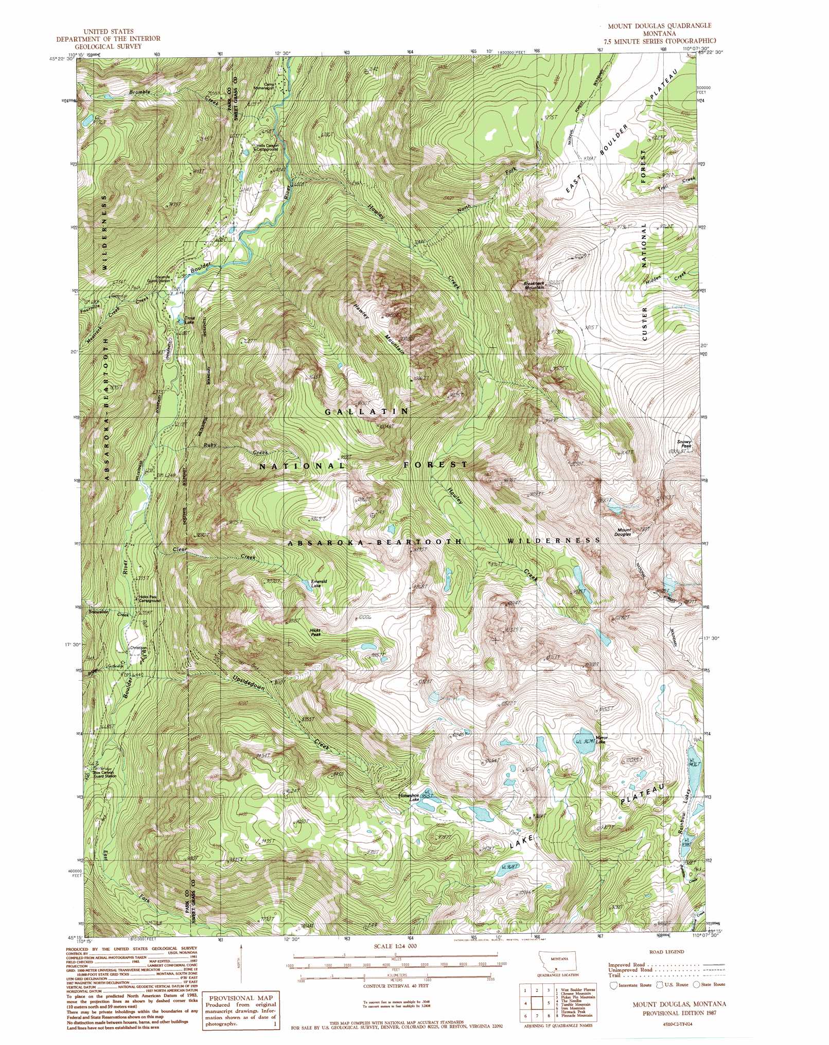
USGS Topo Quad 45110c2 - 1:24,000 scale
| Topo Map Name: | Mount Douglas |
| USGS Topo Quad ID: | 45110c2 |
| Print Size: | ca. 21 1/4" wide x 27" high |
| Southeast Coordinates: | 45.25° N latitude / 110.125° W longitude |
| Map Center Coordinates: | 45.3125° N latitude / 110.1875° W longitude |
| U.S. State: | MT |
| Filename: | o45110c2.jpg |
| Download Map JPG Image: | Mount Douglas topo map 1:24,000 scale |
| Map Type: | Topographic |
| Topo Series: | 7.5´ |
| Map Scale: | 1:24,000 |
| Source of Map Images: | United States Geological Survey (USGS) |
| Alternate Map Versions: |
Mount Douglas MT 1987, updated 1987 Download PDF Buy paper map Mount Douglas MT 2000, updated 2005 Download PDF Buy paper map Mount Douglas MT 2011 Download PDF Buy paper map Mount Douglas MT 2014 Download PDF Buy paper map |
| FStopo: | US Forest Service topo Mount Douglas is available: Download FStopo PDF Download FStopo TIF |
1:24,000 Topo Quads surrounding Mount Douglas
Livingston Peak |
Mount Rae |
Mcleod Basin |
Squaw Peak |
Sliderock Mountain |
Mount Cowen |
West Boulder Plateau |
Chrome Mountain |
Picket Pin Mountain |
Meyer Mountain |
The Pyramid |
The Needles |
Mount Douglas |
Tumble Mountain |
Cathedral Point |
Mount Wallace |
Iron Mountain |
Haystack Peak |
Pinnacle Mountain |
Little Park Mountain |
Specimen Creek |
Hummingbird Peak |
Roundhead Butte |
Cutoff Mountain |
Cooke City |
> Back to 45110a1 at 1:100,000 scale
> Back to 45110a1 at 1:250,000 scale
> Back to U.S. Topo Maps home
Mount Douglas topo map: Gazetteer
Mount Douglas: Lakes
Armour Pond elevation 1860m 6102′Emerald Lake elevation 2777m 9110′
Horseshoe Lake elevation 2902m 9520′
Mirror Lake elevation 2950m 9678′
Rainbow Lakes elevation 2878m 9442′
Trout Lake elevation 1876m 6154′
Mount Douglas: Populated Places
Lazy Day (historical) elevation 1999m 6558′Mount Douglas: Post Offices
Cowles Post Office (historical) elevation 2094m 6870′Hicks Post Office (historical) elevation 1939m 6361′
Lazy Day Post Office (historical) elevation 1999m 6558′
Mount Douglas: Streams
Bramble Creek elevation 1786m 5859′Bridge Creek elevation 1962m 6437′
Clear Creek elevation 1911m 6269′
East Fork Boulder River elevation 2011m 6597′
Fourmile Creek elevation 1873m 6145′
Hawley Creek elevation 1828m 5997′
Meatrack Creek elevation 1991m 6532′
North Fork Hawley Creek elevation 2202m 7224′
Ruby Creek elevation 1899m 6230′
Snowslide Creek elevation 1936m 6351′
Upsidedown Creek elevation 1962m 6437′
Mount Douglas: Summits
Breakneck Mountain elevation 3100m 10170′Breakneck Plateau elevation 2839m 9314′
Hawley Mountain elevation 3076m 10091′
Hicks Peak elevation 2988m 9803′
Mount Douglas elevation 3439m 11282′
Snowy Peak elevation 2933m 9622′
Mount Douglas digital topo map on disk
Buy this Mount Douglas topo map showing relief, roads, GPS coordinates and other geographical features, as a high-resolution digital map file on DVD: