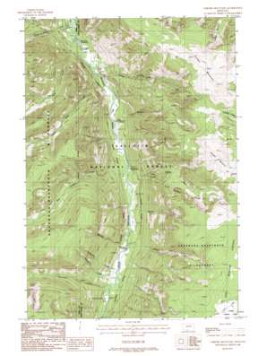
Chrome Mountain Topo Map Montana
To zoom in, hover over the map of Chrome Mountain
USGS Topo Quad 45110d2 - 1:24,000 scale
| Topo Map Name: | Chrome Mountain |
| USGS Topo Quad ID: | 45110d2 |
| Print Size: | ca. 21 1/4" wide x 27" high |
| Southeast Coordinates: | 45.375° N latitude / 110.125° W longitude |
| Map Center Coordinates: | 45.4375° N latitude / 110.1875° W longitude |
| U.S. State: | MT |
| Filename: | o45110d2.jpg |
| Download Map JPG Image: | Chrome Mountain topo map 1:24,000 scale |
| Map Type: | Topographic |
| Topo Series: | 7.5´ |
| Map Scale: | 1:24,000 |
| Source of Map Images: | United States Geological Survey (USGS) |
| Alternate Map Versions: |
Chrome Mountain MT 1987, updated 1987 Download PDF Buy paper map Chrome Mountain MT 2000, updated 2005 Download PDF Buy paper map Chrome Mountain MT 2011 Download PDF Buy paper map Chrome Mountain MT 2014 Download PDF Buy paper map |
| FStopo: | US Forest Service topo Chrome Mountain is available: Download FStopo PDF Download FStopo TIF |
1:24,000 Topo Quads surrounding Chrome Mountain
> Back to 45110a1 at 1:100,000 scale
> Back to 45110a1 at 1:250,000 scale
> Back to U.S. Topo Maps home
Chrome Mountain topo map: Gazetteer
Chrome Mountain: Bridges
Flemming Bridge elevation 1707m 5600′Twomile Bridge elevation 1597m 5239′
Chrome Mountain: Mines
Bonanza Number 3 Mine elevation 2333m 7654′Boulder River Number 1 Mine elevation 1708m 5603′
Gish Mine elevation 1711m 5613′
Lower Gish Mine elevation 1708m 5603′
Middle Gish Mine elevation 1724m 5656′
Nicon Number 1 Mine elevation 1659m 5442′
Red Fox Claim Mine elevation 2335m 7660′
Skillman Mine elevation 2513m 8244′
Upper Gish Mine elevation 1749m 5738′
Chrome Mountain: Streams
Blakely Creek elevation 1706m 5597′East Chippy Creek elevation 1662m 5452′
Falls Creek elevation 1586m 5203′
Firewater Creek elevation 1803m 5915′
Froze-to-Death Creek elevation 1586m 5203′
Graham Creek elevation 1612m 5288′
Great Falls Creek elevation 1622m 5321′
Miller Creek elevation 1707m 5600′
Raspberry Creek elevation 1790m 5872′
Shorty Creek elevation 1672m 5485′
Silvertip Creek elevation 1728m 5669′
Speculator Creek elevation 1730m 5675′
West Chippy Creek elevation 1669m 5475′
Chrome Mountain: Summits
Chrome Mountain elevation 3090m 10137′Contact Mountain elevation 3031m 9944′
Chrome Mountain: Wells
04S12E25CBBD02 Well elevation 1633m 5357′Chrome Mountain digital topo map on disk
Buy this Chrome Mountain topo map showing relief, roads, GPS coordinates and other geographical features, as a high-resolution digital map file on DVD:


