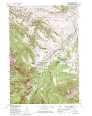
Mount Rae Topo Map Montana
To zoom in, hover over the map of Mount Rae
USGS Topo Quad 45110e3 - 1:24,000 scale
| Topo Map Name: | Mount Rae |
| USGS Topo Quad ID: | 45110e3 |
| Print Size: | ca. 21 1/4" wide x 27" high |
| Southeast Coordinates: | 45.5° N latitude / 110.25° W longitude |
| Map Center Coordinates: | 45.5625° N latitude / 110.3125° W longitude |
| U.S. State: | MT |
| Filename: | o45110e3.jpg |
| Download Map JPG Image: | Mount Rae topo map 1:24,000 scale |
| Map Type: | Topographic |
| Topo Series: | 7.5´ |
| Map Scale: | 1:24,000 |
| Source of Map Images: | United States Geological Survey (USGS) |
| Alternate Map Versions: |
Mount Rae MT 1951, updated 1953 Download PDF Buy paper map Mount Rae MT 1951, updated 1957 Download PDF Buy paper map Mount Rae MT 1951, updated 1976 Download PDF Buy paper map Mount Rae MT 1951, updated 1981 Download PDF Buy paper map Mount Rae MT 1951, updated 1981 Download PDF Buy paper map Mount Rae MT 2000, updated 2005 Download PDF Buy paper map Mount Rae MT 2011 Download PDF Buy paper map Mount Rae MT 2014 Download PDF Buy paper map |
| FStopo: | US Forest Service topo Mount Rae is available: Download FStopo PDF Download FStopo TIF |
1:24,000 Topo Quads surrounding Mount Rae
> Back to 45110e1 at 1:100,000 scale
> Back to 45110a1 at 1:250,000 scale
> Back to U.S. Topo Maps home
Mount Rae topo map: Gazetteer
Mount Rae: Basins
Ellis Basin elevation 1759m 5770′Mount Rae: Flats
Burrls Flat elevation 1945m 6381′Taylor Flat elevation 1942m 6371′
West Boulder Meadows elevation 1744m 5721′
Mount Rae: Lakes
Horseshoe Lake elevation 1914m 6279′Lost Lakes elevation 1912m 6272′
Nurses Lakes elevation 1931m 6335′
Redfield Lake elevation 1992m 6535′
Mount Rae: Parks
Pruitt Park elevation 2028m 6653′Mount Rae: Post Offices
Bruffeys Post Office (historical) elevation 1891m 6204′Swingley Post Office (historical) elevation 1789m 5869′
Mount Rae: Ridges
West Boulder Divide elevation 1927m 6322′Mount Rae: Streams
Anderson Creek elevation 1650m 5413′Basin Creek elevation 1749m 5738′
Bullis Creek elevation 1657m 5436′
Canyon Creek elevation 1940m 6364′
Crystal Creek elevation 1798m 5898′
Davis Creek elevation 1710m 5610′
Grouse Creek elevation 1668m 5472′
Lost Creek elevation 1735m 5692′
Sheep Creek elevation 1947m 6387′
Mount Rae: Summits
Lion Mountain elevation 2424m 7952′Mount Greeley elevation 2155m 7070′
Mount Rae elevation 2802m 9192′
Mount Rae digital topo map on disk
Buy this Mount Rae topo map showing relief, roads, GPS coordinates and other geographical features, as a high-resolution digital map file on DVD:


