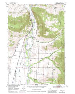
Brisbin Topo Map Montana
To zoom in, hover over the map of Brisbin
USGS Topo Quad 45110e5 - 1:24,000 scale
| Topo Map Name: | Brisbin |
| USGS Topo Quad ID: | 45110e5 |
| Print Size: | ca. 21 1/4" wide x 27" high |
| Southeast Coordinates: | 45.5° N latitude / 110.5° W longitude |
| Map Center Coordinates: | 45.5625° N latitude / 110.5625° W longitude |
| U.S. State: | MT |
| Filename: | o45110e5.jpg |
| Download Map JPG Image: | Brisbin topo map 1:24,000 scale |
| Map Type: | Topographic |
| Topo Series: | 7.5´ |
| Map Scale: | 1:24,000 |
| Source of Map Images: | United States Geological Survey (USGS) |
| Alternate Map Versions: |
Brisbin MT 1951, updated 1953 Download PDF Buy paper map Brisbin MT 1951, updated 1967 Download PDF Buy paper map Brisbin MT 1951, updated 1981 Download PDF Buy paper map Brisbin MT 1951, updated 1981 Download PDF Buy paper map Brisbin MT 2000, updated 2005 Download PDF Buy paper map Brisbin MT 2011 Download PDF Buy paper map Brisbin MT 2014 Download PDF Buy paper map |
| FStopo: | US Forest Service topo Brisbin is available: Download FStopo PDF Download FStopo TIF |
1:24,000 Topo Quads surrounding Brisbin
> Back to 45110e1 at 1:100,000 scale
> Back to 45110a1 at 1:250,000 scale
> Back to U.S. Topo Maps home
Brisbin topo map: Gazetteer
Brisbin: Bridges
Carter Bridge elevation 1386m 4547′Pine Creek Bridge elevation 1427m 4681′
Brisbin: Canals
Park Branch Canal elevation 1472m 4829′Pine Creek Ditch elevation 1705m 5593′
Spring Creek Ditch elevation 1409m 4622′
Brisbin: Populated Places
Brisbin elevation 1432m 4698′Pine Creek elevation 1483m 4865′
Brisbin: Post Offices
Pinecreek Post Office (historical) elevation 1483m 4865′Richland Post Office (historical) elevation 1420m 4658′
Brisbin: Streams
Bullis Creek elevation 1423m 4668′Deep Creek elevation 1417m 4648′
North Fork Deep Creek elevation 1546m 5072′
Pine Creek elevation 1427m 4681′
Pool Creek elevation 1417m 4648′
South Fork Deep Creek elevation 1545m 5068′
Strickland Creek elevation 1430m 4691′
Suce Creek elevation 1397m 4583′
Trail Creek elevation 1400m 4593′
Brisbin: Valleys
Paradise Valley elevation 1383m 4537′Brisbin digital topo map on disk
Buy this Brisbin topo map showing relief, roads, GPS coordinates and other geographical features, as a high-resolution digital map file on DVD:


