Hunters Hot Springs Topo Map Montana
To zoom in, hover over the map of Hunters Hot Springs
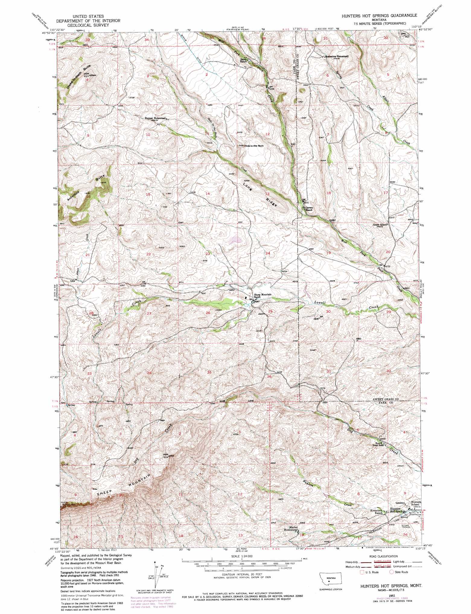
USGS Topo Quad 45110g3 - 1:24,000 scale
| Topo Map Name: | Hunters Hot Springs |
| USGS Topo Quad ID: | 45110g3 |
| Print Size: | ca. 21 1/4" wide x 27" high |
| Southeast Coordinates: | 45.75° N latitude / 110.25° W longitude |
| Map Center Coordinates: | 45.8125° N latitude / 110.3125° W longitude |
| U.S. State: | MT |
| Filename: | o45110g3.jpg |
| Download Map JPG Image: | Hunters Hot Springs topo map 1:24,000 scale |
| Map Type: | Topographic |
| Topo Series: | 7.5´ |
| Map Scale: | 1:24,000 |
| Source of Map Images: | United States Geological Survey (USGS) |
| Alternate Map Versions: |
Hunters Hot Springs MT 1951, updated 1953 Download PDF Buy paper map Hunters Hot Springs MT 1951, updated 1976 Download PDF Buy paper map Hunters Hot Springs MT 1951, updated 1981 Download PDF Buy paper map Hunters Hot Springs MT 2011 Download PDF Buy paper map Hunters Hot Springs MT 2014 Download PDF Buy paper map |
1:24,000 Topo Quads surrounding Hunters Hot Springs
Lena Creek |
Campfire Lake |
Crazy Peak |
Amelong Creek |
Battleship Butte |
Clyde Park |
Ibex Mountain |
Fairview Peak |
Raspberry Butte |
Grosfield Ranch |
Chadborn |
Grannis |
Hunters Hot Springs |
Kelly Hills |
Carney |
Livingston |
Mission |
Elton |
Springdale |
Mcleod |
Brisbin |
Livingston Peak |
Mount Rae |
Mcleod Basin |
Squaw Peak |
> Back to 45110e1 at 1:100,000 scale
> Back to 45110a1 at 1:250,000 scale
> Back to U.S. Topo Maps home
Hunters Hot Springs topo map: Gazetteer
Hunters Hot Springs: Populated Places
Hunters Hot Springs elevation 1337m 4386′Hunters Hot Springs: Post Offices
Hunters Hot Springs Post Office (historical) elevation 1337m 4386′Hunters Hot Springs: Ridges
Long Ridge elevation 1603m 5259′Hunters Hot Springs: Springs
01N11E01D___01 Spring elevation 1677m 5501′01N11E21D___01 Spring elevation 1648m 5406′
01S12E09CADD01 Spring elevation 1336m 4383′
01S12E09CCAD01 Spring elevation 1341m 4399′
Hunters Hot Springs elevation 1351m 4432′
Hunters Hot Springs: Streams
Hole-In-The-Rock Creek elevation 1505m 4937′Spring Creek elevation 1547m 5075′
Hunters Hot Springs: Summits
Antelope Butte elevation 1889m 6197′Choke-To-Death Butte elevation 1925m 6315′
Hole-In-The Rock elevation 1660m 5446′
Sheep Mountain elevation 1922m 6305′
Hunters Hot Springs: Wells
01S11E01A___01 Well elevation 1593m 5226′Hunters Hot Springs digital topo map on disk
Buy this Hunters Hot Springs topo map showing relief, roads, GPS coordinates and other geographical features, as a high-resolution digital map file on DVD: