Clyde Park Topo Map Montana
To zoom in, hover over the map of Clyde Park
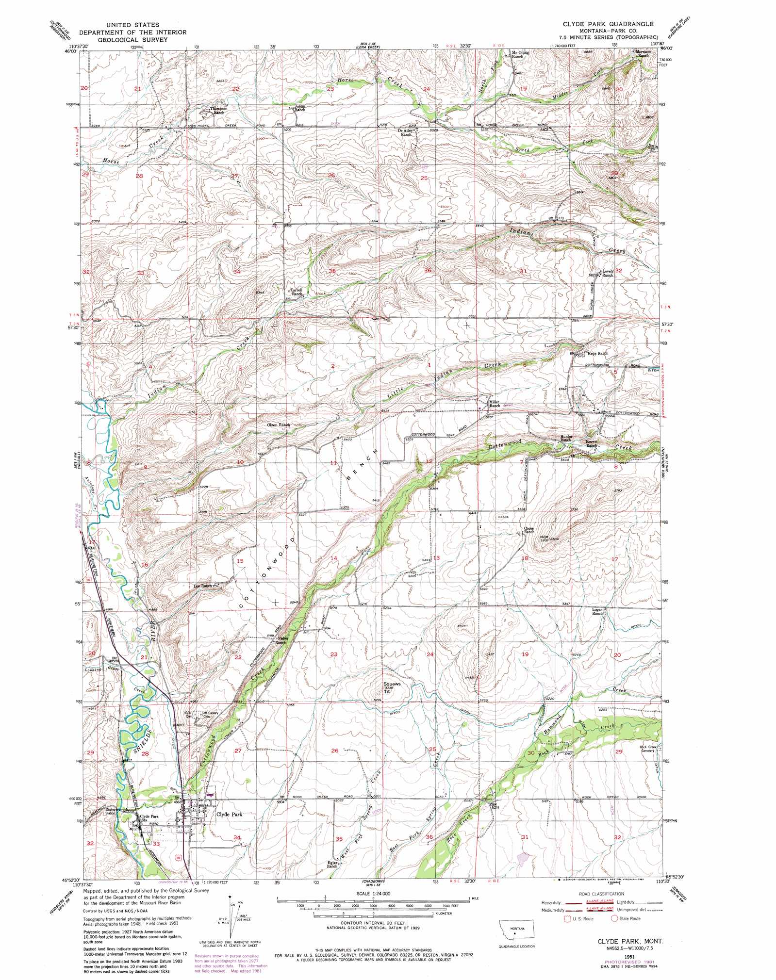
USGS Topo Quad 45110h5 - 1:24,000 scale
| Topo Map Name: | Clyde Park |
| USGS Topo Quad ID: | 45110h5 |
| Print Size: | ca. 21 1/4" wide x 27" high |
| Southeast Coordinates: | 45.875° N latitude / 110.5° W longitude |
| Map Center Coordinates: | 45.9375° N latitude / 110.5625° W longitude |
| U.S. State: | MT |
| Filename: | o45110h5.jpg |
| Download Map JPG Image: | Clyde Park topo map 1:24,000 scale |
| Map Type: | Topographic |
| Topo Series: | 7.5´ |
| Map Scale: | 1:24,000 |
| Source of Map Images: | United States Geological Survey (USGS) |
| Alternate Map Versions: |
Clyde Park MT 1951, updated 1953 Download PDF Buy paper map Clyde Park MT 1951, updated 1981 Download PDF Buy paper map Clyde Park MT 2011 Download PDF Buy paper map Clyde Park MT 2014 Download PDF Buy paper map |
1:24,000 Topo Quads surrounding Clyde Park
Sixteen Ne |
Wolf Hill |
Scab Rock Mountain |
Virginia Peak |
Loco Mountain |
Wallrock |
Cotttonwood Reservoir |
Lena Creek |
Campfire Lake |
Crazy Peak |
Sedan |
Wilsall |
Clyde Park |
Ibex Mountain |
Fairview Peak |
Grassy Mountain |
Gobblers Knob |
Chadborn |
Grannis |
Hunters Hot Springs |
Bozeman Pass |
Hoppers |
Livingston |
Mission |
Elton |
> Back to 45110e1 at 1:100,000 scale
> Back to 45110a1 at 1:250,000 scale
> Back to U.S. Topo Maps home
Clyde Park topo map: Gazetteer
Clyde Park: Benches
Cottonwood Bench elevation 1635m 5364′Clyde Park: Populated Places
Clyde Park elevation 1483m 4865′Clyde Park: Post Offices
Clyde Park Post Office elevation 1483m 4865′Clyde Park: Springs
02N09E22C___01 Spring elevation 1548m 5078′Clyde Park: Streams
Antelope Creek elevation 1484m 4868′Basin Creek elevation 1677m 5501′
Cottonwood Creek elevation 1490m 4888′
Hammond Creek elevation 1554m 5098′
Indian Creek elevation 1492m 4895′
Little Indian Creek elevation 1486m 4875′
Looking Glass Creek elevation 1470m 4822′
Middle Fork Horse Creek elevation 1619m 5311′
North Fork Horse Creek elevation 1619m 5311′
South Fork Horse Creek elevation 1608m 5275′
Clyde Park: Summits
Moolsh Hill elevation 1621m 5318′Clyde Park: Wells
02N09E24B___01 Well elevation 1599m 5246′02N09E26CD__01 Well elevation 1535m 5036′
02N09E33B___01 Well elevation 1459m 4786′
02N10E18CB__01 Well elevation 1648m 5406′
03N09E23C___01 Well elevation 1575m 5167′
03N09E24C___01 Well elevation 1605m 5265′
03N09E24C___02 Well elevation 1605m 5265′
03N09E25B___01 Well elevation 1635m 5364′
03N10E32B___01 Well elevation 1780m 5839′
Clyde Park digital topo map on disk
Buy this Clyde Park topo map showing relief, roads, GPS coordinates and other geographical features, as a high-resolution digital map file on DVD: