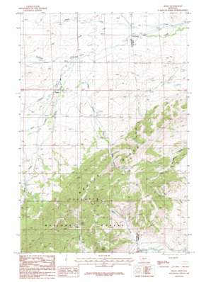
Sedan Topo Map Montana
To zoom in, hover over the map of Sedan
USGS Topo Quad 45110h7 - 1:24,000 scale
| Topo Map Name: | Sedan |
| USGS Topo Quad ID: | 45110h7 |
| Print Size: | ca. 21 1/4" wide x 27" high |
| Southeast Coordinates: | 45.875° N latitude / 110.75° W longitude |
| Map Center Coordinates: | 45.9375° N latitude / 110.8125° W longitude |
| U.S. State: | MT |
| Filename: | o45110h7.jpg |
| Download Map JPG Image: | Sedan topo map 1:24,000 scale |
| Map Type: | Topographic |
| Topo Series: | 7.5´ |
| Map Scale: | 1:24,000 |
| Source of Map Images: | United States Geological Survey (USGS) |
| Alternate Map Versions: |
Sedan MT 1987, updated 1987 Download PDF Buy paper map Sedan MT 2000, updated 2005 Download PDF Buy paper map Sedan MT 2011 Download PDF Buy paper map Sedan MT 2014 Download PDF Buy paper map |
| FStopo: | US Forest Service topo Sedan is available: Download FStopo PDF Download FStopo TIF |
1:24,000 Topo Quads surrounding Sedan
> Back to 45110e1 at 1:100,000 scale
> Back to 45110a1 at 1:250,000 scale
> Back to U.S. Topo Maps home
Sedan topo map: Gazetteer
Sedan: Populated Places
Sedan elevation 1690m 5544′Sedan: Post Offices
Brackett Post Office (historical) elevation 1658m 5439′Sedan Post Office (historical) elevation 1690m 5544′
Sedan: Ridges
Battle Ridge elevation 2064m 6771′Sedan: Streams
Cache Creek elevation 1656m 5433′Carrol Creek elevation 1657m 5436′
Dry Creek elevation 1591m 5219′
Fairy Creek elevation 1717m 5633′
Green Canyon Creek elevation 1640m 5380′
Middle Fork Dry Creek elevation 1623m 5324′
Nixon Creek elevation 1633m 5357′
South Fork Dry Creek elevation 1616m 5301′
Sedan: Summits
Nixon Peak elevation 2083m 6833′Sedan: Valleys
Green Canyon elevation 1766m 5793′Sedan: Wells
03N08E20C___01 Well elevation 1599m 5246′03N08E20D___01 Well elevation 1595m 5232′
03N08E29D___01 Well elevation 1610m 5282′
03N08E31C___01 Well elevation 1707m 5600′
Sedan digital topo map on disk
Buy this Sedan topo map showing relief, roads, GPS coordinates and other geographical features, as a high-resolution digital map file on DVD:


