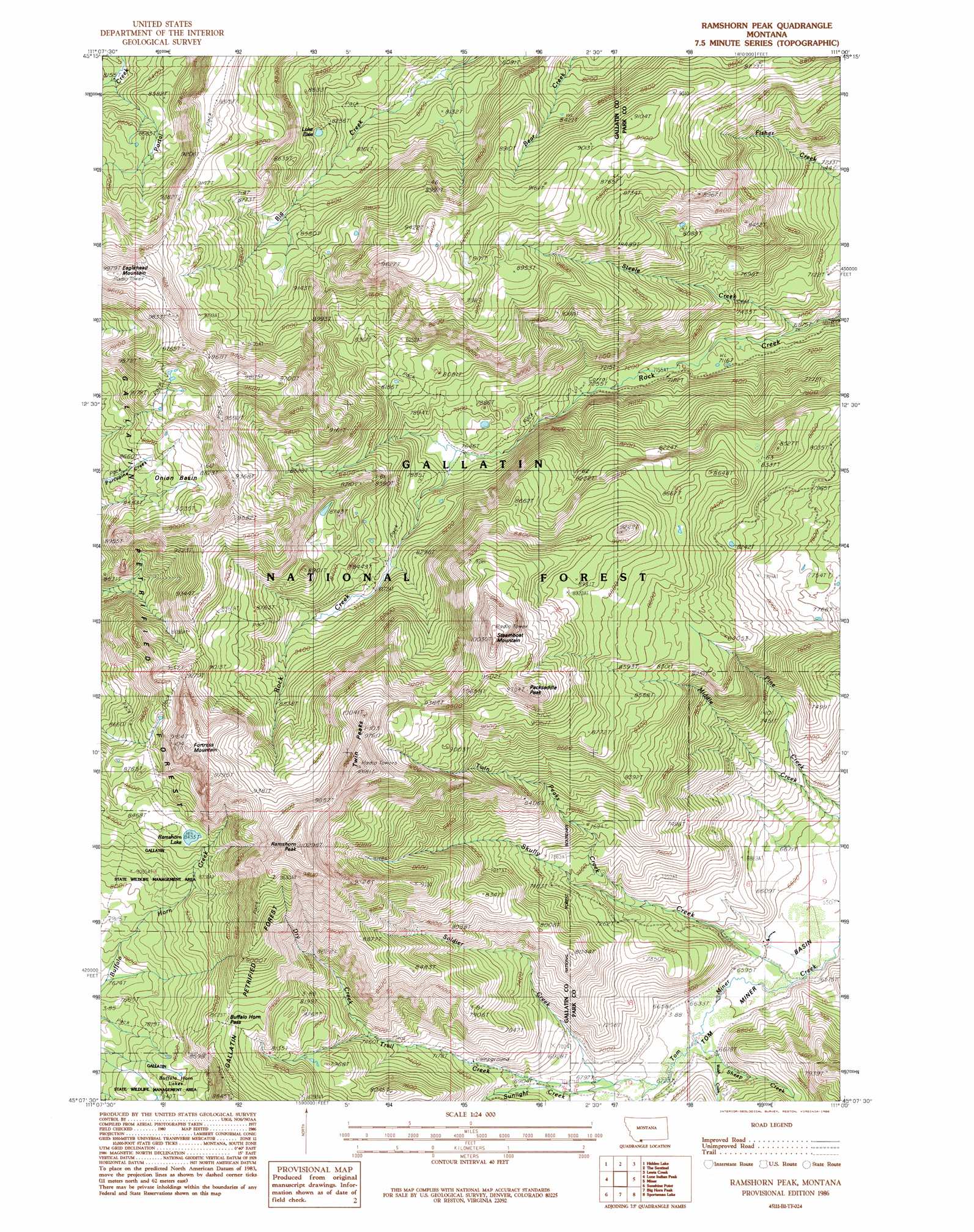
Ramshorn Peak Topo Map Montana
To zoom in, hover over the map of Ramshorn Peak
USGS Topo Quad 45111b1 - 1:24,000 scale
| Topo Map Name: | Ramshorn Peak |
| USGS Topo Quad ID: | 45111b1 |
| Print Size: | ca. 21 1/4" wide x 27" high |
| Southeast Coordinates: | 45.125° N latitude / 111° W longitude |
| Map Center Coordinates: | 45.1875° N latitude / 111.0625° W longitude |
| U.S. State: | MT |
| Filename: | o45111b1.jpg |
| Download Map JPG Image: | Ramshorn Peak topo map 1:24,000 scale |
| Map Type: | Topographic |
| Topo Series: | 7.5´ |
| Map Scale: | 1:24,000 |
| Source of Map Images: | United States Geological Survey (USGS) |
| Alternate Map Versions: |
Ramshorn Peak MT 1986, updated 1986 Download PDF Buy paper map Ramshorn Peak MT 1986, updated 1986 Download PDF Buy paper map Ramshorn Peak MT 2000, updated 2005 Download PDF Buy paper map Ramshorn Peak MT 2011 Download PDF Buy paper map Ramshorn Peak MT 2014 Download PDF Buy paper map |
| FStopo: | US Forest Service topo Ramshorn Peak is available: Download FStopo PDF Download FStopo TIF |
1:24,000 Topo Quads surrounding Ramshorn Peak
Beacon Point |
Garnet Mountain |
Mount Blackmore |
Fridley Peak |
Big Draw |
Gallatin Peak |
Hidden Lake |
The Sentinel |
Lewis Creek |
Dailey Lake |
Ousel Falls |
Lone Indian Peak |
Ramshorn Peak |
Miner |
Dome Mountain |
Lincoln Mountain |
Sunshine Point |
Big Horn Peak |
Sportsman Lake |
Electric Peak |
Pika Point |
Upper Tepee Basin |
Divide Lake |
Joseph Peak |
Quadrant Mountain |
> Back to 45111a1 at 1:100,000 scale
> Back to 45110a1 at 1:250,000 scale
> Back to U.S. Topo Maps home
Ramshorn Peak topo map: Gazetteer
Ramshorn Peak: Basins
Onion Basin elevation 2684m 8805′Ramshorn Peak: Gaps
Buffalo Horn Pass elevation 2600m 8530′Ramshorn Peak: Lakes
Lake Elsie elevation 2538m 8326′Ramshorn Lake elevation 2569m 8428′
Ramshorn Peak: Streams
Dry Creek elevation 2280m 7480′Sheep Creek elevation 2024m 6640′
Skully Creek elevation 1996m 6548′
Soldier Creek elevation 2065m 6774′
Steele Creek elevation 2097m 6879′
Sunlight Creek elevation 2042m 6699′
Trail Creek elevation 2072m 6797′
Twin Peaks Creek elevation 2128m 6981′
Walsh Creek elevation 2024m 6640′
Ramshorn Peak: Summits
Fortress Mountain elevation 2930m 9612′Packsaddle Peak elevation 2951m 9681′
Ramshorn Peak elevation 3113m 10213′
Steamboat Mountain elevation 3044m 9986′
Twin Peaks elevation 3066m 10059′
Ramshorn Peak digital topo map on disk
Buy this Ramshorn Peak topo map showing relief, roads, GPS coordinates and other geographical features, as a high-resolution digital map file on DVD: