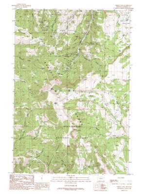
Cirque Lake Topo Map Montana
To zoom in, hover over the map of Cirque Lake
USGS Topo Quad 45111b8 - 1:24,000 scale
| Topo Map Name: | Cirque Lake |
| USGS Topo Quad ID: | 45111b8 |
| Print Size: | ca. 21 1/4" wide x 27" high |
| Southeast Coordinates: | 45.125° N latitude / 111.875° W longitude |
| Map Center Coordinates: | 45.1875° N latitude / 111.9375° W longitude |
| U.S. State: | MT |
| Filename: | o45111b8.jpg |
| Download Map JPG Image: | Cirque Lake topo map 1:24,000 scale |
| Map Type: | Topographic |
| Topo Series: | 7.5´ |
| Map Scale: | 1:24,000 |
| Source of Map Images: | United States Geological Survey (USGS) |
| Alternate Map Versions: |
Cirque Lake MT 1988, updated 1989 Download PDF Buy paper map Cirque Lake MT 1997, updated 2002 Download PDF Buy paper map Cirque Lake MT 2011 Download PDF Buy paper map Cirque Lake MT 2014 Download PDF Buy paper map |
| FStopo: | US Forest Service topo Cirque Lake is available: Download FStopo PDF Download FStopo TIF |
1:24,000 Topo Quads surrounding Cirque Lake
> Back to 45111a1 at 1:100,000 scale
> Back to 45110a1 at 1:250,000 scale
> Back to U.S. Topo Maps home
Cirque Lake topo map: Gazetteer
Cirque Lake: Dams
Middle Axolotl Lake Number 1 Dam elevation 2210m 7250′Middle Axolotl Lake Number 2 Dam elevation 2210m 7250′
South Axolotl Lake Dam elevation 2263m 7424′
Cirque Lake: Lakes
Blue Lake elevation 2363m 7752′Cirque Lake elevation 2620m 8595′
Grassy Lake elevation 2202m 7224′
Talus Lake elevation 2565m 8415′
Cirque Lake: Mines
Alder Gulch Mine elevation 2272m 7454′Apex Mine elevation 2418m 7933′
Atlas/SW Section 13 Mine elevation 2339m 7673′
Bartlett Mine elevation 2189m 7181′
Bartlett Mine elevation 2412m 7913′
Blade Mine elevation 2410m 7906′
Copper Mine elevation 2275m 7463′
Dorsey Mine elevation 2343m 7687′
Eagle Black Mine elevation 2266m 7434′
Eastern Pacific Mine elevation 2248m 7375′
Easton Mine elevation 2086m 6843′
Easton-Pacific Mine elevation 2356m 7729′
Garrison Mine elevation 2397m 7864′
Garrison Mine elevation 2403m 7883′
Gem Number 1 Mine elevation 2407m 7896′
General Shafter Mine elevation 2403m 7883′
General Shafter Mine elevation 2310m 7578′
Giltedge Mine elevation 2098m 6883′
J T C Mine elevation 2424m 7952′
Kearsage Mine elevation 2154m 7066′
Kearsage Mine elevation 2173m 7129′
Laciede Mine elevation 2407m 7896′
Little Mine elevation 2225m 7299′
Marietta Mine elevation 2488m 8162′
Marietta Mine elevation 2358m 7736′
Montana Twister Mine elevation 2248m 7375′
Nelson Mine elevation 2539m 8330′
NW Section 16 Mine elevation 2347m 7700′
Omaha Mine elevation 2297m 7536′
Ore Cash Mine elevation 2411m 7910′
Pacific Mine elevation 2337m 7667′
Pacific Mine elevation 2267m 7437′
Peggy Ann Mine elevation 2513m 8244′
Randolph Mine elevation 2212m 7257′
Saint John Mine elevation 1937m 6354′
SE SW Section 13 Mine elevation 2144m 7034′
Sunrise 77 Mine elevation 2145m 7037′
SW Section 16 Mine elevation 2323m 7621′
Tunnel Mine elevation 2121m 6958′
Yankee Mine elevation 2423m 7949′
Cirque Lake: Populated Places
Summit elevation 2155m 7070′Cirque Lake: Post Offices
Summit Post Office (historical) elevation 2155m 7070′Cirque Lake: Springs
Maloney Spring elevation 2688m 8818′Cirque Lake: Streams
Arasta Creek elevation 2063m 6768′Buffalo Creek elevation 2186m 7171′
Meadow Fork Greenhorn Creek elevation 2217m 7273′
North Fork Wigwam Creek elevation 2063m 6768′
Cirque Lake: Summits
Baldy Mountain elevation 2931m 9616′Horse Hill elevation 2395m 7857′
Cirque Lake: Valleys
Bachelor Gulch elevation 2183m 7162′French Gulch elevation 2140m 7020′
Greybacke Gulch elevation 2091m 6860′
Mill Gulch elevation 2173m 7129′
Cirque Lake digital topo map on disk
Buy this Cirque Lake topo map showing relief, roads, GPS coordinates and other geographical features, as a high-resolution digital map file on DVD:


