Fan Mountain Topo Map Montana
To zoom in, hover over the map of Fan Mountain
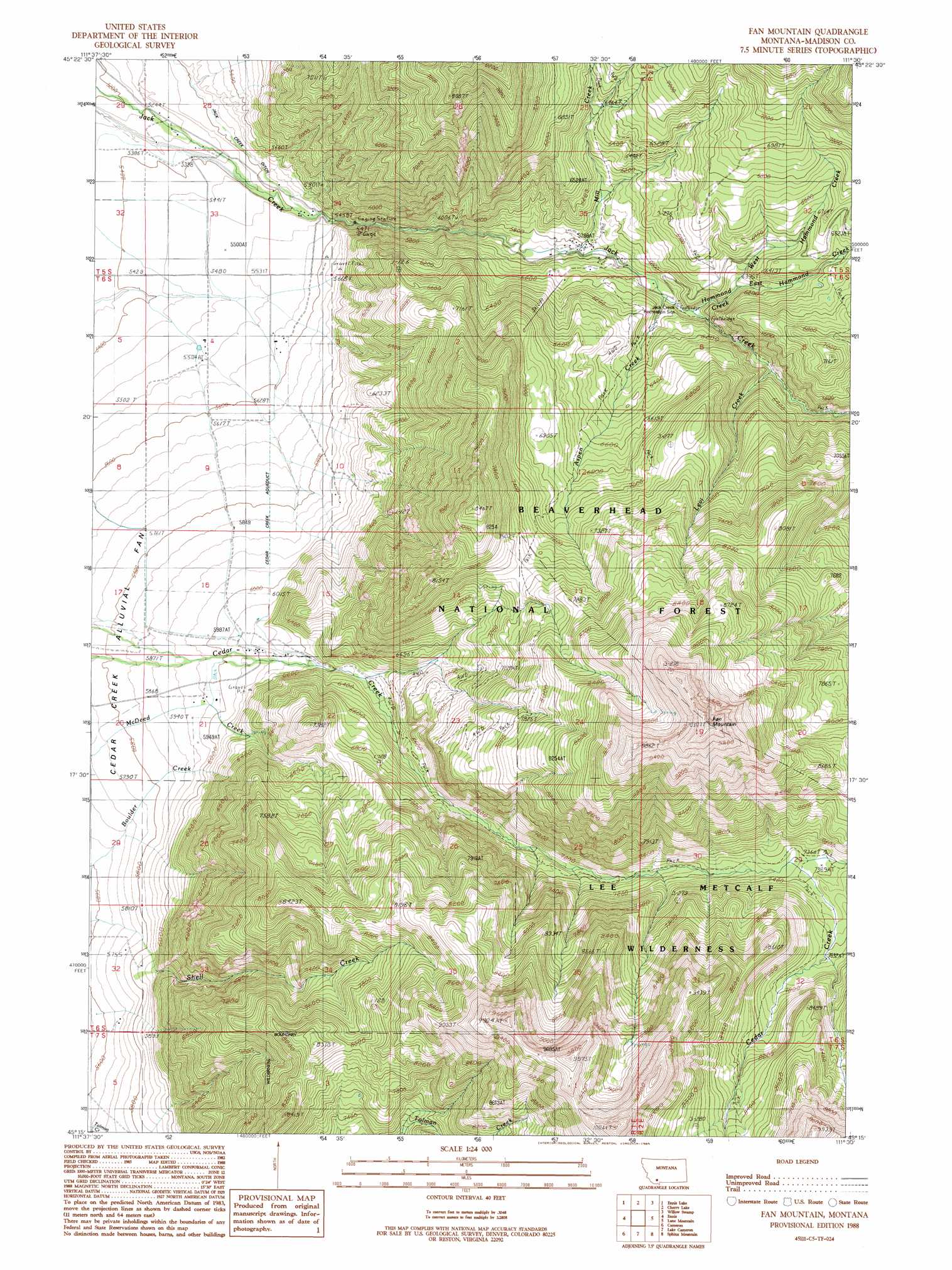
USGS Topo Quad 45111c5 - 1:24,000 scale
| Topo Map Name: | Fan Mountain |
| USGS Topo Quad ID: | 45111c5 |
| Print Size: | ca. 21 1/4" wide x 27" high |
| Southeast Coordinates: | 45.25° N latitude / 111.5° W longitude |
| Map Center Coordinates: | 45.3125° N latitude / 111.5625° W longitude |
| U.S. State: | MT |
| Filename: | o45111c5.jpg |
| Download Map JPG Image: | Fan Mountain topo map 1:24,000 scale |
| Map Type: | Topographic |
| Topo Series: | 7.5´ |
| Map Scale: | 1:24,000 |
| Source of Map Images: | United States Geological Survey (USGS) |
| Alternate Map Versions: |
Fan Mountain MT 1988, updated 1989 Download PDF Buy paper map Fan Mountain MT 1997, updated 2002 Download PDF Buy paper map Fan Mountain MT 2011 Download PDF Buy paper map Fan Mountain MT 2014 Download PDF Buy paper map |
| FStopo: | US Forest Service topo Fan Mountain is available: Download FStopo PDF Download FStopo TIF |
1:24,000 Topo Quads surrounding Fan Mountain
Maltbys Mound |
Norris |
Bear Trap Creek |
Cherry Creek Canyon |
Ruby Mountain |
Leonard Creek |
Ennis Lake |
Cherry Lake |
Willow Swamp |
Beacon Point |
Eightmile Creek |
Ennis |
Fan Mountain |
Lone Mountain |
Gallatin Peak |
Varney |
Cameron |
Lake Cameron |
Sphinx Mountain |
Ousel Falls |
Broomtail Ridge |
Bucks Nest |
No Man Peak |
Koch Peak |
Lincoln Mountain |
> Back to 45111a1 at 1:100,000 scale
> Back to 45110a1 at 1:250,000 scale
> Back to U.S. Topo Maps home
Fan Mountain topo map: Gazetteer
Fan Mountain: Canals
Cedar Creek Aqueduct elevation 1760m 5774′H Lazy Ditch elevation 1635m 5364′
Fan Mountain: Streams
Aspen Creek elevation 1787m 5862′East Hammond Creek elevation 1840m 6036′
Hammond Creek elevation 1793m 5882′
Levi Creek elevation 1866m 6122′
Mill Creek elevation 1757m 5764′
West Hammond Creek elevation 1842m 6043′
Fan Mountain: Summits
Fan Mountain elevation 3125m 10252′Fan Mountain: Wells
05S01E28CDDD01 Well elevation 1615m 5298′05S01E34BDCB01 Well elevation 1670m 5479′
Fan Mountain digital topo map on disk
Buy this Fan Mountain topo map showing relief, roads, GPS coordinates and other geographical features, as a high-resolution digital map file on DVD: